BMT Astoria Line
| BMT Astoria Line | |
|---|---|
|
| |
| Overview | |
| Type | Rapid transit |
| System | New York City Subway |
| Termini |
Ditmars Boulevard Queensboro Plaza |
| Stations | 7 |
| Operation | |
| Opened | 1917 |
| Owner | City of New York |
| Operator(s) | New York City Transit Authority |
| Character | Elevated |
| Technical | |
| Number of tracks | 2-3 |
| Track gauge | 4 ft 8 1⁄2 in (1,435 mm) |
| Electrification | 600V DC third rail |
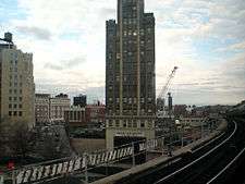
The Astoria Line is a rapid transit line of the BMT Division of the New York City Subway, serving the Queens neighborhood of Astoria. It runs south from Ditmars Boulevard in Astoria to 39th Avenue in Long Island City above 31st Street. It then turns west and serves Queensboro Plaza over Queens Plaza.
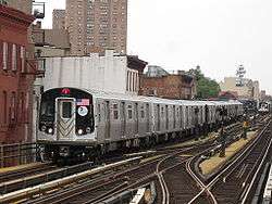
The entire line is served by the N train at all times, joined by the W on weekdays.[1][2] It was built as part of the Dual Contracts and jointly operated by the IRT and BMT using IRT-sized cars until 1949, when the platforms were shaved to accept the wider BMT cars and joint service was discontinued.
Description and service
All services make all stops on the BMT Astoria Line.[1][2]
| Time period | ||
|---|---|---|
| Weekdays | All other times | |
| full line | ||
| full line | no service | |
The north end of the Astoria Line is a two-track terminal at Ditmars Boulevard, with one island platform. South of the station, the center express track, currently not used in revenue service, begins (with crossovers to allow terminating trains to reach the correct track). The next station, Astoria Boulevard, is the only express station on the three-track section. The next four stations are local ones with two side platforms.[3]
South of 39th Avenue, the express track merges with the two outer tracks. The line then curves west and enters Queensboro Plaza, a dual-level station with northbound trains on the upper level, southbound trains on the lower level, and cross-platform transfers to the IRT Flushing Line. Crossover tracks exist between the upper level tracks just north of the station, one of a few connections between the BMT / IND and IRT. After Queensboro Plaza, the line ramps underground, and merges with the 60th Street Tunnel Connection to become the BMT Broadway Line via the 60th Street Tunnel to Manhattan.[3]
History


The Astoria Line was originally part of the IRT, as a spur off the IRT Queensboro Line, now the IRT Flushing Line. The whole line north of Queensboro Plaza opened on February 1, 1917 and was used by trains between Grand Central and Astoria.[4][5] Through IRT service to the Corona Line (now the Flushing Line) began two months later on April 21.[6]
On July 23, 1917, the Queensboro Bridge spur of the elevated IRT Second Avenue Line opened. At that time, all elevated trains to Queensboro Plaza used the Astoria Line while all subway trains used the Corona Line, though this was later changed with trains alternating between branches.[5][7]
The 60th Street Tunnel opened on August 1, 1920, allowing BMT trains to reach Queensboro Plaza. However, the stations on the Astoria and Corona Lines were built to IRT specifications, which were too narrow for BMT rolling stock. As a result, those trains terminated at Queensboro Plaza using a relay track east of the station to turn around for the return trip to Manhattan.[8]
On April 8, 1923, the BMT, using elevated cars, started running shuttles along the Astoria (numbered BMT 8 in 1924) and Corona Lines (BMT 9) in addition to the existing IRT service. On June 23, 1942, the IRT Second Avenue Line spur to Queensboro Plaza closed.[9]
The IRT services were numbered in 1948, with 7 being assigned to the Flushing Line and 8 to the Astoria Line. A year later on October 17, 1949, the Flushing Line became IRT-only. The platforms on the Astoria Line were shaved back to allow through BMT trains to operate on it, the first ones being the Brighton Local (BMT 1) weekdays & Broadway - Fourth Avenue Local (BMT 2) at all times.[10] Since then, the Astoria Line has hosted the northern end of various services running from Brooklyn through Manhattan; see B, N, Q, R, T and W for details.
Extension proposals
A 1920s Transit Commission study proposed extending the line northwest across or under Randalls and Wards Islands back into Manhattan as a crosstown line at 125th Street, roughly following the route of what is now the Triborough Bridge.[11] As part of the IND Second System plan from 1929, the BMT/IRT Astoria Line would be extended east via Ditmars Boulevard, Astoria Boulevard, 112th Street, and Nassau Boulevard (today's Long Island Expressway) terminating at Cross Island Boulevard. The new line that would have been an extension of the Astoria Line would be called the Long Island City-Horace Harding Boulevard Line. The line would have been 2 tracks to Astoria Boulevard, and afterwards it would become a 4 track line before going back to 2 tracks at Parsons Boulevard. The entire line would be elevated except for part of it, which would have been depressed under Nassau Boulevard. The line would have been extended 8.1 miles at a cost of $17,700,000.[12][13][14]
In 1998, an extension of the BMT Astoria Line to LaGuardia Airport was planned as part of a $1.2 billion package to provide access to the New York City airports with funding from the MTA, the Port Authority and the city. The preferred route would have extended the Astoria Line along 31st Street north onto Con Edison’s property at the edge of Astoria and then east along 19th Avenue to the Marine Air Terminal. The MTA also considered an eastward extension along Ditmars Boulevard, and a plan to reroute LaGuardia-bound trains from Queensboro Plaza through the Sunnyside rail yard and along the eastern edge of St. Michael’s Cemetery to elevated tracks parallel to the Grand Central Parkway. A fourth route was to have trains turn east via Astoria Boulevard.[15] All of the options would have new elevated sections built. $645 million for the LaGuardia extension was included in the MTA’s 2000-2004 Five-Year Capital Plan, and in late 2002, Mayor Bloomberg supported the extension. These option were studied in the LaGuardia Airport Subway Access Study.[16] However, community opposition was strong and therefore the plan was canceled in July 2003.[17][18]
Station listing
| Station service legend | |
|---|---|
| |
Stops all times |
| |
Stops all times except late nights |
| |
Stops weekdays only |
| |
Stops rush hours in the peak direction only |
| Time period details | |
| Neighborhood (approximate) |
Station | Tracks | Services | Opened | Transfers and notes | |
|---|---|---|---|---|---|---|
| Astoria | Astoria–Ditmars Boulevard | N |
February 1, 1917[4] | originally Ditmars Avenue | ||
| Center Express track begins (No Regular Service) | ||||||
| Astoria Boulevard | all | N |
February 1, 1917[4] | M60 Select Bus Service to LaGuardia Airport originally Hoyt Avenue | ||
| 30th Avenue | local | N |
February 1, 1917[4] | originally Grand Avenue | ||
| Broadway | local | N |
February 1, 1917[4] | |||
| 36th Avenue | local | N |
February 1, 1917[4] | originally Washington Avenue | ||
| Long Island City | 39th Avenue | local | N |
February 1, 1917[4] | originally Beebe Avenue | |
| Center Express track ends | ||||||
| connecting tracks to IRT Flushing Line (No regular service) | ||||||
| Queensboro Plaza | all | N |
February 1, 1917[4] | 7 | ||
| merges with the 60th Street Tunnel Connection (R BMT Broadway Line via the 60th Street Tunnel (N | ||||||
References
- 1 2 "N Subway Timetable, Effective November 7, 2016" (PDF). New York Metropolitan Transportation Authority. Retrieved November 7, 2016.
- 1 2 "W Subway Timetable, Effective November 7, 2016" (PDF). New York Metropolitan Transportation Authority. Retrieved November 7, 2016.
- 1 2 Marrero, Robert (2015-09-13). "469 Stations, 846 Miles" (PDF). B24 Blog, via Dropbox. Retrieved 2015-10-09.
- 1 2 3 4 5 6 7 8 "First Train Runs On Elevated Line to Astoria Section". Brooklyn Daily Eagle. February 1, 1917. Retrieved 29 June 2015 – via Newspapers.com.
- 1 2 Annual report. 1916-1917. New York: Interborough Rapid Transit Company. 1917.
- ↑ "New Astoria Line Opened". The New York Times. February 2, 1917. p. 14. Retrieved 2011-12-18.
- ↑ "Subway Link Over Queensboro Bridge". The New York Times. July 22, 1917. p. 31. Retrieved 2011-12-18.
- ↑ "New Subway Link Opens". The New York Times. August 1, 1920. p. 12. Retrieved 2011-12-18.
- ↑ "Additional Subway Service to Borough of Queens". The New York Times. April 8, 1923. p. RE1. Retrieved 2011-12-18.
- ↑ "Direct Subway Runs to Flushing, Astoria". The New York Times. October 15, 1949. p. 17. Retrieved 2011-12-18.
- ↑ http://www.nycsubway.org/wiki/New_Subways:_Proposed_Additions_to_Rapid_Transit_System..._(1922)
- ↑ 100 Miles of Subway in New City Project; 52 of them in Queens, The New York Times September 16, 1929, p. 1. Retrieved June 11, 2014
- ↑ nycsubway.org—IND Second System – 1929 Plan
- ↑ Roess, Roger P.; Sansone, Gene (2012-08-23). The Wheels That Drove New York: A History of the New York City Transit System. Springer Science & Business Media. ISBN 9783642304842.
- ↑ "Dreams of taking the N to LaGuardia". Second Ave. Sagas. 2010-01-19. Retrieved 2016-05-01.
- ↑ "Second Avenue Subway Supplemental Draft Environmental Impact Statement (SDEIS), April 2003 Appendix A Planning Context" (PDF). mta.info. Metropolitan Transportation Authority. April 2003. Retrieved August 9, 2016.
- ↑ Toscano, John (July 16, 2003). "N Train Extension To LaG Scrapped". Queens Gazette. Retrieved July 26, 2009.
- ↑ "Flashback To 1999 | www.qgazette.com | Queens Gazette". www.qgazette.com. June 27, 2007. Retrieved March 25, 2014.
External links
![]() Media related to BMT Astoria Line at Wikimedia Commons
Media related to BMT Astoria Line at Wikimedia Commons
| Services |
|      | ||||||
|---|---|---|---|---|---|---|---|---|
| Stations | ||||||||
| Divisions | ||||||||
| Other lists | ||||||||
| Expansion | ||||||||
| History | ||||||||
| Infrastructure | ||||||||
| Arts and culture | ||||||||
| Miscellaneous | ||||||||
| Other rapid transit in NYC | ||||||||