Bække
| Bække | |
|---|---|
| Town | |
|
Bække Church | |
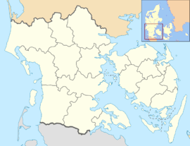 Bække Location in the Region of Southern Denmark | |
| Coordinates: 55°34′20″N 9°8′10″E / 55.57222°N 9.13611°ECoordinates: 55°34′20″N 9°8′10″E / 55.57222°N 9.13611°E | |
| Country | Denmark |
| Region | Southern Denmark |
| Municipality | Vejen |
| Population (2015)[1] | |
| • Total | 1,091 |
| Time zone | CET (UTC+1) |
| • Summer (DST) | CEST (UTC+2) |
| Postal code | 6622 |
.jpg)
Bække is a town in Vejen Municipality, Southern Denmark.
Bække grew up around the road between Ribe and Vejle. The road roughly follows the course of the historic Hærvejen or Ox Road past the church and inn.[2] At an early stage the city extended along the old road and another parallel to the main street. The city currently has a compact form.
By 1917, Bække had a station on the Troldhede to Kolding railway. The railway closed in 1969, but the town still has significance as a hub for bus services. The church, school and most shops are in the middle of the city linked to the main street, Søndergade-Nørregade.
In recent years Bække has experienced an increase in tourism, based on the Hærvejen route and the river Holme Å. The square at the bus station has also been redeveloped with a modern sculpture by Niels Aage Schmidt symbolizing the Hærvejen.
Bække has distinctive historic architecture with several landmark buildings.
References
- ↑ "Danmarks Statistikbank 575-18383 Bække". Retrieved 2016-02-16.
- ↑ "Destination Hærvejen". Retrieved 2016-02-16.
External links
| Wikimedia Commons has media related to Bække. |