Ayios Nikolaos Station
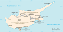

Ayios Nikolaos Station (also spelled Agios Nikolaos; Greek: Άγιος Νικόλαος, lit. "Saint Nicholas") is a British Army station and part of in the British Sovereign Base Area of Dhekelia in Cyprus. It is a former village (Ayios Nikolaos, SBA) connected by a road to the main area of the Dhekelia Garrison. The Joint Service Signal Unit (JSSU), formerly 9 Signal Regiment (2 Wireless Regiment pre-1959) and the Royal Air Force's 33 Signals Unit, is based at Ayios Nikolaos. This unit is a British Armed Forces run Static Communications station.
The Joint Service Signal Unit (Cyprus) (JSSU(Cyp)) was formed on 1 April 1999 as a result of the amalgamation of the Joint Service Signal Unit (Ayios Nikolaos) and elements of 33 Signals Unit RAF.[1] It is a three-squadron organisation, commanded by a Royal Signals Lieutenant Colonel, with a number of Royal Air Force and civilian contractors attached. JSSU is a static communications organisation maintaining secure links from Cyprus to the rest of the world.Ayios Nikolaos or Agios Nikolaos is a very common place name in Greece and Cyprus; it is Greek for "Saint Nicholas".
For satellite interception, the Ayios Nikolaos station has a number of dish antennas of various sizes. Somewhere between 2008 and 2011, also a torus antenna was installed, which is able to receive the signals of up to 35 satellites simultaneously.[2]
Declassified documents show that the station was run for the Government Communications Headquarters (GCHQ), and documents released by Edward Snowden suggest that in recent years half the cost of running the station is funded by the U.S. National Security Agency.[3]
See also
References
- ↑ Ayios Nikolaos Station archived on 5 August 2009 from the original Archived November 9, 2009, at the Wayback Machine.
- ↑ Electrospaces.net: Torus: the antenna to significantly increase satellite interception, April 8, 2015
- ↑ "GCHQ worked hard to maintain presence on Cyprus after independence". Gloucestershire Echo. 1 December 2013. Retrieved 14 April 2015.
Coordinates: 35°05′35″N 33°53′12″E / 35.09306°N 33.88667°E