Awendaw, South Carolina
| Awendaw, South Carolina | |
|---|---|
| Town | |
|
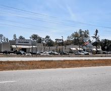
Awendaw, with U.S. Highway 17 in foreground | |
 Location of Awendaw in South Carolina | |
| Coordinates: 32°59′11″N 79°38′36″W / 32.98639°N 79.64333°WCoordinates: 32°59′11″N 79°38′36″W / 32.98639°N 79.64333°W | |
| Country | United States |
| State | South Carolina |
| County | Charleston |
| Government | |
| • Mayor | Miriam C. Green |
| Area | |
| • Total | 9.7 sq mi (25.1 km2) |
| • Land | 9.5 sq mi (24.5 km2) |
| • Water | 0.2 sq mi (0.5 km2) |
| Elevation | 20 ft (6 m) |
| Population (2010) | |
| • Total | 1,294 |
| • Density | 137/sq mi (52.8/km2) |
| Time zone | EST (UTC-5) |
| • Summer (DST) | EDT (UTC-4) |
| ZIP code | 29429 |
| Area code(s) | 843 |
| FIPS code | 45-03385[1] |
| GNIS feature ID | 1229363[2] |
| Website |
www |

Awendaw is a small fishing town in Charleston County, South Carolina, United States. The population was 1,294 at the 2010 census.[3] Awendaw is part of the Charleston, South Carolina metropolitan area.
History
Awendaw was named by the Sewee tribe. It is also home to an oyster shell mound created by the Sewee tribe. It is the northernmost shell ring in a group that stretches south to the tip of Florida. Most of the mound is still intact. The rest of it was destroyed to construct roads and homes for the citizens of Awendaw. Awendaw was settled in 1696 as "Wappetaw" by settlers from Salem, Massachusetts, who had left after the Salem Witch Trials. The town was heavily damaged by Hurricane Hugo in September 1989, but did not receive as significant damage in 2004 when Hurricane Gaston made landfall in the region. In 1992, the town of Awendaw was first incorporated and elected Willam H. Alston as the first Mayor. Alston served as Mayor until 2009.
The Sewee Mound was listed on the National Register of Historic Places in 1970.[4]
Geography
Awendaw is located in northeastern Charleston County, along U.S. Route 17 at 32°59′11″N 79°38′36″W / 32.98639°N 79.64333°W (32.986445, -79.643451).[5] US 17 leads southwest 28 miles (45 km) to Charleston and northeast 32 miles (51 km) to Georgetown.
According to the United States Census Bureau, Awendaw has a total area of 9.7 square miles (25.1 km2), of which 9.5 square miles (24.5 km2) is land and 0.2 square miles (0.5 km2), or 2.13%, is water.[3]
Demographics
| Historical population | |||
|---|---|---|---|
| Census | Pop. | %± | |
| 2000 | 1,195 | — | |
| 2010 | 1,294 | 8.3% | |
| Est. 2015 | 1,371 | [6] | 6.0% |
| U.S. Decennial Census | |||
As of the census[1] of 2000, there were 1,195 people, 400 households, and 312 families residing in the town. The population density was 144.3 people per square mile (55.7/km²). There were 443 housing units at an average density of 53.5 per square mile (20.7/km²). The racial makeup of the town was 64.60% African American, 34.39% White, 0.08% Asian, 0.59% from other races, and 0.33% from two or more races. Hispanic or Latino of any race were 0.92% of the population.
There were 400 households out of which 33.8% had children under the age of 18 living with them, 54.8% were married couples living together, 19.8% had a female householder with no husband present, and 22.0% were non-families. 20.3% of all households were made up of individuals and 7.3% had someone living alone who was 65 years of age or older. The average household size was 2.97 and the average family size was 3.47.
In the town the population was spread out with 29.5% under the age of 18, 7.5% from 18 to 24, 27.8% from 25 to 44, 23.8% from 45 to 64, and 11.4% who were 65 years of age or older. The median age was 36 years. For every 100 females there were 91.2 males. For every 100 females age 18 and over, there were 87.8 males.
The median income for a household in the town was $35,250, and the median income for a family was $42,917. Males had a median income of $31,696 versus $21,422 for females. The per capita income for the town was $15,781. About 13.5% of families and 12.4% of the population were below the poverty line, including 12.6% of those under age 18 and 18.1% of those age 65 or over.
Government
The town is run by an elected Mayor-council government system.
Mayor Miriam C. Green
Council members
- Bryan McNeal, Jr.
- Betty Simmons
- Sheila Powell
- Rodney Porcher
- Roberta S. Whiteside
Administrator
- Bill Wallace
Town clerk
- Gregory Saxton
Landmarks
The 609.6-meter-high (2,000 ft) WCSC-Tower is one of the world's tallest constructions. The Media General Tower is also more than 600 m (2,000 ft) high.
In 2001, the town's public library was opened as the "Awendaw Community Library". Currently named the William H. Alston Municipal Public Library, it is one of two municipal public libraries in the state.
In 2011, Tractor Supply Company opened a new store. It was the first national chain of its kind to open in Awendaw.
Blue Crab Festival
To many Awendaw citizens, crabbing is a hobby and one of the town's main economic resources. Every year in the summer, the town has the Blue Crab Festival.
Notable people
- Danielle Howle, singer-songwriter
Climate
| Climate data for Awendaw, South Carolina (Airport), 1981–2010 normals | |||||||||||||
|---|---|---|---|---|---|---|---|---|---|---|---|---|---|
| Month | Jan | Feb | Mar | Apr | May | Jun | Jul | Aug | Sep | Oct | Nov | Dec | Year |
| Average high °F (°C) | 59.0 (15) |
62.8 (17.1) |
69.6 (20.9) |
76.5 (24.7) |
83.2 (28.4) |
88.4 (31.3) |
91.1 (32.8) |
89.6 (32) |
84.9 (29.4) |
77.1 (25.1) |
69.8 (21) |
61.6 (16.4) |
76.1 (24.5) |
| Average low °F (°C) | 38.1 (3.4) |
41.2 (5.1) |
47.2 (8.4) |
53.8 (12.1) |
62.4 (16.9) |
70.2 (21.2) |
73.6 (23.1) |
72.9 (22.7) |
67.8 (19.9) |
57.3 (14.1) |
48.1 (8.9) |
40.6 (4.8) |
56.1 (13.4) |
| Average precipitation inches (mm) | 3.70 (94) |
2.96 (75.2) |
3.71 (94.2) |
2.91 (73.9) |
3.02 (76.7) |
5.64 (143.3) |
6.52 (165.6) |
7.15 (181.6) |
6.10 (154.9) |
3.75 (95.3) |
2.43 (61.7) |
3.11 (79) |
50.99 (1,295.1) |
| Average snowfall inches (cm) | 0.1 (0.3) |
0.2 (0.5) |
0 (0) |
0 (0) |
0 (0) |
0 (0) |
0 (0) |
0 (0) |
0 (0) |
0 (0) |
0 (0) |
0.3 (0.8) |
0.6 (1.5) |
| Average precipitation days (≥ 0.01 in) | 9.5 | 8.6 | 7.9 | 7.7 | 7.8 | 11.9 | 13.0 | 13.2 | 10.0 | 7.3 | 7.0 | 8.7 | 112.6 |
| Average snowy days (≥ 0.1 in) | 0.1 | 0.1 | 0 | 0 | 0 | 0 | 0 | 0 | 0 | 0 | 0 | 0.2 | 0.4 |
| Mean monthly sunshine hours | 179.8 | 189.3 | 244.9 | 276.0 | 294.5 | 279.0 | 288.3 | 257.3 | 219.0 | 223.2 | 189.0 | 170.5 | 2,810.8 |
| Source: NOAA,[7] HKO (sun only, 1961–1990)[8] | |||||||||||||
References
- 1 2 "American FactFinder". United States Census Bureau. Archived from the original on 2013-09-11. Retrieved 2008-01-31.
- ↑ "US Board on Geographic Names". United States Geological Survey. 2007-10-25. Retrieved 2008-01-31.
- 1 2 "Geographic Identifiers: 2010 Census Summary File 1 (G001): Awendaw town, South Carolina". U.S. Census Bureau, American Factfinder. Retrieved June 25, 2015.
- ↑ National Park Service (2010-07-09). "National Register Information System". National Register of Historic Places. National Park Service.
- ↑ "US Gazetteer files: 2010, 2000, and 1990". United States Census Bureau. 2011-02-12. Retrieved 2011-04-23.
- ↑ "Annual Estimates of the Resident Population for Incorporated Places: April 1, 2010 to July 1, 2015". Retrieved July 2, 2016.
- ↑ "NowData – NOAA Online Weather Data". National Oceanic and Atmospheric Administration. Retrieved February 12, 2012.
- ↑ "Climatological Normals of Charleston, South Carolina". Hong Kong Observatory. Retrieved June 9, 2010.
External links
Municipalities and communities of Charleston County, South Carolina, United States | ||
|---|---|---|
| Cities | 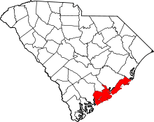 | |
| Towns | ||
| CDP | ||
| Unincorporated communities | ||
| Footnotes | ‡This populated place also has portions in an adjacent county or counties | |