Awarua Plains
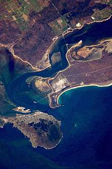
The Awarua Plain is a large area of wetland to the east of Bluff, New Zealand.[1] Covering an area of around 600 km², the plain stretches for 35 kilometres along the coast of Foveaux Strait. This stretch of coast includes the peninsula of Tiwai Point, Awarua Bay, the Waituna Lagoon, and Toetoes Bay. The Mataura River is the major river responsible for the presence of the Awarua Plain; along with the Oreti River, it is a remnant of the rivers from the Ice Ages that formed the Southland Plains (Murihiku). In addition, several small streams enter Foveaux Strait along this stretch of coast, mainly via Awarua Bay and Waituna Lagoon.
Radio facilities
The Awarua Plain is suitable for radio facilities, due to low distant skylines, high ground conductivity and distance from sources of radio interference.[2][3] An expedition seeking 'an extensive area of flat lands [producing] the best results' first scouted the area for radio purposes in 1911.[4]
Radio-related facilities here are:
Awarua Radio
Awarua Radio (callsign VLB or ZLB) was New Zealand's main receiving and transmitting coast radio station providing worldwide radiotelegraph and voice communications with ships at sea. Some facilities were built by Telefunken of Germany. It was operated from 18 December 1913 by the New Zealand Post Office (to 31 March 1986) then by NZPO successor corporation Telecom New Zealand until the station closed on 30 August 1991.[5]
The site was selected following an expedition in 1911 led by Mr J Orchiston, head of the New Zealand Telegraph Department, Captain Gard'ner of the New Zealand Artillery and representatives of Australian Wireless, seeking 'an extensive area of flat lands [producing] the best results'.[4]
References
- ↑ "Place Name Detail: Awarua Plains". New Zealand Geographic Placenames Database. Land Information New Zealand. Retrieved 2009-11-27.
- ↑ NZ space link seen as a showcase for satellite imaging Archived 18 July 2011 at the Wayback Machine. by NZPA, retrieved from Yahoo News website on 2011-02-15
- ↑ Unwin Radar on Venture Southland website, retrieved 2011-04-12
- 1 2 The Otago Daily Times, 1911-04-03, republished in 'Tea party in the Antarctic' on Otago Daily Times website, 2011-04-03
- ↑ Awarua Radio VLB - ZLB
Coordinates: 46°31′41″S 168°28′54″E / 46.5281°S 168.4816°E