Awaran District
| Awaran آواران | |
|---|---|
| District | |
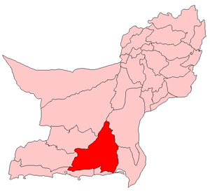 Map of Pakistani districts with Awaran district highlighted in maroon | |
| Country | Pakistan |
| Province | Balochistan |
| Notified | 11 November 1992[1] |
| Headquarters | Awaran |
| Government | |
| • Members of National Assembly | Jam Kamal Khan (NA-270) |
| Area | |
| • Total | 21,630 km2 (8,350 sq mi) |
| Population (1998 Census) | |
| • Total | 118,173[2] |
| • Density | 5.5/km2 (14/sq mi) |
| Time zone | PKT (UTC+5) |
| Number of Tehsils | 3 |
| Tehsils |
Awaran Jhal Jhao Mashkai |
| Website | www.bdd.sdnpk.org/awaran.htm |
Awaran District (Urdu: ضِلع آواران), is a district in the south of the Balochistan province of Pakistan. It was created as a separate district on 11 November 1992; but previously it was a sub-division of Khuzdar District. The old name of Awaran was Kolwa. It is considered the poorest district in the province.[3]
It is located in the south of the Balochistan province, Awaran district is bordered by Gwadar to its south and south west, Lasbela to its east and south, Kech and Panjgur to its west, Khuzdar to its north east and Kharan to its north.
Population
Administrative divisions
The district is administratively subdivided into the following three tehsils,[5] which are sub-divided into eight union councils:[6]
Demographics
Over 98% of the people of the area are Muslims[4] with a small Zikri minority. They belong to Sajdi, Bezinjo, Sanghur, Muhammad Hasni and Gichki tribes.
Agriculture
Awaran is known as oasis of dates. Annual production of dates is approx 15,000 ton. Mashaki is famous for Dates production, however due to non-existence of storage facility in district dates don't reach to the big markets in country. Beside Dates, Onion is grown on large scale, estimated annual production is 53,000 tons. Wheat and [barley]] is the other major Rabi crop. Kharif crops are fruits and pulses.
References
- ↑ Awaran Archived 31 August 2011 at the Wayback Machine. UN profile. Retrieved 6 September 2010.
- 1 2 3 Awaran District Archived 12 September 2011 at the Wayback Machine. Population Census Organisation, Government of Pakistan. Retrieved 6 September 2010.
- ↑ Awaran District Balochistan Flood Assessment pg 6. July 2007 Archived 11 March 2012 at the Wayback Machine. PDI,Khuzdar. Retrieved 6 September 2010.
- 1 2 Awaran District Balochistan Flood Assessment pg 4. July 2007 Archived 11 March 2012 at the Wayback Machine. PDI,Khuzdar. Retrieved 6 September 2010.
- 1 2 3 4 Awaran District Archived 1 June 2012 at the Wayback Machine. Government of Balochistan. Retrieved 24 July 2012
- ↑ Tehsils & Unions in the District of Awaran - Government of Pakistan
External links
| Wikimedia Commons has media related to Awaran District. |

Coordinates: 26°10′N 65°30′E / 26.167°N 65.500°E