Aus, Namibia
| Aus | |
|---|---|
 Aus Location in Namibia | |
| Coordinates: 26°40′S 16°16′E / 26.667°S 16.267°E | |
| Country |
|
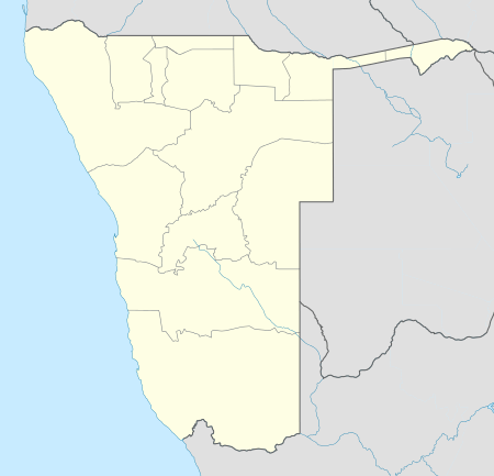
| Region | ǁKaras Region |
| Constituency | ǃNamiǂNûs Constituency |
| Climate | BWk |
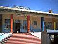
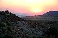
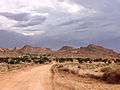
Aus is a village in the ǁKaras Region of southern Namibia. It lies on a railway line and the B4 national road, 230 km west of Keetmanshoop and about 125 km east of Lüderitz and belongs to the ǃNamiǂNûs electoral constituency. Trains from Keetmanshoop now terminate at the village but formerly continued on to Lüderitz. The village is small but has a number of amenities including a hotel, police station, shop and garage. It is located in the Aus Mountains above the plains of the Namib Desert. The climate is usually hot and arid but snow has been recorded in winter in 1963.


The village was formerly the site of a prisoner-of-war camp established by the South African army in 1915 to house German inmates captured during the First World War. The inmates initially lived in tents but later built brick houses. The number of prisoners reached 1500 but by May 1919 the last inmates left and the camp closed. A plaque marks the site today and some of the houses have been reconstructed.
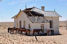
The area west of Aus is noted for its herd of feral horses living in the desert. Their origin is uncertain but today there is a population of between 150 and 200 individuals which have adapted to the harsh environment. They urinate less than domestic horses and can go five days without water. They drink at an artificial water hole at Garub Pan where a blind has been erected to enable tourists to watch the animals without disturbing them.
References
- Ballard, Sebastian & Santcross, Nick (1999) Footprint Namibia Handbook (2nd ed.), Footprint Handbooks, Bath. ISBN 0-8442-2133-3
- Hardy, Paula & Firestone, Matthew D. (2007) Botswana & Namibia, Lonely Planet, London. ISBN 978-1-74104-760-8
Gallery

Coordinates: 26°40′S 16°16′E / 26.667°S 16.267°E