Aua Island
For other uses, see AUA.
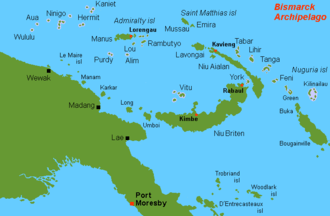
Location map, Aua at top left
Aua is an island in the Bismarck Archipelago. It is part of the Western Islands, Papua New Guinea.
The first sighting by Europeans of Aua island was by the Spanish navigator Iñigo Órtiz de Retes on 27 July 1545 when on board of the carrack San Juan tried to return from Tidore to New Spain. He charted this island together with the nearby islands, Wuvulu and Manu, as La Barbada (the bearded island in Spanish).[1][2]
Coordinates: 1°27′S 143°04′E / 1.450°S 143.067°E
References
This article is issued from Wikipedia - version of the 2/19/2015. The text is available under the Creative Commons Attribution/Share Alike but additional terms may apply for the media files.