Aspen Island
.jpg) Aerial view with Kings Avenue Bridge, behind. | |
| Geography | |
|---|---|
| Location | Lake Burley Griffin, Canberra |
| Coordinates | 35°17′56″S 149°08′32″E / 35.29889°S 149.14222°ECoordinates: 35°17′56″S 149°08′32″E / 35.29889°S 149.14222°E |
| Total islands | 1 |
| Highest elevation | 578 m (1,896 ft) (approx.) |
| Administration | |
|
Australia | |
Aspen Island, within Lake Burley Griffin, is a man-made island located in Canberra, Australian Capital Territory, Australia.
Aspen Island is located on the south-eastern side of the Central Basin of Lake Burley Griffin, adjacent to Kings Park, Parkes. The island lies within the Canberra ceremonial precinct, called the Parliamentary Triangle. The Australian National Carillon is situated on the island, that is linked to the mainland at Kings Park, by a footbridge which is named after John Douglas Gordon, who played the inaugural recital.[1]
The name of Aspen Island was gazetted on 21 November 1963, and named after the aspen tree,[2] of which some are classified by botanists in the section Populus, of the poplar genus.
Aspen Island is the largest of three islands at the south-eastern end of Central Basin of Lake Burley Griffin. The two smaller adjacent island are unnamed.[3]
Gallery
-
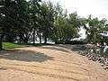
The north-west end of Aspen Island, during summer.
-

Aspen Island viewed from the Kings Avenue Bridge
See also
References
| Wikimedia Commons has media related to Aspen Island. |
- ↑ "Aspen Island - Home to the National Carillon". National Capital Authority. Retrieved 11 March 2010.
- ↑ "Aspen Island". Place name search. Government of the Australian Capital Territory. Retrieved 17 February 2013.
- ↑ Marshall, Duncan; Firth, Dianne (2011). "National Carillon & Aspen Island Heritage Management Plan" (PDF). National Capital Authority. p. 7. Retrieved 17 February 2013.
Rivers, other watercourses, reservoirs, river islands and waterfalls of the Australian Capital Territory | |
|---|---|
| Rivers and creeks |
|
| Reservoirs | |
| River islands | |
| Waterfalls |
|
| |