Ash Hollow State Historical Park
|
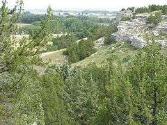
Ash Hollow Cave | |
 | |
 Location of Ash Hollow State Historical Park in Nebraska | |
| Location | Garden County, Nebraska, USA, near Lewellen, Nebraska |
|---|---|
| Coordinates | 41°17′53″N 102°7′12″W / 41.29806°N 102.12000°WCoordinates: 41°17′53″N 102°7′12″W / 41.29806°N 102.12000°W |
| Area | 8.9 acres (3.6 ha) |
| NRHP Reference # | 66000445[1] |
| Significant dates | |
| Added to NRHP | October 15, 1966[1] |
| Designated NHL | July 19, 1964[2] |
Ash Hollow State Historical Park is located near Lewellen, Nebraska in Garden County. The park comprises two attractions located 2.5 miles (4.0 km) from each other: Ash Hollow Cave and Windlass Hill.
Ash Hollow Cave
A spring in the vicinity of Ash Hollow Cave made it an attractive site for human habitation. Archaeological explorations of the cave have revealed that at least four distinct indigenous cultures occupied this area, during a period of more than 1,500 years. These include the Apache from A.D. 1675-1725; the Central Plains Tradition from A.D. 900-1450; the Woodland Tradition from A.D. 0-1100; and the Late Archaic Tradition from 1000 B.C.-A.D. 500. The cave was used as a base camp for hunting and food collecting.
From the early 18th century, this became an area predominately of Lakota Sioux occupation. The September 1855 Battle of Ash Hollow took place near here. The United States Army, with 600 troops, made a punitive attack on a Brule Sioux encampment, killing a total of 86 people, including women and children, and taking another 70 women and children as captives.
In 1962 the site was protected as part of an 8.9 acre Nebraska state park. Ash Hollow Cave was named as a National Historic Landmark in 1966, and the surrounding area was named the Ash Hollow Historic District in 1975; it is listed on the National Register of Historic Places. In 1978, a visitor center was built overlooking the canyon.
Windlass Hill
Windlass Hill is located along the Oregon-California Trail. The hill marked the entrance from the high table lands to the south into the Ash Hollow area and the North Platte River valley. Wagon ruts are visible on the hill. The name "Windlass Hill" was not used by the emigrants, and the source of the name is unknown. Emigrants had a hard time going down the hill at a 25-degree angle, going down for about 300 feet.
See also
| Wikimedia Commons has media related to Ash Hollow State Historical Park (Garden County, Nebraska). |
- Battle of Ash Hollow
- List of Registered Historic Places in Nebraska
- List of Nebraska state parks
- Courthouse and Jail Rocks
References
- 1 2 National Park Service (2010-07-09). "National Register Information System". National Register of Historic Places. National Park Service.
- ↑ "Ash Hollow Cave". National Historic Landmark summary listing. National Park Service. Retrieved June 27, 2008.
External links
- Ash Hollow Geology, Nebraska State Historical Society
- Ash Hollow State Historical Park, Nebraska Game and Parks Commission
Bibliography
- Champe, J.L. Ash Hollow Cave, A Study of Stratigraphic Sequence in the Central Great Plains.
| Historic and present tribes | |
|---|---|
| Present languages | |
| Present reservations | |
| Present tribal colleges and universities | |
| Historic figures | |
| Historic events | |
| Historic reservations | |
| Historic communities |
|
| Historic sacred places | |
| Other historic places |
|
| Prehistoric peoples | |
| Prehistoric communities |
|
| Other prehistoric places |
|
| Other topics | |
| Topics | |
|---|---|
| Lists by states |
|
| Lists by insular areas | |
| Lists by associated states | |
| Other areas | |
| |