Asara
For the administrative subdivisions, see Asara District and Asara Rural District. For the village in India, see Asara, India.
| Asara آسارا | |
|---|---|
| city | |
 Asara | |
| Coordinates: 36°02′11″N 51°11′39″E / 36.03639°N 51.19417°ECoordinates: 36°02′11″N 51°11′39″E / 36.03639°N 51.19417°E | |
| Country |
|
| Province | Alborz |
| County | Karaj |
| Bakhsh | Asara |
| Population (2006) | |
| • Total | 1,030 |
| Time zone | IRST (UTC+3:30) |
| • Summer (DST) | IRDT (UTC+4:30) |
Asara (Persian: آسارا, also Romanized as Āsārā)[1] is a city in and the capital of Asara District, in Karaj County, Alborz Province, Iran.
It is located in the Alborz (Elburz) mountain range.
At the 2006 census, its population (including the amalgamated villages) was 1,030, in 282 families; Asara village alone had a population of 430, in 125 families.[2]
The city of Asara was formed from the former villages of Asara, Rey Zamin, Sira, and Pol-e Khvab.
References
- ↑ Asara can be found at GEOnet Names Server, at this link, by opening the Advanced Search box, entering "-3053816" in the "Unique Feature Id" form, and clicking on "Search Database".
- ↑ "Census of the Islamic Republic of Iran, 1385 (2006)". Islamic Republic of Iran. Archived from the original (Excel) on 2011-11-11.
| Capital | 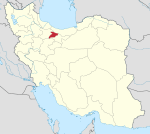 | ||||||||||||||||||
|---|---|---|---|---|---|---|---|---|---|---|---|---|---|---|---|---|---|---|---|
| Counties and cities | |||||||||||||||||||
| Sights |
| ||||||||||||||||||
| populated places | |||||||||||||||||||
| Capital | |||||||||||||||||||||||||||||||||||||||
|---|---|---|---|---|---|---|---|---|---|---|---|---|---|---|---|---|---|---|---|---|---|---|---|---|---|---|---|---|---|---|---|---|---|---|---|---|---|---|---|
| Districts |
| ||||||||||||||||||||||||||||||||||||||
This article is issued from Wikipedia - version of the 3/22/2016. The text is available under the Creative Commons Attribution/Share Alike but additional terms may apply for the media files.