Artesa de Segre
| Artesa de Segre | |
|---|---|
| Municipality | |
|
Artesa de Segre | |
 Artesa de Segre Location in Catalonia | |
| Coordinates: 41°53′50″N 1°02′56″E / 41.89722°N 1.04889°ECoordinates: 41°53′50″N 1°02′56″E / 41.89722°N 1.04889°E | |
| Country |
|
| Community |
|
| Province | Lleida |
| Comarca | Noguera |
| Government | |
| • Mayor | Mingo Sabanés Porta (2015)[1] |
| Area[2] | |
| • Total | 175.9 km2 (67.9 sq mi) |
| Elevation | 394 m (1,293 ft) |
| Population (2014)[1] | |
| • Total | 3,656 |
| • Density | 21/km2 (54/sq mi) |
| Demonym(s) | Artesenc, artesenca |
| Website |
www |

Artesa de Segre is a municipality in the comarca of the Noguera in Catalonia, Spain. It is situated in the valley of the Segre river, between Ponts and Balaguer. The municipal territory extends as far as the confluence of the Segre with the Boix. The Urgell canal runs through the municipality to the south of the Segre. The municipality is served by the C-1313 road between Balaguer and Ponts, and is linked to Agramunt by the L-302 road.
Demography
| 1900 | 1930 | 1950 | 1970 | 1986 | 2007 |
|---|---|---|---|---|---|
| 4712 | 4901 | 4600 | 3541 | 3250 | 3737 |
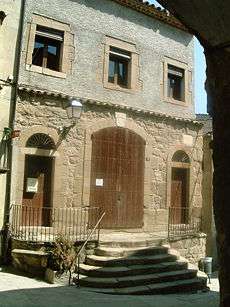
Artesa de Segre Museum
Subdivisions
The municipality of Artesa de Segre include nineteen outlying villages: populations are given as of 2005.
- Alentorn (143)
- Anya (32)
- Baldomar (127)
- La Clua (19)
- Collderat (33)
- Collfred (29)
- Comiols (7)
- Folquer (4)
- Montargull (57)
- Montmagastre (22)
- El Pont d'Alentorn (31)
- Sant Marc del Batlliu (20)
- Seró (93)
- Tudela de Segre (108)
- La Vall d'Ariet
- Vall-llebrera(35)
- La Vedrenya (15)
- Vernet (42)
- Vilves (58)
References
- 1 2 "Ajuntament d'Artesa de Segre". Generalitat of Catalonia. Retrieved 2015-11-13.
- ↑ "El municipi en xifres: Artesa de Segre". Statistical Institute of Catalonia. Retrieved 2015-11-23.
- Panareda Clopés, Josep Maria; Rios Calvet, Jaume; Rabella Vives, Josep Maria (1989). Guia de Catalunya, Barcelona:Caixa de Catalunya. ISBN 84-87135-01-3 (Spanish). ISBN 84-87135-02-1 (Catalan).
External links
- Official website (Catalan)
- Information - Generalitat de Catalunya (Catalan)
- Statistical information - Institut d'Estadística de Catalunya (Catalan)
 |
Vilanova de Meià | Isona i Conca Dellà Gavet de la Conca |
La Baronia de Rialb | |
| Alòs de Balaguer | |
Ponts Oliola | ||
| ||||
| | ||||
| Foradada | Preixens | Agramunt |
This article is issued from Wikipedia - version of the 10/18/2016. The text is available under the Creative Commons Attribution/Share Alike but additional terms may apply for the media files.