Arrondissement of Dole
| Dole | |
|---|---|
| Arrondissement of France | |
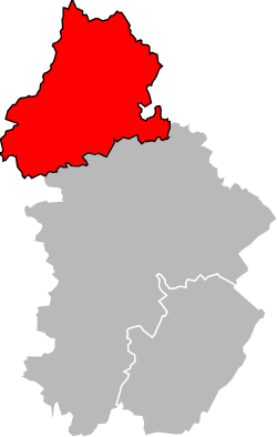 Map of the arrondissement of Dole within Jura | |
| Country | France |
| Region | Bourgogne-Franche-Comté |
| Department | Jura |
| Communes | 125 |
| Subprefecture | Dole |
| Area¹ | |
| • Total | 1,171 km2 (452 sq mi) |
| Population (2013) | |
| • Total | 83,474 |
| • Density | 71/km2 (180/sq mi) |
| ¹ French Land Register data, which exclude lakes, ponds, and glaciers larger than 1 km² as well as the estuaries of rivers. | |
The arrondissement of Dole is an arrondissement of France in the Jura department in the Bourgogne-Franche-Comté region. It has 125 communes.
Composition
Cantons
The cantons of the arrondissement of Dole are:
- Authume
- Dole-1
- Dole-2
- Mont-sous-Vaudrey
- Tavaux
Communes
The communes of the arrondissement of Dole are:[1]
- Abergement-la-Ronce
- Amange
- Annoire
- Archelange
- Asnans-Beauvoisin
- Audelange
- Augerans
- Aumur
- Authume
- Auxange
- Balaiseaux
- Bans
- La Barre
- Baverans
- Belmont
- Biarne
- Brans
- La Bretenière
- Bretenières
- Brevans
- Chaînée-des-Coupis
- Chamblay
- Champagne-sur-Loue
- Champagney
- Champdivers
- Champvans
- Chatelay
- Châtenois
- Chaussin
- Chemin
- Chêne-Bernard
- Chevigny
- Chissey-sur-Loue
- Choisey
- Courtefontaine
- Cramans
- Crissey
- Dammartin-Marpain
- Damparis
- Dampierre
- Le Deschaux
- Dole
- Éclans-Nenon
- Écleux
- Les Essards-Taignevaux
- Étrepigney
- Évans
- Falletans
- Foucherans
- Fraisans
- Frasne-les-Meulières
- Gatey
- Gendrey
- Germigney
- Gevry
- Grange-de-Vaivre
- Gredisans
- Les Hays
- Jouhe
- Lavangeot
- Lavans-lès-Dole
- Longwy-sur-le-Doubs
- Louvatange
- La Loye
- Malange
- Menotey
- Moissey
- Molay
- Monnières
- Montbarrey
- Monteplain
- Montmirey-la-Ville
- Montmirey-le-Château
- Mont-sous-Vaudrey
- Mouchard
- Mutigney
- Neublans-Abergement
- Nevy-lès-Dole
- Offlanges
- Orchamps
- Ougney
- Ounans
- Our
- Pagney
- Pagnoz
- Parcey
- Peintre
- Peseux
- Le Petit-Mercey
- Petit-Noir
- Pleure
- Plumont
- Pointre
- Port-Lesney
- Rahon
- Rainans
- Ranchot
- Rans
- Rochefort-sur-Nenon
- Romain
- Romange
- Rouffange
- Saint-Aubin
- Saint-Baraing
- Saint-Loup
- Salans
- Saligney
- Sampans
- Santans
- Séligney
- Sermange
- Serre-les-Moulières
- Souvans
- Tassenières
- Tavaux
- Taxenne
- Thervay
- Vaudrey
- La Vieille-Loye
- Villeneuve-d'Aval
- Villers-Farlay
- Villers-Robert
- Villette-lès-Dole
- Vitreux
- Vriange
References
External links
Coordinates: 47°05′N 5°29′E / 47.083°N 5.483°E
This article is issued from Wikipedia - version of the 4/24/2016. The text is available under the Creative Commons Attribution/Share Alike but additional terms may apply for the media files.