Arosa
| Arosa | ||
|---|---|---|
 | ||
| ||
 Arosa | ||
|
Location of Arosa  | ||
| Coordinates: 46°47′N 9°41′E / 46.783°N 9.683°ECoordinates: 46°47′N 9°41′E / 46.783°N 9.683°E | ||
| Country | Switzerland | |
| Canton | Graubünden | |
| District | Plessur | |
| Area[1] | ||
| • Total | 154.78 km2 (59.76 sq mi) | |
| Elevation | 1,775 m (5,823 ft) | |
| Population (Dec 2015[2]) | ||
| • Total | 3,205 | |
| • Density | 21/km2 (54/sq mi) | |
| Postal code | 7050 | |
| SFOS number | 3921 | |
| Localities | Innerarosa, Maran, Prätschli, Tschuggen | |
| Surrounded by | Alvaneu, Davos, Langwies, Lantsch/Lenz, Molinis, Peist, Schmitten, Tschiertschen, Vaz/Obervaz, Wiesen | |
| Twin towns | Fukumitsu (Japan) | |
| Website |
www SFSO statistics | |

Arosa is a town and a municipality in the district of Plessur in the canton of Graubünden in Switzerland. It is both a summer and a winter tourist resort.
On 1 January 2013, the former municipalities of Calfreisen, Castiel, Langwies, Lüen, Molinis, Peist and St. Peter-Pagig merged into the municipality of Arosa.[3]
At the end of 2013 the Arosa ski resort was linked with Lenzerheide by cable-car, creating the new ski resort of Arosa Lenzerheide. Since then transport passes work in both resorts.
The town is known throughout Switzerland for its famous ice hockey team, the EHC Arosa which is one of the most successful teams in the country.
History
Arosa is first mentioned about 1330 as Araus. In 1383 it was mentioned as Orossen and in 1428 it was first mentioned as Arosa.[4]
The first known settlements are from the 13th century. After 1300 Arosa German-speaking Walser settlers came from Davos and replaced the original Romansh-speaking inhabitants. During the following centuries, the village had a subsistence alpine pasture economy. Until 1851 it was politically a part of the Davos municipality. Arosa was established as a health resort by a German doctor in 1883, and the first sanatorium was opened in 1888. From 1900 on it gradually developed as a winter resort. In 1938 the first ski lifts were built, and in 1956 the Weisshorn cable car was opened and further rope and chair lifts followed.

In 1851 Arosa separated from the municipality of Davos.[5]
Skiing in Switzerland received a big boost from Sir Arthur Conan Doyle, author of the Sherlock Holmes series. Conan Doyle, an avid sportsman, was wintering in Davos. For entertainment, he ordered some skiing "boards" from Norway and hiked up the mountain with two local guides. They then skied down into Arosa, ending their journey with a luncheon at a local inn, the Seehof, the first hotel in Arosa. Conan Doyle wrote of his pioneering Davos/Arosa ski adventure in a British magazine, The Strand, in 1894, and the story attracted British skiers to Switzerland.
Erwin Schrödinger was vacationing in Arosa at Christmas 1926 when he made his breakthrough discovery of wave mechanics.
In 1933, Thomas Mann stayed in Arosa during the first week of his Swiss exile.
The 1939 film Over the Moon (shot 1937-9) has brief Technicolor exterior shots of the train station and ski resort areas.
On February 20, 1940, Germany's Hassall met with British J. Lonsdale Bryant in Arosa, to make a plan to overthrow the ruling German Nazi Adolf Hitler. [6]
Geography
.jpg)
The municipality of Arosa has an area of 42.6 km2 (16.4 sq mi). Of this, 42% is used for agriculture, and 15.2% is forested. 3.1% is settled (buildings and roads) and the remainder (39.7%) includes the rivers, glaciers and mountains which attract tourists which constitute the primary industry.[7]
The municipality is in the Schanfigg sub-district of the Plessur district, on the south-east slope of the Weisshorn chain. The town of Arosa is at the top of the Schanfigg valley at the foot of the Aroser Weisshorn (2,653 m (8,704 ft)). Adjoining are the areas of Innerarosa, Dorf-Obersee, Untersee and Maran-Prätschli at an elevation of 1,690 and 1,950 meters (5,540 and 6,400 ft).
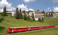
The two lakes in the centre of Arosa are the Obersee (upper lake) and Untersee. The town's railway station is at the end of a branch line from Chur.
Tourism
Arosa has a well-known and safe skiing area and boasts over 60 kilometers (37 mi) of slopes.
The main industry is tourism: there are 4287 guest beds. Arosa has an unemployment rate of 1.32%. As of 2005, there were only 4 people employed in the primary economic sector and about 2 businesses involved in this sector. 308 people are employed in the secondary sector and there are 30 businesses in this sector. 1,202 people are employed in the tertiary sector, with 185 businesses in this sector.[7]
Demographics

Arosa has a year-round population (as of December 2015) of 3,205.[2] As of 2008, 22.0% of the population was made up of foreign nationals.[8] Over the last 10 years the population has decreased by 9.8%, but fluctuates seasonally from about 4600 in January to about 2500 in May. Most of the population (as of 2000) speak German (79.8%), with Portuguese being second most common language (7.3%) and Italian third (4.1%).[7]
As of 2000, there were 51.1% males and 48.9% females.[9] The age distribution, as of 2000, in Arosa is: 7.0% between 0 and 9 years old; 3.2% are 10 to 14; 4.5% are 15 to 19. 26.2% are between 20 and 29 years old. 18.0% are 30 to 39, 14.5% are 40 to 49, 11.6% are 50 to 59. 7.0% are between 60 and 69 years old, 4.9% are 70 to 79, 2.3% are 80 to 89, and 0.6% are 90 to 99.[8]
In the 2007 federal election the most popular party was the SVP which received 45% of the vote. The next three most popular parties were the FDP (24.7%), the SP (17%) and the CVP (12%).[7]
In Arosa about 70.3% of the population between age 25-64 have completed either non-mandatory upper secondary education or additional higher education (either university or a Fachhochschule).[7]
From the 2000 census, 1,140 or 41.1% are Roman Catholic, while 1,150 or 41.5% belonged to the Swiss Reformed Church. 109 individuals (or about 3.9% of the population) belong to the Orthodox Church, and 17 individuals (about 0.6% of the population) who belong to another Christian church. The remainder belong to other religions or did not specify a religion.[8]
The historical population is given in the following table:[4]
| year | population |
|---|---|
| 1550–1750 | c. 125 |
| 1850 | 52 |
| 1900 | 1,071 |
| 1930 | 3,466 |
| 1941 | 1,980 |
| 2000 | 2,771 |
Heritage sites of national significance

The archeological site of Carschlingg near Castiel, a prehistoric, late-Roman and Early Middle Ages settlement, and the Langwieser Viaduct for the Rhätischen Bahn are listed as Swiss heritage site of national significance. The hamlets of Medergen, Sapün and Strassberg are all part of the Inventory of Swiss Heritage Sites.[10]
Weather

Between 1961 and 1990 Arosa had an average of 147 days of rain per year and on average received 1,335 mm (52.6 in) of precipitation. The wettest month was August, with an average of 159 mm (6.3 in) of precipitation and an average of 14.5 days with rain. The month with the most days of precipitation was June, with 15.6, but with only 147 mm (5.8 in) of precipitation. The driest month of the year was February with 75 mm (3.0 in) of precipitation over 14.5 days.[11]
| Climate data for Arosa (1981-2010) | |||||||||||||
|---|---|---|---|---|---|---|---|---|---|---|---|---|---|
| Month | Jan | Feb | Mar | Apr | May | Jun | Jul | Aug | Sep | Oct | Nov | Dec | Year |
| Average high °C (°F) | −0.3 (31.5) |
0.1 (32.2) |
2.6 (36.7) |
5.5 (41.9) |
10.7 (51.3) |
14.1 (57.4) |
16.8 (62.2) |
16.2 (61.2) |
12.6 (54.7) |
9.2 (48.6) |
3.1 (37.6) |
0.2 (32.4) |
7.6 (45.7) |
| Daily mean °C (°F) | −3.4 (25.9) |
−3.6 (25.5) |
−1.5 (29.3) |
1.5 (34.7) |
6.4 (43.5) |
9.5 (49.1) |
11.9 (53.4) |
11.5 (52.7) |
8.3 (46.9) |
5.3 (41.5) |
−0.1 (31.8) |
−2.7 (27.1) |
3.6 (38.5) |
| Average low °C (°F) | −6.1 (21) |
−6.6 (20.1) |
−4.5 (23.9) |
−1.6 (29.1) |
2.9 (37.2) |
5.8 (42.4) |
8.2 (46.8) |
8.2 (46.8) |
5.3 (41.5) |
2.4 (36.3) |
−2.6 (27.3) |
−5.3 (22.5) |
0.5 (32.9) |
| Average precipitation mm (inches) | 86 (3.39) |
79 (3.11) |
92 (3.62) |
96 (3.78) |
119 (4.69) |
152 (5.98) |
163 (6.42) |
170 (6.69) |
124 (4.88) |
88 (3.46) |
106 (4.17) |
90 (3.54) |
1,365 (53.74) |
| Average snowfall cm (inches) | 115.9 (45.63) |
101.3 (39.88) |
109.1 (42.95) |
92.7 (36.5) |
32.9 (12.95) |
12.1 (4.76) |
2.4 (0.94) |
3.4 (1.34) |
12.3 (4.84) |
36.3 (14.29) |
97.5 (38.39) |
106.7 (42.01) |
722.6 (284.49) |
| Average precipitation days (≥ 1.0 mm) | 11.2 | 9.7 | 12.5 | 12.4 | 13.7 | 15.1 | 13.8 | 13.9 | 11.0 | 9.4 | 11.7 | 11.3 | 145.7 |
| Average snowy days (≥ 1.0 cm) | 12.9 | 11.6 | 13.5 | 11.4 | 4.6 | 1.8 | 0.5 | 0.5 | 2 | 4.5 | 11.1 | 13.2 | 87.6 |
| Average relative humidity (%) | 69.4 | 70.6 | 72.3 | 75.4 | 76.8 | 76.6 | 74.9 | 76.8 | 75.8 | 68.0 | 69.4 | 69.2 | 72.9 |
| Mean monthly sunshine hours | 108 | 115 | 138 | 141 | 159 | 159 | 195 | 181 | 153 | 142 | 99 | 87 | 1,676 |
| Source: MeteoSwiss [12] | |||||||||||||
Notable people
_(c._1885).jpg)
- 'Science'
- Otto Amrein, doctor
- Otto Herwig, doctor
- Ernst Rahm, botanist and historian
- Martin Röthlisberger, doctor
- Carl Rüedi, (1848-1901), doctor and lung expert
- Art and culture:
- Daniel Meisser, ski instructor and architect, "Gigi Arosa"
- Felix Moeschlin, spa director and writer
- Kathrin Rüegg, (born 1930), author and TV chef of the consignment What the grandmother still knew
- Hans Roelli, spa director, composer and poet
- Roman Vital, filmmaker
- Sports:
- Livia Altmann, (born 1994), ice hockey goaltender
- Ueli Fritz, musher
- Beni Leaders, skier
- Jürg Gadient, skier
- Werner Geeser, (1948-2011), cross-country skier
- Heini Klotz, skier
- Heini Lohrer, (1919-2011), ice hockey player
- Werner Lohrer, (1917-1991), ice hockey player
- Werner Mattle, (born 1949), former alpine skier and Olympic medalist
- Jöri Mattli, hockey player
- Yvonne Rüegg, (born 1938), former alpine skier
- Gian Simmen, (born 1977), snowboarder
- Charles Stoffel, bobsled and rider
- David Zogg, skier and climber
- 'Policy and Entrepreneurship:'
- Hans Hold, politician and Brigadier
- Karl-Heinz Kipp, (born 1924), entrepreneur and billionaire, founder of the Massa chain of German department stores
References
- ↑ Arealstatistik Standard - Gemeindedaten nach 4 Hauptbereichen
- 1 2 Swiss Federal Statistical Office - STAT-TAB, online database – Ständige und nichtständige Wohnbevölkerung nach institutionellen Gliederungen, Geburtsort und Staatsangehörigkeit (German) accessed 30 August 2016
- ↑ Nomenklaturen – Amtliches Gemeindeverzeichnis der Schweiz (German) accessed 9 February 2013
- 1 2 Arosa in German, French and Italian in the online Historical Dictionary of Switzerland.
- ↑ Amtliches Gemeindeverzeichnis der Schweiz published by the Swiss Federal Statistical Office (German) accessed 23 September 2009
- ↑ Shirer's Rise and Fall of the Third. Reich, location 17382, 56% into the book.
- 1 2 3 4 5 Swiss Federal Statistical Office accessed 27-Oct-2009
- 1 2 3 Graubunden Population Statistics (German) accessed 21 September 2009
- ↑ Graubunden in Numbers (German) accessed 21 September 2009
- ↑ Swiss inventory of cultural property of national and regional significance Archived 1 May 2009 at the Wayback Machine. 21.11.2008 version, (German) accessed 27-Oct-2009
- ↑ "Temperature and Precipitation Average Values-Table, 1961-1990" (in German, French, and Italian). Federal Office of Meteorology and Climatology - MeteoSwiss. Archived from the original on 27 June 2009. Retrieved 8 May 2009., the weather station elevation is 1840 metres above sea level.
- ↑ "Climate Norm Value Tables". Climate diagrams and normals from Swiss measuring stations. Federal Office of Meteorology and Climatology (MeteoSwiss). Archived from the original on 14 May 2013. Retrieved 23 January 2013. The weather station elevation is 1840 meters above sea level.
External links
- Official Arosa tourism site
- Alpine Pearls
- Livecams of Arosa
- Hans Danuser: Arosa in Romansh, German, French and Italian in the online Historical Dictionary of Switzerland.
 Media related to Arosa at Wikimedia Commons