Arghandab River
| Arghandab River | |
|---|---|
|
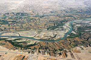
Aerial photograph of Arghandab River in Kandahar Province of Afghanistan | |
| Native name | Arghandaw rod |
| Other name(s) | Sanzari wala,Arghandab wala, Arghandab sind,ارغنداب رود |
| Countries | Afghanistan |
| Cities | Kandahar |
| Basin | |
| Main source | Afghanistan |
| Physical characteristics | |
| Length | 400 km (250 mi) |
Arghandab is a river in Afghanistan, about 400 km (250 mi) in length. It rises in the Hazarajat country north-west of Ghazni, and flows south-west falls into the Helmand 30 km (19 mi) below Girishk. In its lower course it is much used for irrigation, under the control of the Helmand and Arghandab Valley Authority, and the valley is cultivated and populous; yet the water is said to be somewhat brackish. It is doubtful whether the ancient Arachotus is to be identified with the Arghandab or with its chief confluent the Tarnak, which joins it on the left out 50 km (31 mi) SW of Kandahar. The Tarnak, which flows south of Kandahar, is much shorter (length about 320 km or 200 miles) and less copious. The ruins at Ulan Robat, supposed to represent the city Arachosia, are in its basin; and the lake known as Ab-i-Istada, the most probable representative of Lake Arachotus, is near the head of the Tarnak, though not communicating with it. The Tarnak is dammed for irrigation at intervals, and in the hot season almost dries up.[1]
There is a good deal of cultivation along the river, but few villages. The Kabul-Kandahar Highway passes this way (another reason for supposing the Tarnak to be Arachotus), and the people live off the road to avoid the onerous duties of hospitality.[1]
In 2008 a project was initiatated to rehabilitate the Dahla Dam, and associated irrigation system.[2][3][4][5][6][7]
See also
References
- 1 2
 Chisholm, Hugh, ed. (1911). "Arghandab". Encyclopædia Britannica. 2 (11th ed.). Cambridge University Press. p. 475.
 - ↑ "Provincial profile for Kandahar Province" (PDF). Regional Rural Economic Regeneration Strategies. Archived from the original (PDF) on 2008-08-28. Retrieved 2008-10-07.
- ↑ Stephen Chase (2008-07-17). "Dahla dam project is potential target: military". Globe and Mail. Retrieved 2008-10-07.
- ↑ Doug Schmidt (2008-06-11). "Cdn. military to safeguard Afghan dam project". Canwest News Service. Retrieved 2008-10-07.
- ↑ "Signature Project: Dahla Dam and Irrigation System". Government of Canada. Retrieved 2008-10-07.
- ↑ "Dahla Dam -- Summer 2008 (video podcast)". Government of Canada. Retrieved 2008-10-07.
- ↑ "Dahla Dam -- Summer 2008". Government of Canada. Retrieved 2008-10-07.
External links
| Wikimedia Commons has media related to Arghandab River. |
Coordinates: 31°50′58″N 65°53′18″E / 31.84944°N 65.88833°E