Ardales
| Ardales | ||
|---|---|---|
| Municipality | ||
 | ||
| ||
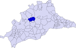 Municipal location in the Province of Málaga | ||
 Ardales Location in Spain | ||
| Coordinates: 36°52′40″N 4°50′41″W / 36.87778°N 4.84472°WCoordinates: 36°52′40″N 4°50′41″W / 36.87778°N 4.84472°W | ||
| Country |
| |
| Community | Andalusia | |
| Province | Málaga | |
| Comarca | Comarca de Antequera, Guadalteba | |
| Government | ||
| • Mayor | Juan Calderón Ramos | |
| Area | ||
| • Total | 106 km2 (41 sq mi) | |
| Elevation | 445 m (1,460 ft) | |
| Population (2010) | ||
| • Total | 2,660 | |
| • Density | 25/km2 (65/sq mi) | |
| Demonym(s) | Ardaleños | |
| Time zone | CET (UTC+1) | |
| • Summer (DST) | CEST (UTC+2) | |
| Postal code | 29550 | |
| Website | Official website | |

Ardales is a town and municipality in the province of Málaga, part of the autonomous community of Andalusia in southern Spain. The municipality is situated approximately 62.5 kilometres from Málaga.
Main sights
On the hill above the town is the historic church and higher still are the ruins of the Ardales castle. At the peak of the hill is the hermitage Ermita del Calvario. The infamous Caminito del Rey is nearby.
External links
| Wikimedia Commons has media related to Ardales. |
- "Ardales, Andalusia, Spain" Motion Views photographs of Ardales
This article is issued from Wikipedia - version of the 1/15/2016. The text is available under the Creative Commons Attribution/Share Alike but additional terms may apply for the media files.