Arapohue
| Arapohue | |
|---|---|
 Arapohue | |
| Coordinates: 36°0′29″S 173°56′43″E / 36.00806°S 173.94528°E | |
| Country | New Zealand |
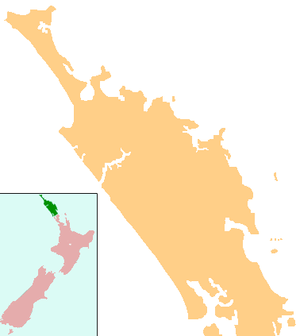
| Region | Northland Region |
| District | Kaipara District |
Arapohue is a locality in Northland, New Zealand, approximately 16 km south east of Dargaville[1][2]
Lime is quarried in the area.[3]
History
In 1806, during the Musket Wars, Ngā Puhi attacked the Te Roroa chief Tāoho at Arapohue, but was repulsed.[4] Samuel Polack passed through in 1832, at which time there was a desolate and decayed village called Warepohuhi in the area.[5]
The Arapohue block (about 79 km²) was sold in the late 1850s for £350, despite a dispute between Ngā Puhi and Ngāti Whātua over claims to the land.[6] The area was heavily forested in kauri. Most of those who purchased lots in the area were absentee owners. In 1876, there were only 30 residents on the 283 holdings of the Arapohue and neighbouring Okahu and Whakahara blocks.[7] The village of Arapohue was owned by Logan Campbell until 1899.[8] The area was developed as farmland in the early 20th century.[9]
Education
Arapohue School is a coeducational full primary (years 1-8) school with a decile rating of 2[10] and 14 students (as of July 2016).[11] The school was founded in 1876.[12]
Notes
- ↑ Peter Dowling (editor) (2004). Reed New Zealand Atlas. Reed Books. pp. map 7. ISBN 0-7900-0952-8.
- ↑ Roger Smith, GeographX (2005). The Geographic Atlas of New Zealand. Robbie Burton. pp. map 26. ISBN 1-877333-20-4.
- ↑ "Dargaville". Encyclopedia of New Zealand (1966).
- ↑ Byrne, Brian (2002). The Unknown Kaipara. p. 10. ISBN 0-473-08831-2.
- ↑ Byrne, p 34
- ↑ Ryburn, Wayne (1999). Tall Spars, Steamers & Gum. pp. 12, 211. ISBN 0-473-06176-7.
- ↑ Ryburn, p 48
- ↑ Ryburn, p 68
- ↑ Ryburn, p 159
- ↑ Te Kete Ipurangi schools database: Arapohue School
- ↑ "Directory of Schools - as at 2 August 2016". New Zealand Ministry of Education. Retrieved 2016-08-16.
- ↑ Powick, Maxine (2001). Arapohue School "Te Ara Ki Mātauranga" 1876-2000, 125th Reunion. Arapohue School Reunion Committee.
Coordinates: 36°0′29″S 173°56′43″E / 36.00806°S 173.94528°E