Aranyaprathet District
Aranyaprathet District (Thai: อรัญประเทศ) is a district (amphoe) in Sa Kaeo Province in Thailand. It borders Cambodia to the east.
| Aranyaprathet อรัญประเทศ | |
|---|---|
| Amphoe | |
|
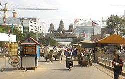
Boundary at Aranyaprathet | |
 Amphoe location in Sa Kaeo Province | |
| Coordinates: 13°42′3″N 102°30′42″E / 13.70083°N 102.51167°ECoordinates: 13°42′3″N 102°30′42″E / 13.70083°N 102.51167°E | |
| Country |
|
| Province | Sa Kaeo |
| Seat | Ban Mai Nong Sai |
| Area | |
| • Total | 821.265 km2 (317.092 sq mi) |
| Population (2014) | |
| • Total | 86,103 |
| • Density | 101.3/km2 (262/sq mi) |
| Time zone | ICT (UTC+7) |
| Geocode | 2706 |
Economy
Until the Khmer Rouge disrupted neighbouring Cambodia in 1975, Aranyaprathet was a stop on the railroad connecting Bangkok with the Cambodian capital Phnom Penh. Aranyaprathet maintains its rail link with Bangkok but Poipet, the neighbouring Cambodian town, is still yet to see any rail activity since the Khmer Rouge destroyed the track.
Southeast of central Aranyaprathet, 6 km away, is the busiest border crossing between Cambodia and Thailand. In addition to being on a major trade route, the border sees much tourist activity as it is on the road between Bangkok and Siem Reap, the town nearest Angkor Wat.
Aran, as the town is known in Thailand, has been affected by the growth of the gambling industry in Poipet. Despite gambling being illegal in both Thailand and Cambodia, the Cambodian government has granted concessions for casinos to be built at many of its land crossings. Cambodians are not permitted to gamble in the casinos. Poipet's proximity to Bangkok (3-5 hrs by road) has made it the most popular of these border casino areas. It now hosts seven casinos.
History
Aranyaprathet was originally a district within the province Kabin Buri. On 1 April 1926 the province was abolished and the two districts Mueang Kabin Buri and Aranyapathret became districts of Prachinburi Province.[1] In 1993 it was one of the districts which formed the new Sa Kaeo Province.
Administration
The district Aranyaprathet is divided into 13 sub-districts (tambon), which are further subdivided into 114 administrative villages (Muban).
| No. | Name | Thai | Villages | Pop.[2] |
|---|---|---|---|---|
| 1. | Aranyaprathet | อรัญประเทศ | - | 16,211 |
| 2. | Mueang Phai | เมืองไผ่ | 8 | 4,307 |
| 3. | Han Sai | หันทราย | 10 | 5,644 |
| 4. | Khlong Nam Sai | คลองน้ำใส | 12 | 5,432 |
| 5. | Tha Kham | ท่าข้าม | 11 | 4,845 |
| 6. | Pa Rai | ป่าไร่ | 9 | 6,338 |
| 7. | Thap Phrik | ทับพริก | 7 | 3,658 |
| 8. | Ban Mai Nong Sai | บ้านใหม่หนองไทร | 8 | 9,634 |
| 9. | Phan Suek | ผ่านศึก | 13 | 6,592 |
| 10. | Nong Sang | หนองสังข์ | 8 | 7,009 |
| 11. | Khlong Thap Chan | คลองทับจันทร์ | 10 | 4,713 |
| 12. | Fak Huai | ฟากห้วย | 11 | 6,940 |
| 13. | Ban Dan | บ้านด่าน | 7 | 4,780 |
References
- ↑ ประกาศ เรื่อง ยุบจังหวัดกบินทร์บุรีลงเป็นอำเภอขึ้นจังหวัดปราจีน (PDF). Royal Gazette (in Thai). 42 (0 ก): 430–431. March 31, 1926.
- ↑ "Population statistics 2014" (in Thai). Department of Provincial Administration. Retrieved 2015-05-11.