Appomattox Court House National Historical Park
|
Appomattox Court House National Historical Park | |
|
Appomattox Court House National Historical Park. The Old Appomattox Court House is at left; the McLean House, the site of the surrender conference is at right. | |
 | |
| Location | Appomattox County, Virginia |
|---|---|
| Nearest city | Appomattox, Virginia |
| Coordinates | 37°22′39″N 78°47′45.6″W / 37.37750°N 78.796000°WCoordinates: 37°22′39″N 78°47′45.6″W / 37.37750°N 78.796000°W |
| Area | 1,774 acres (718 ha)[1] |
| Built | 1865 |
| Visitation | 176,040 (2011)[2] |
| Website | Appomattox Court House National Historical Park |
| NRHP Reference # | 66000827[3] |
| VLR # | 006-0033 |
| Significant dates | |
| Added to NRHP | October 15, 1966 |
| Designated VLR | July 6, 1971[4] |

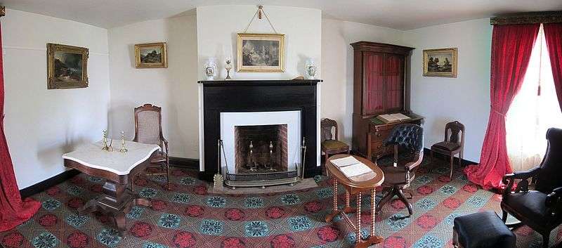
The Appomattox Court House National Historical Park is a National Historical Park of original and reconstructed 19th century buildings in Appomattox County, Virginia.[5] The village is famous as the site of the Battle of Appomattox Court House and containing the house of Wilmer McLean, where the surrender of the Confederate army under Robert E. Lee to Union commander Ulysses S. Grant took place on April 9, 1865, effectively ending the American Civil War.[6] The McLean House was the site of the surrender conference, but the village itself is named for the presence nearby of what is now preserved as the Old Appomattox Court House.
The park was established August 3, 1935.[7] The village was made a national monument in 1940 and a national historical park in 1954. It is located about three miles (5 km) east of Appomattox, Virginia, the location of the Appomattox Station and the "new" Appomattox Court House. It is in the center of the state about 25 miles (40 km) east of Lynchburg, Virginia.The historical park was described in 1989 as having an area of 1,325 acres (536 ha).[8]
History of the village
The antebellum village started out as "Clover Hill" named after its oldest existing structure, the Clover Hill Tavern (c. 1819). The village was a stagecoach stop along the Richmond-Lynchburg stage road. The activity in Clover Hill centered around Clover Hill Tavern. The tavern provided lodging to travelers. Fresh horses for the stage line were also provided at the stop, which had been done since the tavern was built.[9] It was also the site of organizational meetings and so when Appomattox County was established by an Act on February 8, 1845, Clover Hill village became the county seat. It was parts of Buckingham, Prince Edward, Charlotte, and Campbell Counties. The jurisdiction took its name from the headwaters that emanate there, the Appomattox River. Early Virginians believe the name Appomattox came from an Indian tribe called Apumetec.[10]
From about 1842, Hugh Raine basically owned most of the Clover Hill area. He obtained it from his brother John Raine who defaulted on his loans. Later, he sold the property to a Colonel Samuel D. McDearmon. Since his acquisition, it became the county seat and he surveyed 30 acres (12 ha) of the hamlet. He designated 2 acres (0.81 ha) to be used by the new county to build a courthouse and other government buildings. The courthouse was to be built across the Stage Road from the Clover Hill Tavern. The jail was to be built behind the courthouse. McDearmon divided the remaining land surrounding the courthouse into 1-acre (0.40 ha) lots. He felt that with Clover Hill's new status as a county seat he would find professional people ready and willing to purchase the lots. His hopes were later dashed in 1854 as the train depot stopped three miles (5 km) west in Appomattox, Virginia. The American Civil War put the final nails in the coffin. The district once known as Clover Hill and later renamed to Appomattox Court House continued to decline as businesses moved to the area of the Appomattox Station.[10]
The village contained 30 acres (12 ha) of the original Patteson's Clover Hill Tavern property of some 200 acres (81 ha).[10] Raine provided the Clover Hill Tavern for meeting space for the organization of the new county in May 1845 and naming the township "Clover Hill."[11]
The county records show:
- "And be it further enacted, that not exceeding thirthy acres of land, now occupied by Captain John Raine, in the now county of Prince Edward, lying on the stage road leading from or through said county to the town of Lynchburg, at the place called and known as Clover Hill, the proposed seat of justice for the said new county, so soon as the same shall be laid off into lots, with convenient streets and alleys, with back and cross streets if necessary, shall be and the same is hereby established a town by the name of Clover Hill."[11]
According to a Union writer at the time of the American Civil War the village consisted of about "five houses, a tavern, and a courthouse — all on one street that was boarded up at one end to keep the cows out." There were actually more dwellings in this obscure hamlet, some of which were off the main village street. There were a large number of cabins and out-buildings. The hamlet had two stores, law offices, a saddler, wheelwright, three blacksmiths, and other businesses. A tavern had been built by John Raine in 1848 that became the celebrated McLean house. Many rural counties in the Southern States had county seats whose names were formed by adding court house (two words) to the name of the county, hence the village name became Appomattox Court House.[12]
It presently has a couple of dozen restored buildings. Some of the notable buildings are the Peers House, McLean House, New County Jail, Jones Law Office, Clover Hill Tavern, Woodson Law Office, Bocock-Isbell House, Mariah Wright House, Plunkett-Meeks Store, Sweeney-Conner Cabin, Charles Sweeney Cabin, Sweeney Prizery and the Old Appomattox Court House. There are also various ruins and cemeteries within the village. At the time of the Act of Congress that authorized the Appomattox Court House National Historical Park in 1935, the existing buildings were the Clover Hill Tavern, the Tavern guest house and kitchen, the Woodson Law office structure, the Plunkett-Meeks Store, the Bocock-Isbell House, and several residences outside the village limits.[11] There are several markers throughout the field of the village that show points of interest within the Park. Some of these are the sites of General Lee's and General Grant's headquarters; the site of the apple tree where General Lee waited for General Grant's reply on the morning of April 9, 1865; the line of General Joshua Lawrence Chamberlain's brigade drawn up to receive the Confederate arms on April 12, 1865; and the position of the last cannon fired by the Confederate artillery on the morning of April 9, 1865. There is also a monument and two tablets that were erected by the state of North Carolina describing the last engagement of the armies this same morning.[11]
General George Armstrong Custer of Little Bighorn fame received a flag of truce at the village of "Appomattox Court House" that brought about the discontinuance of hostilities of the Confederate and the Union armies leading to the surrender meeting between General Lee and General Grant at the McLean House.[13]
The program for the development of the Park calls for a partial restoration of Clover Hill and the hamlet of Appomattox Court House to its appearance in April 1865. This will constitute for the people of the United States a memorial to the termination of the American Civil War. World War II stopped temporarily the development of the Park, however it was resumed in 1947. Some structures in the village that were built after 1865 were taken down that did not represent a true picture of the end of the Civil War. In 1954, Virginia State Route 24 was relocated south of the Appomattox Court House Historical Park so the National Park Service could restore the Richmond-Lynchburg stage road to its 1865 appearance. Also this would allow the National Park Service to do archeological exploration at the original Appomattox Court House building.[11]
Gallery
-

Appomattox Court House with Union Army soldiers, April 1865
-
Tavern, Main Street, Appomattox
-

Appomattox park main entrance sign
-
_IMG_4128.JPG)
Union Army General Ulysses S. Grant accepts the surrender of Confederate General Robert E. Lee, as depicted at the visitors' center museum
-

Confederate Cemetery at historical park
-

Grassy field at Appomattox Park
-

National Park Service guide at the McLean House at Appomattox
-

Richmond-Lynchburg
stage road
See also
- American Civil War
- Confederate States of America
- Origins of the American Civil War
- Conclusion of the American Civil War
- Turning point of the American Civil War
- Military of the Confederate States of America
Notes
| Wikimedia Commons has media related to Appomattox Court House National Historical Park. |
- ↑ "Listing of acreage as of December 31, 2011". Land Resource Division, National Park Service. Retrieved 2012-03-30.
- ↑ "NPS Annual Recreation Visits Report". National Park Service. Retrieved 2012-03-30.
- ↑ National Park Service (2009-03-13). "National Register Information System". National Register of Historic Places. National Park Service.
- ↑ "Virginia Landmarks Register". Virginia Department of Historic Resources. Retrieved 2013-05-12.
- ↑ Marvel, A place called Appomattox, has an extensive bibliography (pp. 369-383) which lists manuscript collections, private papers and letters that were consulted, as well as, newspapers, government documents, and other published monographs that were used in his research of Appomattox.
- ↑ "Appomattox Court House village". Retrieved 2009-01-21.
- ↑ Burnham, p. 331
- ↑ Author not noted (n.d.). "National Register of Historic Places Registration: Appomattox Court House / Appomattox Court House National Historical Park" (PDF). National Park Service. Retrieved 2009-06-26. and Accompanying 12 photos, undated (2.82 MB) (Incomplete copy, lacking author and date)
- ↑ "Clover Hill village". Archived from the original on 2008-05-03. Retrieved 2009-01-21.
- 1 2 3 Marvel, pp 1-6
- 1 2 3 4 5 "1961 Park tour guide brochure". Retrieved 2009-01-11.
- ↑ "Appomattox Court House village — National Historic Park buildings". Archived from the original on 26 December 2008. Retrieved 2009-01-21.
- ↑ "Original Structures at Appomattox Court House National Historical Park". Archived from the original on 31 December 2008. Retrieved 2009-01-11.
References
- Bradford, Ned, Battles and Leaders of the Civil War, Plume, 1989
- Burnham, Bill, The Virginia Handbook, Hunter Publishing, Inc, 2005, ISBN 1-58843-512-1
- Catton, Bruce, A Stillness at Appomattox, Doubleday 1953, Library of Congress # 53-9982, ISBN 0-385-04451-8
- Catton, Bruce, This Hallowed Ground, Doubleday 1953, Library of Congress # 56-5960
- Chaffin, Tom, 2006. Sea of Gray: The Around-the-World Odyssey of the Confederate Raider Shenandoah, Hill and Wang/Farrar, Straus and Giroux,.
- Davis, Burke, The Civil War: Strange & Fascinating Facts, Wings Books, 1960 & 1982, ISBN 0-517-37151-0
- Davis, Burke, To Appomattox - Nine April Days, 1865, Eastern Acorn Press, 1992, ISBN 0-915992-17-5
- Gutek, Patricia, Plantations and Outdoor Museums in America's Historic South, University of South Carolina Press, 1996, ISBN 1-57003-071-5
- Kaiser, Harvey H., The National Park Architecture Sourcebook, Princeton Architectural Press, 2008, ISBN 1-56898-742-0
- Kennedy, Frances H., The Civil War Battlefield Guide, Houghton Mifflin Company, 1990, ISBN 0-395-52282-X
- Korn, Jerry et al., The Civil War, Pursuit to Appomattox, The Last Battles, Time-Life Books, 1987, ISBN 0-8094-4788-6
- Marvel, William, A Place Called Appomattox, UNC Press, 2000, ISBN 0-8078-2568-9
- Marvel, William, Lee's Last Retreat, UNC Press, 2006, ISBN 0-8078-5703-3
- McPherson, James M., Battle Cry of Freedom, Oxford University Press, 1988,
- National Park Service, Appomattox Court House: Appomattox Court House National Historical Park, Virginia, U.S. Dept. of the Interior, 2002, ISBN 0-912627-70-0
- Tidwell, William A., April '65: Confederate Covert Action in the American Civil War, Kent State University Press, 1995, ISBN 0-87338-515-2
- Weigley, Russel F., A Great Civil War: A Military and Political History, 1861-1865, Indiana University Press, 2000, ISBN 0-253-33738-0
External links
|
|
- National Park Service, Appomattox Court House - official site
- Appomattox Court House buildings photos
- A Brief History of Appomattox County
- Appomattox Court House National Historic Park — Spotlight America
- Road to Appomattox PowerPoint slide show Civil-War-Journeys.org
- Civil War Surrender Furniture at the National Museum of American History
- Appomattox Courthouse, Appomattox, Appomattox County, VA at the Historic American Buildings Survey (HABS)

