Appleton, Minnesota
| Appleton, Minnesota | |
|---|---|
| City | |
|
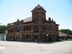
Appleton's Old City Hall | |
| Nickname(s): "Home of Honored Veterans" | |
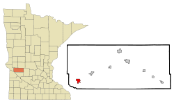 Location of Appleton within Swift County, Minnesota | |
| Coordinates: 45°12′5″N 96°1′11″W / 45.20139°N 96.01972°W | |
| Country | United States |
| State | Minnesota |
| County | Swift |
| Area[1] | |
| • Total | 2.04 sq mi (5.28 km2) |
| • Land | 1.97 sq mi (5.10 km2) |
| • Water | 0.07 sq mi (0.18 km2) |
| Elevation | 1,007 ft (307 m) |
| Population (2010)[2] | |
| • Total | 1,412 |
| • Estimate (2012[3]) | 1,378 |
| • Density | 716.8/sq mi (276.8/km2) |
| Time zone | Central (CST) (UTC-6) |
| • Summer (DST) | CDT (UTC-5) |
| ZIP code | 56208 |
| Area code(s) | 320 |
| FIPS code | 27-01864[4] |
| GNIS feature ID | 0639416[5] |
| Website | www.appletonmn.com |
Appleton is a city in Swift County, Minnesota, United States. The population was 1,412 at the 2010 census.[6] The town is home to a vacant medium-security prison, the Prairie Correctional Facility, which is wholly owned and operated by Corrections Corporation of America. Appleton's economy took a huge hit when the prison closed in 2010.
Elmer A. Benson, who served as a United States Senator and as governor of Minnesota, was born in Appleton on September 23, 1895. Appleton is also home to many retirees and military veterans. All of its twenty-some streets, except Minnesota Street, are named for local veterans who died in combat. It appears that if any more Appleton veterans die in combat, there are no streets left to be used as memorials.
History
Appleton was laid out in 1872, and named after Appleton, Wisconsin.[7] A post office has been in operation at Appleton since 1873.[8] Appleton was incorporated in 1881.[7]
Gethsemane Episcopal Church on North Hering Street at Snelling Avenue was built in 1879 and was listed on the National Register of Historic Places in 2011.
Geography
According to the United States Census Bureau, the city has a total area of 2.04 square miles (5.28 km2); 1.97 square miles (5.10 km2) is land and 0.07 square miles (0.18 km2) is water.[1] The Pomme de Terre River flows through the city and continues 10 miles to the west and south into Marsh Lake on the Minnesota River.[9]
U.S. Highway 59 and Minnesota State Highways 7 and 119 are three of the main routes in the city.
Demographics
| Historical population | |||
|---|---|---|---|
| Census | Pop. | %± | |
| 1880 | 400 | — | |
| 1890 | 994 | 148.5% | |
| 1900 | 1,184 | 19.1% | |
| 1910 | 1,221 | 3.1% | |
| 1920 | 1,579 | 29.3% | |
| 1930 | 1,625 | 2.9% | |
| 1940 | 1,877 | 15.5% | |
| 1950 | 2,256 | 20.2% | |
| 1960 | 2,172 | −3.7% | |
| 1970 | 1,789 | −17.6% | |
| 1980 | 1,842 | 3.0% | |
| 1990 | 1,552 | −15.7% | |
| 2000 | 2,871 | 85.0% | |
| 2010 | 1,412 | −50.8% | |
| Est. 2015 | 1,341 | [10] | −5.0% |
| U.S. Decennial Census | |||
2010 census
As of the census[2] of 2010, there were 1,412 people, 677 households, and 342 families residing in the city. The population density was 716.8 inhabitants per square mile (276.8/km2). There were 851 housing units at an average density of 432.0 per square mile (166.8/km2). The racial makeup of the city was 92.8% White, 1.3% African American, 1.1% Native American, 0.5% Asian, 0.1% Pacific Islander, 2.3% from other races, and 1.8% from two or more races. Hispanic or Latino of any race were 4.2% of the population.
There were 677 households of which 22.3% had children under the age of 18 living with them, 35.6% were married couples living together, 10.8% had a female householder with no husband present, 4.1% had a male householder with no wife present, and 49.5% were non-families. 44.9% of all households were made up of individuals and 24.8% had someone living alone who was 65 years of age or older. The average household size was 2.00 and the average family size was 2.78.
The median age in the city was 48.5 years. 20% of residents were under the age of 18; 6.5% were between the ages of 18 and 24; 20% were from 25 to 44; 26.2% were from 45 to 64; and 27.5% were 65 years of age or older. The gender makeup of the city was 46.6% male and 53.4% female.
2000 census
As of the census[4] of 2000, there were 2,871 people, 729 households, and 376 families residing in the city. The population density was 1,442.2 people per square mile (557.0/km²). There were 860 housing units at an average density of 432.0 per square mile (166.9/km²). The racial makeup of the city was 68.13% White, 10.73% African American, 1.57% Native American, 5.02% Asian, 6.27% Pacific Islander, 2.40% from other races, and 5.89% from two or more races. Hispanic or Latino of any race were 4.84% of the population. Total U.S. Census population number, includes about 1,000 inmates in the prison.
There were 729 households out of which 23.5% had children under the age of 18 living with them, 40.1% were married couples living together, 8.6% had a female householder with no husband present, and 48.4% were non-families. 45.5% of all households were made up of individuals and 27.4% had someone living alone who was 65 years of age or older. The average household size was 2.02 and the average family size was 2.82.
In the city the population was spread out with 12.1% under the age of 18, 9.2% from 18 to 24, 42.7% from 25 to 44, 19.9% from 45 to 64, and 16.2% who were 65 years of age or older. The median age was 39 years. For every 100 females there were 240.6 males. For every 100 females age 18 and over, there were 266.9 males.
The median income for a household in the city was $25,950, and the median income for a family was $40,313. Males had a median income of $26,991 versus $20,991 for females. The per capita income for the city was $12,429. About 9.9% of families and 14.7% of the population were below the poverty line, including 14.9% of those under age 18 and 23.2% of those age 65 or over.
Education
Appleton Public Schools are part of the Lac Qui Parle Valley School District. Schools in the district include MMN Elementary School, Appleton Elementary School, LqPV Middle School and Lac Qui Parle Valley High School.
Appleton Elementary School is located in Appleton.
Ranae Tostenson is the Superintendent of Schools.[11]
Media
Television stations
Appleton did have one full-service television station, PBS member station KWCM-TV. Pioneer Public TV moved from Appleton to Granite Falls in 2016. Appleton is also home to several low-power free-to-air and pay TV stations that show programming normally seen on cable television. While this phenomenon is fairly common in Canada, it is unusual in the United States. The following stations are licensed to Appleton:
Free-to-air Stations:
- KWCM-TV analog 10/digital 31 (PBS)
- K56BZ analog 56 - KARE via K50AG (NBC)
- K58EO analog 58 - WFTC (MyNetworkTV)
Defunct TV Stations:
- K15DC analog 15 - A&E
- K17CS analog 17 - TBS (not WTBS)
- K19CW analog 19 - USA Network
- K21AK analog 21 - Nickelodeon (owned by Teleview Systems of Minnesota, Inc.)
- K23DF analog 23 - Discovery Channel
- K29CC analog 29 - ABC Family
- K31BT - (formerly CNN, shut down for KWCM-DT's signal)
- K33CR - (formerly Showtime)
- K49ED analog 49 - TNT
- K52AH analog 52 - Spike TV (formerly TNN)
- K54AK - KMSP-TV (Fox)
- K60AB - (formerly FSN North)
Notable people
- Jerry Koosman - former Major League Baseball pitcher
- Brad Rheingans - former pro wrestler
- Elmer Benson - United States Senator and Governor of Minnesota
- Charles Peter “Chuck” Brown (April 3, 1951 – August 14, 2003) - politician and former member of the Minnesota House of Representatives
- Clinton Sundberg - Hollywood actor
- Martin J. McGowan, Jr. - former member of the Minnesota House of Representatives
References
- 1 2 "US Gazetteer files 2010". United States Census Bureau. Archived from the original on 2012-01-24. Retrieved 2012-11-13.
- 1 2 "American FactFinder". United States Census Bureau. Retrieved 2012-11-13.
- ↑ "Population Estimates". United States Census Bureau. Archived from the original on 2013-06-17. Retrieved 2013-05-28.
- 1 2 "American FactFinder". United States Census Bureau. Archived from the original on 2013-09-11. Retrieved 2008-01-31.
- ↑ "US Board on Geographic Names". United States Geological Survey. 2007-10-25. Retrieved 2008-01-31.
- ↑ "2010 Census Redistricting Data (Public Law 94-171) Summary File". American FactFinder. U.S. Census Bureau, 2010 Census. Archived from the original on 26 July 2011. Retrieved 23 April 2011.
- 1 2 Upham, Warren (1920). Minnesota Geographic Names: Their Origin and Historic Significance. Minnesota Historical Society. p. 539.
- ↑ "Swift County". Jim Forte Postal History. Retrieved 9 August 2015.
- ↑ Minnesota Atlas & Gazetteer. Yarmouth, Me.: DeLorme. 1994. p. 36. ISBN 0-89933-222-6.
- ↑ "Annual Estimates of the Resident Population for Incorporated Places: April 1, 2010 to July 1, 2015". Retrieved July 2, 2016.
- ↑ "Lac qui Parle Valley School District #2853". Lac qui Parle Valley School District #2853. Retrieved 2012-06-26.
External links
| Wikimedia Commons has media related to Appleton, Minnesota. |
Municipalities and communities of Swift County, Minnesota, United States | ||
|---|---|---|
| Cities | 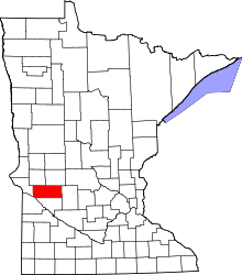 | |
| Townships | ||
| Unincorporated community | ||
Coordinates: 45°11′49″N 96°01′11″W / 45.19694°N 96.01972°W