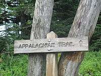
Appalachian Trail
| Appalachian Trail | |
|---|---|
|
Map of Appalachian Trail | |
| Length | About 2,200 miles (3,500 km)[lower-alpha 1] |
| Location | Appalachian Mountains |
| Designation | National Scenic Trail |
| Trailheads |
Springer Mountain, Georgia Mount Katahdin, Maine |
| Use | Hiking |
| Elevation | |
| Highest point | Clingmans Dome, 6,643 ft (2,025 m) |
| Lowest point | Bear Mountain State Park, 124 ft (38 m) |
| Hiking details | |
| Trail difficulty | Easy to strenuous |
| Season | Early spring to autumn |
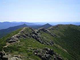
| Sights | Appalachian Mountains |
| Hazards |
Severe weather American black bear Tick-borne diseases Mosquitos Yellowjackets Biting flies Chiggers Steep grades Limited water Dangerous Fordings Diarrhea from water Poison ivy Venomous snake |
| Website | Appalachian Trail |
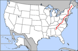
The Appalachian National Scenic Trail, generally known as the Appalachian Trail or simply the A.T., is a marked hiking trail in the eastern United States extending between Springer Mountain in Georgia and Mount Katahdin in Maine.[1] The trail is about 2,200 miles (3,500 km)[lower-alpha 1] long, though the precise length changes over time as parts are modified or rerouted. The trail passes through 14 states: Georgia, North Carolina, Tennessee, Virginia, West Virginia, Maryland, Pennsylvania, New Jersey, New York, Connecticut, Massachusetts, Vermont, New Hampshire, and Maine.
The Appalachian Trail was completed in 1937 after more than a decade of work, although improvements and changes continue. It is maintained by 31 trail clubs and multiple partnerships,[2] and managed by the National Park Service, United States Forest Service, and the nonprofit Appalachian Trail Conservancy.[3][4] The majority of the trail is in forest or wild lands, although some portions traverse towns, roads and farms. The trail conservancy claims that the Appalachian Trail is the longest hiking-only trail in the world.[5]
At least 2 million people are said to do at least one day-hike on the trail each year.[6] Thru-hikers attempt to hike it in its entirety in a single season — more than 2,700 people thru-hiked the trail in 2014 — and some hike from one end to the other, then turn around and thru-hike the trail the other way, known as a "yo-yo". Many books, memoirs, web sites, and fan organizations are dedicated to these pursuits.
An extension known as the International Appalachian Trail continues northeast, crossing Maine and cutting through Canada to Newfoundland, with sections continuing in Greenland, through Europe, and into Morocco. Other separate extensions continue the southern end of the Appalachian range in Alabama and continue south into Florida, creating what is known as the Eastern Continental Trail.
The Appalachian Trail, the Continental Divide Trail, and the Pacific Crest Trail form what is known as the Triple Crown of long–distance hiking in the United States.[7][8]
History

The trail was conceived by Benton MacKaye, a forester who wrote his original plan—called "An Appalachian Trail, A Project in Regional Planning"[9]—shortly after the death of his wife in 1921. MacKaye's idea detailed a grand trail that would connect a series of farms and wilderness work/study camps for city-dwellers. In 1922, at the suggestion of Major William A. Welch, director of the Palisades Interstate Park Commission, his idea was publicized by Raymond H. Torrey with a story in the New York Evening Post under a full-page banner headline reading "A Great Trail from Maine to Georgia!" The idea was quickly adopted by the new Palisades Interstate Park Trail Conference as their main project.
On October 7, 1923, the first section of the trail, from Bear Mountain west through Harriman State Park to Arden, New York, was opened. MacKaye then called for a two-day Appalachian Trail conference to be held in March 1925 in Washington, D.C. This meeting inspired the formation of the Appalachian Trail Conference (now called the Appalachian Trail Conservancy) (ATC).[10]
A retired judge named Arthur Perkins and his younger associate Myron Avery took up the cause. In 1929, Perkins, who was also a member of the Connecticut Forest and Park Association and its Blue Blazed Trails committee, found Ned Anderson, a farmer in Sherman, Connecticut, who took on the task of mapping and blazing the Connecticut leg of the trail (1929–1933). It ran from Dog Tail Corners in Webatuck, New York, which borders Kent, Connecticut, at Ashley Falls, 50 miles (80 km) through the northwest corner of the state, up to Bear Mountain at the Massachusetts border.[11] (A portion of the Connecticut trail has since been rerouted (1979–1983) to be more scenic, adhering less to highways and more to wilderness, and includes a Ned K. Anderson Memorial Bridge.)[12]
Anderson's efforts helped spark renewed interest in the trail, and Avery (who led the charge after Perkins’ death in 1932) was able to bring other states on board. Upon taking over the ATC, Avery adopted the more practical goal of building a simple hiking trail. He and MacKaye clashed over the ATC's response to a major commercial development along the trail's path; MacKaye left the organization, while Avery was willing to simply reroute the trail. Avery reigned as Chairman of the ATC from 1932 to 1952 (he died that same year).
Avery became the first to walk the trail end-to-end, though not as a thru-hike, in 1936. In August 1937, the trail was completed to Sugarloaf Mountain in Maine, and the ATC shifted its focus toward protecting the trail lands and mapping the trail for hikers.
Many of the trail's present highlights were not part of the trail in 1937: Roan Mountain, North Carolina and Tennessee; the Mount Rogers high country, including Grayson Highlands, Virginia; the Pochuck Creek swamp, New Jersey; Nuclear Lake, New York; Thundering Falls, Vermont; and Saddleback Mountain, Maine. Except for places where the Civilian Conservation Corps was brought in (mostly in Shenandoah National Park, the Great Smoky Mountains, and Maine), the original trail often climbed straight up and down mountains, creating rough hiking conditions and a treadway prone to severe erosion. The ATC's trail crews and volunteer trail-maintaining clubs have relocated or rehabilitated miles of trail since that time.[13]
A 121-day Maine to Georgia veteran funded and supported thru-hike was reported to have been completed in 1936, with all but three miles of the new trail cleared and blazed, by six Boy Scouts from New York City and their guides.[14] The completed thru-hike was much later recorded and accepted by the Appalachian Long Distance Hikers Association.[15]
In 1948, Earl Shaffer of York, Pennsylvania, brought a great deal of attention to the project by publicizing the first claimed thru-hike. The claim was later criticized for the hike's omission of significant portions due to short-cuts and car rides.[16][17][18] Shaffer later claimed the first north-to-south thru-hike, the first to claim do so in each direction.[19] Chester Dziengielewski was later to be named the first south bound thru-hiker.[16] In 1998, Shaffer, nearly 80 years old, hiked the trail, making him the oldest person to claim a completed thru-hike.[20][21]
In the 1960s, the ATC made progress toward protecting the trail from development, thanks to efforts of politicians and officials. The National Trails System Act of 1968 designated the Pacific Crest Trail and Appalachian Trail as the first national scenic trails and paved the way for a series of National Scenic Trails within the National Park and National Forest systems.[22] Trail volunteers worked with the National Park Service to map a permanent route for the trail, and by 1971 a permanent route had been marked (though minor changes continue to this day). By the close of the 20th century, the Park Service had completed the purchase of all but a few miles of the trail's span.
Extensions
The International Appalachian Trail is a 1,900-mile (3,100 km) extension running northeast from Maine into New Brunswick and Quebec's Gaspé Peninsula, where it ends at Forillon National Park. It is a separate trail and not an official extension of the Appalachian Trail.[23] Other branches are designated in parts of Nova Scotia, Prince Edward Island, and along the western shore of Newfoundland, to the northern end of the Appalachian Mountain range, where it enters the Atlantic Ocean, near L'Anse aux Meadows National Historic Site. The route has since been extended to Greenland, Europe, and Morocco.[24]
Although the Appalachian Trail ends in Georgia, the Appalachian Mountains continue south to Flagg Mountain in Alabama.[25] In 2008, the Pinhoti National Recreation Trail in Alabama and Georgia, which terminates at Flagg Mountain, was connected to the southern terminus of the Appalachian Trail via the Benton MacKaye Trail. Promoters of the Southern extension refer to MacKaye's statement at the 1925 conference that the Georgia to New Hampshire trail should, in the future, extend to Katahdin, and "then to Birmingham, Alabama". As of March 2015, The Pinhoti Trail terminates at the base of Flagg Mountain, near Weogufka in Coosa County, 50 miles (80 km) east of Birmingham.[26][27] In 2010, the Alabama state legislature formed the Alabama Appalachian Mountain Trail Commission to provide state resources for trail improvements, although officially designating Pinhoti as part of the Appalachian Trail would require an act of the United States Congress.[28]
The Appalachian Trail approach trail to Springer Mountain begins near Amicalola Falls State Park.[29]
Flora and fauna
The Appalachian Trail is home to thousands of species of plants and animals, including 2,000 rare, threatened, endangered, and sensitive plant and animal species.[2]
Animals
The American black bear (Ursus americanus), among the largest animals along the Appalachian Trail, rarely confronts people.[30] The black bear is the largest omnivore that may be encountered on the trail, and it inhabits all regions of the Appalachians.[31] Bear sightings on the trail are uncommon, except in certain sections, especially Shenandoah National Park and portions of New Jersey, New York, Connecticut, and Massachusetts sections, where bear populations have increased steadily since 1980; confrontations are rarer still.[30] Other hazards include venomous snakes, including the Eastern timber rattlesnake and copperhead, which are common along the trail. Both snakes are generally found in drier, rockier sections of the trail; the copperhead's range extends north to around the New Jersey–New York state line, while rattlesnakes are commonly found along the trail in Connecticut and have been reported, although rarely, as far north as New Hampshire.[32] Other large mammals commonly sighted include deer;[33] elk, reintroduced in the Smoky Mountains; and moose, which may be found in the vicinity of Massachusetts and northward.[34]
Small mammal species that inhabit along the trails are beaver, squirrel, river otter, chipmunk, porcupine, bobcat, two species of fox, boar, woodchuck, raccoon, and coyote. Bird species that reside in the trails are wild turkey, ruffed grouse, mourning dove, raven, two species of eagle, wood duck, three species of owl, and three species of hawk as well as warblers.
For most hikers, the most persistent pests along the trail are ticks, mosquitos, and black flies along with the mice that inhabit shelters.[35]
Plants
Plant life along the trail is varied. The trail passes through several different biomes from south to north, and the climate changes significantly, particularly dependent upon elevation. In the south, lowland forests consist mainly of second-growth; nearly the entire trail has been logged at one time or another. There are, however, a few old growth locations along the trail, such as Sages Ravine straddling the Massachusetts-Connecticut border and atop higher peaks along the trail on either side of the same border, the Hopper (a glacial cirque westward of the trail as it traverses Mt. Greylock in Massachusetts), and "The Hermitage", near Gulf Hagas in Maine. In the south, the forest is dominated by hardwoods, including oak and tulip trees, also known as yellow poplar.[36] Farther north, tulip trees are gradually replaced by maples and birches. Oaks begin to disappear in Massachusetts. By Vermont, the lowland forest is made up of maples, birch and beech, which provide spectacular foliage displays for hikers in September and October.[33] While the vast majority of lowland forest south of the White Mountains is hardwood, many areas have some coniferous trees as well, and in Maine, these often grow at low elevations.[36]
There is a drastic change between the lowland and subalpine, evergreen forest, as well as another, higher break, at tree line, above which only hardy alpine plants grow.[36] The sub-alpine region is far more prevalent along the trail than true alpine conditions. While it mainly exists in the north, a few mountains in the south have subalpine environments, which are typically coated in an ecosystem known as the Southern Appalachian spruce-fir forest. Southern ranges and mountains where sub-alpine environments occur include the Great Smoky Mountains, where sub-alpine environments only begin around 6,000 feet (1,800 m) in elevation, Roan Highlands on the North Carolina-Tennessee border, where sub-alpine growth descends below 6,000 feet (1,800 m), and Mount Rogers and the Grayson Highlands in Virginia, where there is some alpine growth above 5,000 feet (1,500 m). Appalachian balds are also found in the Southern highlands, and are believed to occur due to fires or grazing in recent centuries, or in some cases due to thin, sandy soils.[37] Several balds are sprouting trees, and on some, the National Forest service actually mows the grasses periodically in order to keep the balds free of trees.
Topography

No sub-alpine regions exist between Mount Rogers in Virginia and Mount Greylock in Massachusetts, mainly because the trail stays below 3,000 feet (910 m) from Shenandoah National Park in Virginia to Mount Greylock. Mount Greylock, however, has a large subalpine region, the only such forest in Massachusetts, extending down to 3,000 feet (910 m), which in the south would be far from the sub-alpine cutoff. This is especially low because Greylock is exposed to prevailing westerly winds, as the summits along its ridgeline rise approximately 200 to 650 feet (61 to 198 m) higher than any other peak in Massachusetts. Farther north, several peaks in Vermont reach into the sub-alpine zone, the bottom of which steadily descends as one proceeds northward, so that by the White Mountains in New Hampshire, it often occurs well below 3,000 feet (910 m). At Mount Moosilauke, which summits at 4,802 feet (1,464 m), the first alpine environment on the trail is reached, where only thin, sporadic flora is interspersed with bare rocks. Between the two regions is the krummholz region, where stunted trees grow with their branches oriented away from the winter's prevailing northwest wind, thus giving the appearance of flags (they are often called "flag trees"). This region resembles lowland terrain hundreds of miles north in Canada. It also contains many endangered and threatened species. The trail has been rerouted over New Hampshire's Presidential Range so the Appalachian Mountain Club can protect certain plant life. The alpine cutoff in the Whites is generally between 4,200 and 4,800 feet (1,300 and 1,500 m). Mountains traversed by the A.T. above treeline include Mount Moosilauke, several miles along the Franconia Range and along the Presidential Range. In the Presidentials, the trail climbs as high as 6,288 feet (1,917 m) on Mount Washington and spends about 13 miles (21 km) continuously above treeline, in the largest alpine environment in the United States east of the Rocky Mountains.
The segments of the trail through Pennsylvania are so rocky that hikers refer to the region as "Rocksylvania".[38] These small rocks—the result of erosion that has worn away the dirt along the trails—can be tough to walk on for extended periods of time without proper hard-soled shoes.
In Maine, the trail extends into even harsher environments, and sub-alpine and alpine growth descends to lower elevations. Alpine growth in the state ranges from around 2,500 feet (760 m) in the Mahoosuc Range to below 1,000 feet (300 m) in parts of the Hundred-Mile Wilderness,[39] where nearly every area higher than 1,000 feet (300 m) is evergreen forest. These forests include more species of evergreen, as well. In addition to the white pine, spruce and hemlock prevalent further south, Maine has many cedar trees along the trail. Near the northern terminus, there are even some tamarack (larch), a coniferous, pine-needled deciduous tree, which provides displays of yellow in the late fall after the birches and maples have gone bare. The hemlocks in Maine are also notable, as the woolly adelgid, which has ravaged populations further south, has not come into the state yet, and may be unable to make it so far north due to the cold climate.
Maine also has several alpine regions. In addition to several areas of the Mahoosuc Range, the Baldpates and Old Blue in southern Maine have alpine characteristics despite elevations below 4,000 feet (1,200 m). Saddleback Mountain and Mount Bigelow, further north, each only extend a bit above 4,000 feet (1,200 m), but have long alpine areas, with no tree growth on the summits and unobstructed views on clear days. From Mount Bigelow, the trail extends for 150 miles (240 km) with only a small area of alpine growth around 3,500 feet (1,100 m) on the summit of White Cap Mountain. Mount Katahdin, the second largest alpine environment in the eastern United States, has several square miles of alpine area on the flat "table land" summit as well as the cliffs and aretes leading up to it. Treeline on Mount Katahdin is only around 3,500 feet (1,100 m). This elevation in Massachusetts would barely be a sub-alpine region, and, south of Virginia, consists of lowland forest. This illustrates the drastic change in climate over 2,000 miles (3,200 km).
Despite the alpine environments well below 5,000 feet (1,500 m) in New Hampshire and Maine, some higher places farther south are not alpine. Examples include Wayah Bald in North Carolina 5,342 feet (1,628 m) and Clingmans Dome in Great Smoky Mountains National Park 6,643 feet (2,025 m).
Hiking the trail
The Appalachian Trail is much more frequently hiked south to north (that is, Georgia to Maine) than vice versa. Hikers typically begin in March or April and finish in late summer or early to late fall of that particular year. Bicycles are prohibited from the trail except for the sections which follow the C&O Canal in Maryland and the Virginia Creeper Trail in Virginia. Horses and pack animals are prohibited except horses on the C&O Canal and in the Great Smoky Mountains National Park.[40] Several short segments of the trail, in towns and scenic natural areas, were built to ADA accessibly standards for wheelchair use.[41]
Navigation
Throughout its length, the AT is marked by 2 by 6 inches (5 by 15 cm) white paint blazes. Side trails to shelters, viewpoints and parking areas use similarly shaped blue blazes. In past years, some sections of the trail also used metal diamond markers with the AT logo, few of which survive.
-

Original 1930 ATC copper marker from a tree in New Jersey
-

An old metal diamond marker beside the trail in Maine
-

A typical white AT blaze along the trail in Pennsylvania
-

An example of a side-trail blue blaze, from Mount Greylock in Massachusetts
Lodging and camping
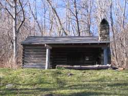
Most hikers carry a lightweight tent, tent hammock or tarp.[42] The trail has more than 250 shelters and campsites available for hikers.[43] The shelters, sometimes called lean-tos (in Maine, Massachusetts, and Connecticut), huts (in Shenandoah National Park), or Adirondack shelters, are generally open, three-walled structures with a wooden floor, although some shelters are much more complex in structure. Shelters are usually spaced a day's hike or less apart, most often near a water source (which may be dry) and with a privy. They generally have spaces for tent sites in the vicinity as the shelters may be full.[1] The Appalachian Mountain Club (AMC) operates a system of eight huts along 56 miles (90 km) of New Hampshire's White Mountains.[33] These huts are significantly larger than standard trail shelters and offer full-service lodging and meals during the summer months. The Fontana Dam Shelter in North Carolina is more commonly referred to as the Fontana Hilton because of amenities (e.g. flush toilets) and its proximity to an all-you-can-eat buffet and post office.[43][44] Several AMC huts have an extended self-service season during the fall, with two extending self-service seasons through the winter and spring.[45] The Potomac Appalachian Trail Club maintains trail cabins, shelters, and huts throughout the Shenandoah region of Virginia.[33]
Shelters are generally maintained by local volunteers. Almost all shelters have one or more pre-hung food hangers (generally consisting of a short nylon cord with an upside-down tuna can suspended halfway down its length) where hikers can hang their food bags to keep them out of the reach of rodents. In hiker lingo, these are sometimes called "mouse trapezes."[46]
In addition to official shelters, many people offer their homes, places of business, or inns to accommodate AT hikers. One example is the Little Lyford Pond camps maintained by the Appalachian Mountain Club. Inns are more common in sections of the trail that coincide with national parks, most notably Virginia's Shenandoah National Park.[47]
Trail towns

The trail crosses many roads, thus providing ample opportunity for hikers to hitchhike into town for food and other supplies. Many trail towns are accustomed to hikers passing through, and thus many have hotels and hiker-oriented accommodations.[1] Some of the most well-known trail towns are Hot Springs, North Carolina; Erwin, Tennessee; Damascus, Virginia; Harpers Ferry, West Virginia; Duncannon, Pennsylvania; Port Clinton, Pennsylvania; Hanover, New Hampshire; Wingdale, NY and Monson, Maine. In the areas of the trail closer to trail towns, many hikers have experienced what is sometimes called "trail magic,"[48] or assistance from strangers through kind actions, gifts, and other forms of encouragement.[49] Trail magic is sometimes done anonymously.[50] In other instances, persons have provided food and cooked for hikers at a campsite.
Hazards

The Appalachian Trail is relatively safe. Most injuries or incidents are consistent with comparable outdoor activities. Most hazards are related to weather conditions, human error, plants, animals, diseases, and fellow humans encountered along the trail.[51]
Many animals live around the trail, with bears, snakes, and wild boars posing the greatest threat to human safety. Several rodent- and bug-borne illnesses are also a potential hazard. In scattered instances, foxes, raccoons, and other small animals may bite hikers, posing risk of rabies and other diseases. There has been one reported case (in 1993) of hantavirus (HPS), a rare but dangerous rodent-borne disease affecting the lungs. The afflicted hiker recovered and hiked the trail the following year.[51] The section of the trail that runs through the Mid-Atlantic and New England states has a very high population of deer ticks carrying Lyme and other tick-borne diseases, and corresponds to the highest density of reported Lyme Disease in the country.[51]
Poison ivy is common the length of the trail, and more plentiful in the South.[1]
The weather is another major consideration of hikers on the trail. Hiking season of the trail generally starts in mid-to-late spring, when conditions are much more favorable in the South. However, this time may also be characterized by extreme heat, sometimes in excess of 100 °F (38 °C). Under such conditions, hydration is imperative. Light clothing and sunscreens are a must at high elevations and areas without foliage, even in relatively cool weather.[51] Farther north and at higher elevations, the weather can be cold, characterized by low temperatures, strong winds, hail or snow storms and reduced visibility. Prolonged rain, though not typically life-threatening, can undermine stamina and ruin supplies.[52] In March 2015, a hiker was killed on the trail in Maryland when a large tree blew over and fell onto him.[53]
Violent crime, including murder, has occurred on the trail in a few instances. Most have been crimes by non-hikers who crossed paths relatively randomly with the AT hiker-victims. The official website of the Appalachian Trail Conservancy points out that the number of violent crimes is extremely low when compared against the number of people (3 to 4 million) who hike on the trail every year.[54]
The first reported homicide on the trail was in 1974 in Georgia.[55] In 1981, the issue of violence on the Appalachian Trail received national attention when Robert Mountford, Jr. and Laura Susan Ramsay, both social workers in Ellsworth, Maine, were murdered by Randall Lee Smith.[56] Another homicide occurred in May 1996, when two women were abducted, bound and murdered near the trail in Shenandoah National Park. The primary suspect was later discovered harassing a female bicycler in the vicinity,[57] but charges against him were dropped, and the case remains unsolved.[58]
Human error can lead to casualties as well. In July 2013, 66-year-old lone hiker Geraldine Largay disappeared on the trail in Maine. She got very lost and survived 26 days before dying. Her remains were found 2 years later in October 2015.[59] In October 2015, a hiker visiting from England was killed on the trail by falling while taking photos at the Annapolis Rocks overlook in Maryland.[60]
Trail completion
Trail hikers who attempt to complete the entire trail in a single season are called "thru-hikers"; those who traverse the trail during a series of separate trips are known as "section-hikers". Rugged terrain, weather extremes, illness, injury, and the time and effort required make thru-hiking difficult to accomplish. Per 2014 estimates around 2700 hikers attempted to thru-hike the trail.[61]
Historically, only about 10% to 15% of those who make the attempt report to the Appalachian Trail Conservancy that they completed it.[62] However, since 2001, the number of people starting out in Georgia to do a thru-hike (or at least registering to do so) has dropped considerably, yet the number of people reporting that they have completed a thru-hike has remained approximately the same. This has resulted in an apparent increase in the completion rate to 29% (as of 2006).
A thru-hike generally requires five to seven months, although some have done it in three months, and several trail runners have completed the trail in less time. Trail runners typically tackle the AT with automobile support teams, without backpacks, and without camping in the woods.
The current speed record for a supported thru-hike of the AT was set by Karl Meltzer on September 18, 2016, completing the 2,190 mile trail in 45 days. 22 hours. 38 minutes,[63][64] Meltzer beat the previous record set in 2015 by Scott Jurek. Jurek made the trip northbound, from late May to mid-July, in 46 days, 8 hours, and 7 minutes.[65] The current speed record for a self-supported (meaning no vehicle or crew support, implying carrying a heavy backpack) thru-hike was set by Heather "Anish" Anderson. She completed the trail, southbound, on September 24, 2015, in 54 days 7 hours and 48 minutes.[66] She broke the previous (2013) record by Matthew Kirk by 4 days and 2 hours.[67]
Thru-hikers are classified into many informal groups. "Purists" are hikers who stick to the official AT trail, follow the white blazes, except for side trips to shelters and camp sites. "Blue Blazers" cut miles from the full route by taking side trails marked by blue blazes. The generally pejorative name "Yellow Blazers," a reference to yellow road stripes, is given to those who hitchhike to move either down or up the trail.
Most thru-hikers walk northward from Georgia to Maine, and generally start out in early spring and follow the warm weather as it moves north.[1] These "north-bounders" are also called NOBO (NOrthBOund) or GAME (Georgia(GA)-to-Maine(ME)), while those heading in the opposite direction are termed "south-bounders" (also SOBO or MEGA).[68][69]
Part of hiker subculture includes making colorful entries in logbooks at trail shelters, signed using pseudonyms called "trail names".[4]
The Appalachian Trail Conservancy gives the name "2000 Miler" to anyone who completes the entire trail. The ATC's recognition policy for "2000 Milers" gives equal recognition to thru-hikers and section-hikers, operates on the honor system, and recognizes blue-blazed trails or officially required roadwalks as substitutes for the official, white-blazed route during an emergency such as a flood, forest fire, or impending storm on an exposed, high-elevation stretch.[70] As of 2010, more than 11,000 people had reported completing the entire trail.[71] About three-quarters of these are thru-hikers.[71]
The Appalachian Trail, the Continental Divide Trail, and the Pacific Crest Trail form what is known as the Triple Crown of long-distance hiking in the United States.[7][8] In 2001, Brian Robinson became the first one to complete all three trails in a year.[72] In 2015, Heather Anderson (trail name "Anish") became the first woman to hold the unsupported record on the Appalachian Trail and the Pacific Crest Trail simultaneously.[66]
Route
- Further information: Appalachian Trail by state

The trail is currently protected along more than 99% of its course by federal or state ownership of the land or by right-of-way. The trail is maintained by a variety of citizen organizations, environmental advocacy groups, governmental agencies and individuals. Annually, more than 4,000 volunteers contribute over 175,000 hours of effort on the Appalachian Trail, an effort coordinated largely by the Appalachian Trail Conservancy (ATC) organization. In total, the AT passes through eight national forests and two national parks.[43]
In the course of its journey, the trail follows the ridge line of the Appalachian Mountains, crossing many of its highest peaks, and running, with only a few exceptions, almost continuously through wilderness. The trail used to traverse many hundreds of miles of private property; currently 99% of the trail is on public land.[73]

Georgia
Georgia has 75 miles (121 km) of the trail, including the southern terminus at Springer Mountain at an elevation of 3,782 feet (1,153 m).[74] At 4,461 feet (1,360 m), Blood Mountain is the highest point on the trail in Georgia. The AT and approach trail, along with many miles of blue blazed side trails, are managed and maintained by the Georgia Appalachian Trail Club. See also: Georgia Peaks on the Appalachian Trail.
North Carolina

North Carolina has 88 miles (142 km) of the trail, not including more than 200 miles (320 km) along the Tennessee Border.[75] Altitude ranges from 1,725 to 5,498 feet (526 to 1,676 m). The trail enters from Georgia at Bly Gap, ascending peaks such as Standing Indian Mountain, Mt. Albert, and Wayah Bald. It then goes by Nantahala Outdoor Center at the Nantahala River Gorge and the Nantahala River crossing. Up to this point, the trail is maintained by the Nantahala Hiking Club. Beyond this point, it is maintained by the Smoky Mountains Hiking Club. 30 miles (48 km) further north, Fontana Dam marks the entrance to Great Smoky Mountains National Park.[76]
Tennessee
Tennessee has 71 miles (114 km) of the trail,[77][78] not including more than 200 miles (320 km) along or near the North Carolina Border.[79] The section that runs just below the summit of Clingmans Dome in Great Smoky Mountains National Park is along the North Carolina and Tennessee border and is the highest point on the trail at 6,643 feet (2,025 m). The Smoky Mountains Hiking Club (Knoxville, TN) maintains the trail throughout the Great Smoky Mountains National Park to Davenport Gap. North of Davenport Gap, the Carolina Mountain Club (Asheville, NC) maintains the trail to Spivey Gap. Then the remaining Tennessee section is maintained by the Tennessee Eastman Hiking & Canoeing Club (Kingsport, TN).
Virginia
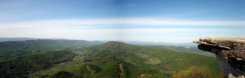
Virginia has 550.3 miles (885.6 km) of the trail (one-fourth of the entire trail) including more than 20 miles (32 km) along the West Virginia border.[80] With the climate, and the timing of northbound thru-hikers, this section is wet and challenging because of the spring thaw and heavy spring rainfall.[81] Substantial portions of the trail closely parallel Skyline Drive in Shenandoah National Park and, further south, the Blue Ridge Parkway.[80]
The Appalachian Trail Conservancy considers as excellent for beginning hikers a well-maintained 104 miles (167 km) section of the trail that the Civilian Conservation Corps constructed in Shenandoah National Park. Climbs in this section rarely exceed 1,000 feet (300 m).[13][80] In the southwestern portion of the state, the trail goes within one half mile of the highest point in Virginia, Mount Rogers, which is a short side-hike from the AT.
West Virginia
West Virginia has 4 miles (6.4 km) of the trail, not including about 20 miles (32 km) along the Virginia border.[82] Here the trail passes through the town of Harpers Ferry, headquarters of the Appalachian Trail Conservancy. Harpers Ferry is what many consider to be the mental midpoint of the entire A.T., although the actual midpoint is further north in southern Pennsylvania. (The exact midpoint moves due to trail rerouting.)[83]

Maryland
Maryland has 41 miles (66 km) of the trail, with elevations ranging from 230 to 1,880 feet (70 to 573 m).[84] Most of the trail runs along the ridgeline of South Mountain in South Mountain State Park.[85] Hikers are required to stay at designated shelters and campsites. The trail runs through the eastern edge of Greenbrier State Park. This can serve as a luxurious stop point for a hot shower and a visit to the camp store. The trail runs along the C&O Canal Towpath route for 3 miles (4.8 km). Hikers will also pass High Rock, which offers spectacular views and is a popular hang-gliding site. The section ends at Pen Mar Park, which sits on the border of Maryland and Pennsylvania.
Pennsylvania
Pennsylvania has 229.6 miles (369.5 km) of the trail.[86] The trail extends from the Pennsylvania – Maryland line at Pen Mar, a tiny town straddling the state line, to the Delaware Water Gap, at the Pennsylvania – New Jersey border. The Susquehanna River is generally considered the dividing line between the northern and southern sections of the Pennsylvania AT. South of the Susquehanna, the trail passes through Pine Grove Furnace State Park. The Pennsylvania section of the trail north of the Susquehanna, from Duncannon until the Delaware Water Gap, is noted for its eroded and rocky terrain which can slow hiking.
New Jersey

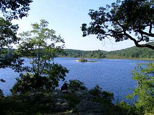
New Jersey is home to 72.2 miles (116.2 km) of the trail.[87] The trail enters New Jersey from the south on a pedestrian walkway along the Interstate 80 bridge over the Delaware River, ascends from the Delaware Water Gap to the top of Kittatinny Mountain in Worthington State Forest, passes Sunfish Pond (right), continues north through the Delaware Water Gap National Recreation Area and Stokes State Forest and eventually reaches High Point State Park, the highest peak in New Jersey (a side trail is required to reach the actual peak). It then turns in a southeastern direction along the New York border for about 30 miles (48 km), passing over long sections of boardwalk bridges over marshy land, then entering Wawayanda State Park and then the Abram S. Hewitt State Forest just before entering New York near Greenwood Lake. In New Jersey the New York - New Jersey Trail Conference maintains and updates the Appalachian Trail.
Black bear activity along the trail in New Jersey increased rapidly starting in 2001. Hence, metal bear-proof trash boxes are in place at all New Jersey shelters.
New York
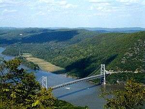
New York's 88.4 miles (142.3 km) of trail contain very little elevation change compared to other states.[88] From south to north, the trail summits many small mountains under 1,400 feet (430 m) in elevation, its highest point in New York being Prospect Rock at 1,433 feet (437 m), and only 3,000 feet (910 m) from the border with New Jersey. The trail continues north, climbing near Fitzgerald Falls, passing through Sterling Forest, and then entering Harriman State Park and Bear Mountain State Park. The lowest point on the entire Appalachian Trail is in the Bear Mountain Zoo 124 feet (38 m). It crosses the Hudson River on the Bear Mountain Bridge. It then passes through Fahnestock State Park, and continues northeast and crosses the Metro-North Railroad's Harlem Line. This track crossing is the site of the only train station along the trail's length. It enters Connecticut via the Pawling Nature Reserve. The section of the trail that passes through Harriman and Bear Mountain State Parks is the oldest section of the trail, completed in 1923. A portion of this section was paved by 700 volunteers with 800 granite-slab steps followed by over a mile of walkway supported by stone crib walls with boulders lining the path.[4] The project took four years, cost roughly $1 million, and was officially opened in June 2010.[4] The project was done by the New York–New Jersey Trail Conference. The New York–New Jersey Trail Conference maintains and updates the Appalachian Trail in New York.
Connecticut

Connecticut's 52 miles (84 km) of trail lie almost entirely along the ridges to the west above the Housatonic River valley.[89]
The state line is also the western boundary of a 480 acres (190 ha) Connecticut reservation inhabited by Schaghticoke Indians. Inside it, the AT roughly parallels its northern boundary, crossing back outside it after 2,000 feet (610 m). The trail proceeds northward through the Housatonic River valley and hills to its west, veering northwesterly and, at Salisbury, ascending the southern Taconic mountains, at Lion's Head affording a view northeasterly towards Mt. Greylock and other points in Massachusetts, and at Bear Mountain, reaching over 2,000 feet (610 m) in elevation for the first time since Pennsylvania and yielding views across the Hudson River valley to the Catskills and across the broad expanse of the Housatonic valley and the Berkshire and Litchfield Hills to the east. Just north of Bear, the trail, as it crosses into Massachusetts, descends into Sages Ravine, a deep gorge in the eastern Taconic ridgeline which is home to a fragile old growth forest. As the trail crosses the brook in the ravine, it leaves the area maintained by the Connecticut section of the Appalachian Mountain Club.
Massachusetts

Massachusetts has 90 miles (140 km) of trail.[90] The entire section of trail is in western Massachusetts' Berkshire County. It summits the highest peak in the southern Taconic Range, Mount Everett (2,604 feet (794 m)), then descends to the Housatonic River valley and skirts the town of Great Barrington. The trail passes through the towns of Dalton and Cheshire, and summits the highest point in the state at 3,491 feet (1,064 m), Mount Greylock. It then quickly descends to the valley within 2 miles (3.2 km) of North Adams and Williamstown, before ascending again to the Vermont state line. The trail throughout Massachusetts is maintained by the Berkshire Chapter of the Appalachian Mountain Club.
Vermont
Vermont has 150 miles (240 km) of the trail.[91] Upon entering Vermont, the trail coincides with the southernmost sections of the generally north/south-oriented Long Trail. It follows the ridge of the southern Green Mountains, summitting such notable peaks as Stratton Mountain, Glastenbury Mountain, and Killington Peak. After parting ways with the Long Trail at Maine Junction, the AT turns in a more eastward direction, crossing the White River, passing through Norwich, and entering Hanover, New Hampshire, as it crosses the Connecticut River. The Green Mountain Club maintains the AT from the Massachusetts state border to Route 12. The Dartmouth Outing Club maintains the trail from VT Route 12 to the New Hampshire state line.
New Hampshire
New Hampshire has 161 miles (259 km) of the trail.[92] The New Hampshire AT is nearly all within the White Mountain National Forest. For northbound thru-hikers, it is the beginning of the main challenges that go beyond enduring distance and time: in New Hampshire and Maine, rough or steep ground are more frequent and alpine conditions are found near summits and along ridges. The trail reaches 17 of the 48 four-thousand footers of New Hampshire, including 6,288-foot (1,917 m) Mount Washington, the highest point of the AT north of Tennessee. The Dartmouth Outing Club maintains the AT from the Vermont border past Mount Moosilauke to Kinsman Notch, northwest of Woodstock, New Hampshire, Randolph Mountain Club maintains 2.2 miles from Osgood Trail near Madison Hut to Edmands Col, with the AMC maintaining the remaining miles through the state. The weather includes strong winds and fog.
Maine

Maine has 281 miles (452 km) of the trail. The northern terminus of the Appalachian Trail is on Mount Katahdin's Baxter Peak in Baxter State Park.
In some parts of the trail in Maine, such as Mahoosuc Notch, even the strongest hikers may only average 1 mile per hour (1.6 km/h). There are other parts in which hikers must hold on to tree limbs and roots to climb and descend, which are especially dangerous and hazardous in wet weather conditions.[93]
The western section includes a mile-long (1.6 km) stretch of boulders, some of which hikers must pass under, at Mahoosuc Notch, sometimes called the trail's hardest mile. Although there are dozens of river and stream fords on the Maine section of the trail, the Kennebec River is the only one on the trail that requires a boat crossing. The most isolated portion of the Appalachian Trail, known as the "Hundred-Mile Wilderness", occurs in Maine. It heads east-northeast from the town of Monson and ends outside Baxter State Park just south of Abol Bridge.[94]
Park management strongly discourages thru-hiking within the park before May 15 or after October 15.[95]
The AMC maintains the AT from the New Hampshire border to Grafton Notch, with the Maine Appalachian Trail Club responsible for maintaining the remaining miles to Mt. Katahdin. The international extension, called the International Appalachian Trail begins at Mt. Katahdin.
Major intersections
Listed from south to north.
Southern terminus: Springer Mountain, Georgia
 U.S. Route 76 in northeast Georgia
 U.S. Route 64 near Nantahala River, North Carolina
 U.S. Route 19/U.S. Route 74 near Fontana Lake, North Carolina
 U.S. Route 441 at North Carolina/Tennessee border
 Interstate 40 at North Carolina/Tennessee border
 U.S. Route 25/U.S. Route 70 in Hot Springs, North Carolina
 Interstate 26/U.S. Route 23 at North Carolina/Tennessee border
 U.S. Route 19W at North Carolina/Tennessee border
 U.S. Route 19E near Roan Mountain, Tennessee
 U.S. Route 321 at Watauga Lake, Tennessee
 U.S. Route 421 near South Holston Lake, Tennessee
 U.S. Route 58 in Damascus, Virginia
 Interstate 81 near Marion, Virginia
 Interstate 77/U.S. Route 52 near Wytheville, Virginia
 U.S. Route 460 in Pearisburg, Virginia
- Interstate 81 near Roanoke, Virginia
 U.S. Route 501 at James River, Virginia
 U.S. Route 60 near Buena Vista, Virginia
 Interstate 64 near Waynesboro, Virginia
 U.S. Route 250 near Waynesboro, Virginia
 U.S. Route 33 in Shenandoah National Park
 U.S. Route 211 near Luray, Virginia
 U.S. Route 522 near Front Royal, Virginia
 Interstate 66 in Front Royal, Virginia
 U.S. Route 17/U.S. Route 50 near Waterloo, Virginia
 U.S. Route 340 in Harpers Ferry, West Virginia
- U.S. Route 340 in Sandy Hook, Maryland

 Interstate 70/U.S. Route 40 near Hagerstown, Maryland
 U.S. Route 30 near Fayetteville, Pennsylvania
 Interstate 76 in Middlesex Township, Pennsylvania
 U.S. Route 11 in Middlesex Township, Pennsylvania
- Interstate 81 in Middlesex Township, Pennsylvania
-
 U.S. Route 11/U.S. Route 15 in Duncannon, Pennsylvania
 U.S. Route 22/U.S. Route 322 in Duncannon, Pennsylvania
- Interstate 81 near Fort Indiantown Gap, Pennsylvania
 Interstate 476 near Slatington, Pennsylvania
 Interstate 80 at Pennsylvania/New Jersey border
 U.S. Route 206 near Frankford, New Jersey
 Interstate 87 near Harriman, New York

 U.S. Route 6/U.S. Route 9W/U.S. Route 202 near Fort Montgomery, New York
 U.S. Route 9 near Garrison, New York
 Taconic State Parkway near Shenandoah, New York
 Interstate 84 near Whaley Lake, New York
 U.S. Route 7 near Falls Village, Connecticut
 U.S. Route 44 near Salisbury, Connecticut
- U.S. Route 7 near Great Barrington, Massachusetts
 Interstate 90 near Lee, Massachusetts
 U.S. Route 20 near Lee, Massachusetts
 U.S. Route 4 near Rutland, Vermont
 Interstate 89 near West Hartford, Vermont
 U.S. Route 5 in Norwich, Vermont
 Interstate 91 in Norwich, Vermont
 Interstate 93/U.S. Route 3 near Franconia, New Hampshire
 U.S. Route 302 in White Mountain National Forest
 U.S. Route 2 near Gorham, New Hampshire
 U.S. Route 201 in Caratunk, Maine
Northern terminus: Mt. Katahdin, Maine
Use in research
The Appalachian Trail has been a resource for researchers in a variety of disciplines. Portions of the trail in Tennessee were used on a study on trail maintenance for the trail's "uniform environmental conditions and design attributes and substantial gradient in visitor use."[78] Beginning in 2007, various citizen groups, including the Appalachian Trail Conservancy and the American Hiking Society, began a study to monitor environmental changes that have resulted from higher ozone levels, acid rain, smog, and other air quality factors.[96] Such research has been supported by the National Park Service, U.S. Forest Service, Cornell University, the National Geographic Society, and Aveda Corporation.[96]
Behavioral studies have also been conducted on hikers themselves. A 2007 study on hikers found that most persons hike the trail "for fun and enjoyment of life and for warm relationships with others" and that "environmental awareness, physical challenge, camaraderie, exercise, and solitude" were chief results among hikers.[97] Since the highest single demographic of thru-hikers are males between the ages of 18–29, one informal study sought to find the correlation between this group and male college drop-outs.[98]
See also
- Appalachian Development Highway System (ADHS) (in the eastern US)
- Appalachian Trail by state
- International Appalachian Trail
- Additional U.S. long-distance trails
- American Discovery Trail
- Continental Divide Trail
- East Coast Greenway
- North Country Trail
- Pacific Crest Trail
- Pacific Northwest Trail
- Connected U.S. long-distance trails
- Allegheny Trail
- Benton MacKaye Trail
- Horse Shoe Trail
- International Appalachian Trail
- Long Path
- Long Trail
- Mason-Dixon Trail
- Mountains-to-Sea Trail
- Pinhoti National Recreation Trail
- Tuscarora Trail
- Virginia Creeper Trail
- Connected National Historic Trails
Notes
- 1 2 The exact length of the Appalachian Trail is not known, as periodic changes and maintenance to the trail alters the trail's length, making an exact figure difficult to ascertain. (See Appalachian Trail Conservancy)
References
- 1 2 3 4 5 Gailey, Chris (2006). "Appalachian Trail FAQs" Outdoors.org (accessed September 14, 2006)
- 1 2 A.T. Essentials" AppalachianTrail.org (accessed September 12, 2006)
- ↑ (January 1985), "A Fork in the Trail". Audubon. 87 (1):140–141
- 1 2 3 4 Applebome, Peter (May 31, 2010), "A Jolt of Energy for a Much Trod-Upon Trail". New York Times. p. 14.
- ↑ "Appalachian Trail Conservancy". Retrieved July 2, 2016.
- ↑ "Appalachian Trail Conservancy - 2000 Milers". Retrieved July 2, 2016.
- 1 2 "Nimblewill Nomad Receives Triple Crown Award". International Appalachian Trail. Archived from the original on January 7, 2009. Retrieved November 27, 2008.
- 1 2 Adams, Glenn (October 27, 2001). "Hiker Achieves 'Triple Crown'". Washington Post. Retrieved November 27, 2008.
- ↑ Miller, D. Jason (Fall 2015). "BackPacked Architecture: The Appalachian Trail and Its "Primitive Huts"". Journal of Appalachian Studies. 21 (2): 247–262. doi:10.5406/jappastud.21.2.0247.
- ↑ "Appalachian Trail Conservancy - History". appalachiantrail.org. Retrieved July 16, 2015.
- ↑ Tomaselli, Doris. 2009. pp. 47–61 Ned Anderson: Connecticut's Appalachian Trailblazer – Small Town Renaissance Man. Sherman Historical Society. Sherman, CT. ISBN 978-0-615-28611-2.
- ↑ Tomaselli, Doris. 2009. pp. 67–75 Ned Anderson: Connecticut's Appalachian Trailblazer – Small Town Renaissance Man. Sherman Historical Society. Sherman, CT. ISBN 978-0-615-28611-2.
- 1 2 "75th Anniversary of the Completion of the Appalachian Trail". Appalachian Trail Conservancy. 2012. Archived from the original on June 9, 2012. Retrieved September 1, 2016.
- ↑ "[at-l] ATN article, 1936 Scout Hike". backcountry.net. Retrieved July 16, 2015.
- ↑ "First Thru Hikers Honored by ATC" (PDF). The Long Distance Hiker. Summer 2000. Archived from the original (PDF) on July 16, 2011.
- 1 2 http://www.roanoke.com/webmin/news/did-the-man-heralded-as-the-first-to-walk-the/article_08e4e205-f2f3-57ee-8528-d81c148bfb2a.html
- ↑ http://hikinginthesmokys.blogspot.com/2011/07/was-earl-shaffer-first-person-to-thru.html
- ↑ "Smithsonian exhibit on Shaffer's 1948 hike". Retrieved December 4, 2009.
- ↑ Shaffer, Earl V. (2004). Walking With Spring. ISBN 0-917953-84-3.
- ↑ Martin, Douglas (May 12, 2002). "Earl Shaffer, First to Hike Length of Appalachian Trail in Both Directions, Dies at 83". NY Times. Retrieved November 16, 2008.
- ↑ (October 26, 1998), "Etceteras". Christian Science Monitor. 90 (232):2
- ↑ Seaborg, Eric (July/August 1984), "The Road Less Traveled". National Parks. 58 (7/8) :34–35
- ↑ Hughes, C. J. (September 27, 2002). "After 2,169 Miles, What's Another 690?". The New York Times.
- ↑ International Appalachian Trail news, October 7, 2015
- ↑ "Alabama's Flagg Mountain eyed as trailhead for Appalachian Trail extension along Pinhoti Trail". AL.com.
- ↑ Cosby, Tom (July 3, 2011). "Birmingham trailhead could create Maine-to-Alabama Appalachian Trail". The Birmingham News. Retrieved July 3, 2011.
- ↑ "New Trailhead for the Southern End of the Pinhoti - Ribbon Cutting on March 22". Outdoor Alabama.
- ↑ "Appalachian Trail expansion gets closer to linking with Alabama". AL.com.
- ↑ Massar, Todd. "The Appalachian Trail". GeorgiaInfo: an Online Georgia Almanac. Digital Library of Georgia. Retrieved 14 November 2016.
- 1 2 Black Bear Neighborhood
- ↑ Wingfoot "Black Bears on the Appalachian Trail" TrailPlace.com (accessed September 14, 2006)
- ↑ Flora and Fauna
- 1 2 3 4 Stroh, Bess Zarafonitis (September–October 1998). "Colorful Climbs". National Parks. 72 (9/10): 34–7.
- ↑ Graham, Jennifer (March 24, 2014). "Massachusetts and moose: Meant for each other". The Boston Globe. Retrieved July 15, 2016.
- ↑ For example, The Trail Journal of Dave Whetstone (accessed July 15, 2016)
- 1 2 3 Appalachian Trail Conservancy Plant FAQ
- ↑ Wells, B.W. (July 1937). "Southern Appalachian Grass Balds". Journal of the Elisha Mitchell Scientific Society. 53 (1): 1–26.
- ↑ Hopey, Don (July 9, 1995). "Rocksylvania is a real boot-buster". Pittsburgh Post-Gazette. PG Publishing Co., Inc. Retrieved February 3, 2016.
- ↑ Brill, David (June 2001), "Walk This Way!". Men's Health. 16 (5):68
- ↑ [Regulations and Permits], Appalachian Trail Conservancy, accessed December 3, 2014
- ↑ Mangan, Tom (March 24, 2010). "Wheelchair-accessible paths on the Appalachian Trail". Trailspace. Retrieved May 29, 2016.
- ↑ "What's In Your Pack?: A Gear Survey of the 2014 Thru-Hikers". Retrieved July 2, 2016.
- 1 2 3 Nickens, T. Edward (July 2001), "Bed and Breakfast". Smithsonian. 32 (4):24
- ↑ Appalachian Trail | Dropping In. OutsideOnline.com. Retrieved on 2013-08-02.
- ↑ White Mountain Huts - NH Appalachian Trail Lodging - Appalachian Mountain Club. Outdoors.org (2012-04-03). Retrieved on July 20, 2016.
- ↑ What is it Like to Sleep in an Appalachian Trail Shelter? SectionHiker.com (accessed July 20, 2016)
- ↑ "Cabins, Huts, and Hostels" AppalachianTrail.org (accessed September 12, 2006)
- ↑ Melville, Greg (August 1999), "The Moocher". Sports Afield. 222 (2):57
- ↑ Berger, Karen. "Appalachian Trail: Trail Magic" Gorp.com (accessed April 30, 2007)
- ↑ A.T. History Kodak.com (accessed April 30, 2007)
- 1 2 3 4 "Health and Safety" AppalachianTrail.org (accessed September 15, 2006)
- ↑ "Environmental Considerations" AppalachianTrail.org (accessed July 15, 2016)
- ↑ "Pa. man dies in Appalachian Trail accident north of Harpers Ferry". The Journal. March 15, 2015. Retrieved March 16, 2015.
- ↑ "2,000-Milers: Facts and Statistics". Appalachian Trail Conservancy. Retrieved July 15, 2016.
- ↑ "Appalachian Trail Murders". Retrieved August 29, 2010.
- ↑ Haygood, Wil (July 8, 2008). "Blood on the Mountain". The Washington Post. Retrieved October 30, 2008.
- ↑ "Trail Murders" Appalachian Long Distance Hikers Association website (accessed September 14, 2006)
- ↑ Nordin, Barbara (2004). "After Rice: New questions in Park murders" http://www.readthehook.com/94820/cover-after-rice-new-questions-park-murders (accessed September 14, 2006)
- ↑ Yuhas, Alan (25 May 2016). "Hiker who went missing on Appalachian trail survived 26 days before dying". The Guardian. Retrieved 27 May 2016.
- ↑ "British university physics professor dies after falling 50ft onto rocks while taking photographs during visit to one of America's longest hiking trails". The Daily Mail. October 11, 2015. Retrieved May 31, 2016.
- ↑ "Appalachian Trail Conservancy - 2000 Milers". Retrieved July 2, 2016.
- ↑ Comeau, Zack (February 4, 2011). "Five months and two thousand miles on The Appalachian Trail". The Gatepost. Framingham, Massachusetts
- ↑ Crouse, Lindsay (September 18, 2016). "Ultra Runner Karl Meltzer Sets Appalachian Trail Record, Fueled by Beer and Candy". New York Times. Retrieved September 19, 2016.
- ↑ Staff (September 19, 2016). "Karl Meltzer sets new Appalachian Trail record". Red Bull. Retrieved September 20, 2016.
- ↑ "Scott Jurek Breaks Appalachian Trail Thru-Hike Record". Runner's World. Retrieved July 16, 2015.
- 1 2 Landers, Rich (2015-10-03). "Seattle's Heather Anderson breaks Appalachian Trail hiking record". Spokesman-Review, via Missoulian. Retrieved 2015-10-03.
- ↑ Chavez, Karen (August 9, 2013). "WNC hiker Matt Kirk breaks AT unsupported record". Asheville Citizen-Times. Retrieved August 9, 2013.
- ↑ "Trail Terms and Slang". Archived from the original on July 18, 2010. Retrieved August 29, 2010.
- ↑ "APPALACHIAN TRAIL – TERMS, DEFINITIONS AND LINGO". Retrieved August 29, 2010.
- ↑ "What Happens When I Finish?" AppalachianTrail.org (accessed September 11, 2006)
- 1 2 2,000-Miler Facts and Statistics, ATC website (accessed May 25, 2010)
- ↑ Ballard, Chris (November 12, 2001), "Historic Feet". Sports Illustrated. 95 (19):A27
- ↑ "History" AppalachianTrail.org (accessed June 24, 2008).
- ↑ "Explore the Trail: Georgia" AppalachianTrail.org (accessed July 14, 2016).
- ↑ "Explore the Trail: North Carolina" AppalachianTrail.org (accessed July 14, 2016).
- ↑ The Appalachian Trail south of Roan Mountain
- ↑ "Tennessee" (PDF). Appalachian Thru-Hikers' Companion-2010. Archived from the original (PDF) on November 19, 2010.
- 1 2 Marion, Jeffrey L.; Leung, Yu-Fai (Fall 2001). "Trail Resource Impacts and An Examination of Alternative Assessment Techniques". Journal of Park & Recreation Administration. 19 (3): 17–37.
- ↑ "Explore the Trail: Tennessee" AppalachianTrail.org (accessed July 14, 2016).
- 1 2 3 "Terrain By Region: Virginia". About The Trail. Appalachian Trail Conservancy. Archived from the original on April 30, 2011. Retrieved September 1, 2016.
- ↑ Bruce P. Hayden; Patrick J. Michaels. "Virginia's Climate". University of Virginia Climatology Office. Retrieved August 29, 2010.
- ↑ "Explore the Trail: West Virginia" AppalachianTrail.org (accessed July 14, 2016).
- ↑ Coupland, David (2004). "Appalachian Adventure" Couplands.net (accessed September 12, 2006)
- ↑ "Explore the Trail: Maryland" AppalachianTrail.org (accessed July 14, 2016).
- ↑ "South Mountain State Park". Maryland Department of Natural Resources.
- ↑ "Terrain By State: Pennsylvania" AppalachianTrail.org (accessed May 23, 2015).
- ↑ "Terrain By State: New Jersey" AppalachianTrail.org (accessed May 21, 2015).
- ↑ "Terrain By State: New York" AppalachianTrail.org (accessed June 24, 2013).
- ↑ "Explore the Trail: Connecticut" AppalachianTrail.org (accessed July 14, 2016).
- ↑ "Explore the Trail: Massachusetts" AppalachianTrail.org (accessed July 14, 2016).
- ↑ "Explore the Trail: Vermont" AppalachianTrail.org (accessed July 14, 2016).
- ↑ "Explore the Trail: New Hampshire" AppalachianTrail.org (accessed July 14, 2016).
- ↑ "Explore the Trail: Maine AppalachianTrail.org (accessed July 14, 2016).
- ↑ "Explore the Trail: Maine" AppalachianTrail.org (accessed July 14, 2016).
- ↑ "Thru-Hiking in Baxter State Park" BaxterStateParkAuthority.com (accessed July 14, 2016)
- 1 2 "Trail with a tale to tell". American Forests. 112 (4): 17. Winter 2007.
- ↑ Goldenberg, Marni; Hill, Eddie; Freidt, Barbara (2008). "Why Individuals Hike the Appalachian Trail: A Qualitative Approach to Benefits". Journal of Experiential Education. 30 (3): 277–81.
- ↑ Arnold, Karen D. (2007). "Education on the Appalachian Trail: What 2,000 Miles Can Teach Us About Learning". About Campus. 12 (5): 2–9.
Further reading
- Online
- ATC's official annual Appalachian Trail guide is the Appalachian Trail Thru-Hiker's Companion, compiled and updated by volunteers of the Appalachian Long Distance Hikers Association (ALDHA) (available at AppalachianTrail.org). Individual state guides and maps are also available via the ATC.
- The Official AT Databook, an annually updated compilation of trail mileages, water sources, road crossings, shelter locations, and other information. The 2015 DataBook is the 37th annual edition, is considered indispensable by many AT hikers, and the data published within is used by many other hiking guides.
- Another annual guide book to the AT isThe A.T. Guide by David Miller, author of "Awol on the Appalachian Trail
- Non-fiction print
- Garvey, Edward (1971). Appalachian Hiker. Oakton: Appalachian Books. ISBN 0-912660-01-5.
- Fisher, Ronald (1972). The Appalachian Trail. Washington: National Geographic Society. ISBN 0-87044-106-X.
- Hare, James R. (1977). From Katahdin to Springer Mountain. Emmaus Pa: Rodale Press. ISBN 0-87857-160-4.
- Garvey, Edward (1978). Appalachian Hiker, II. Oakton: Appalachian Books. ISBN 0-912660-15-5.
- Shaffer, Earl (1983). Walking with Spring. Harpers Ferry: Appalachian Trail Conference. ISBN 0-917953-84-3.
- Irwin, Bill (1992). Blind Courage. Waco: WRS Pub. ISBN 0-941539-86-5.
- Luxenberg, Larry (1994). Walking the Appalachian Trail. Mechanicsburg: Stackpole Books. ISBN 0-8117-3095-6.
- Mittlefehldt, Sarah (2013). Tangled Roots: The Appalachian Trail and American Environmental Politics. Seattle, WA: University of Washington Press.
- Emblidge, David (1996). The Appalachian Trail Reader. Oxford Oxfordshire: Oxford University Press. ISBN 0-19-510091-3.
- Bryson, Bill (1998). A Walk in the Woods: Rediscovering America on the Appalachian Trail. New York: Anchor Books. ISBN 978-0-307-27946-0.
- Hall, Adrienne (2000). A Journey North. Boston: Appalachian Mountain Club Books. ISBN 1-878239-91-0.
- Setzer, Lynn (2001). A Season on the Appalachian Trail. Harpers Ferry: Appalachian Trail Conference. ISBN 0-89732-382-3.
- Mckinney, Rick (2005). Dead Men Hike No Trails. City: Booklocker.com, Inc. ISBN 1-59113-870-1.
- Miller, David (2006). Awol on the Appalachian Trail. Livermore: Wingspan Press. ISBN 0547745524.
- Tapon, Francis (2006). Hike Your Own Hike: 7 Life Lessons from Backpacking Across America. San Francisco: SonicTrek. ISBN 978-0-9765812-0-8.
- Buras, Thom (2006). The Wayfarer's Journal Episode One: Journey to Katahdin. http://thewayfarersjournal.com: The Wayfarer's Journal. ISBN 0-9786169-0-1.
- Alt, Jeff (2007). A Walk for Sunshine. Cincinnati: Dreams Shared Publications. ISBN 0-9679482-2-3.
- Chenowith, Lon (2009). Five Million Steps: Adventure Along the Appalachian Trail. Tate Publishing. ISBN 1-60799-416-X.
- Tomaselli, Doris (2009). Ned Anderson: Connecticut's Appalachian trailblazer, small town Renaissance man. Sherman Historical Society. ISBN 0-615-28611-9.
- Letcher, Susan & Lucy (2010). Barefoot Sisters: Southbound & Barefoot Sisters Walking. Harrisburg: Stackpole Books. ISBN 978-0-8117-3529-2.
- Miller, David (2010). AWOL on the Appalachian Trail. Seattle: AmazonEncore. ISBN 1-935597-19-1.
- Davis, Zach (2012). Appalachian Trials. Denver: Good Badger Publishing. ISBN 0985090103.
External links
| Wikivoyage has a travel guide for Appalachian Trail. |
| Wikimedia Commons has media related to Appalachian Trail. |
Official sites
- Official site of the Appalachian Trail Conservancy
- National Park Service Trail information, with maps
- Appalachian Trail at DMOZ