Apikuni Mountain
| Apikuni Mountain | |
|---|---|
|
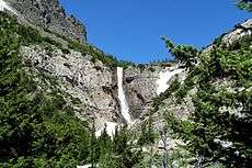
Apikuni Falls in the mountain range | |
| Highest point | |
| Elevation | 9,068 ft (2,764 m) [1] |
| Prominence | 1,468 ft (447 m) [1] |
| Parent peak | Gable Mountain[1] |
| Listing | Mountains in Glacier County, Montana |
| Coordinates | 48°50′11″N 113°39′14″W / 48.83639°N 113.65389°WCoordinates: 48°50′11″N 113°39′14″W / 48.83639°N 113.65389°W [2] |
| Geography | |
 Apikuni Mountain | |
| Parent range | Lewis Range |
| Topo map | USGS Many Glacier MT |
Apikuni Mountain (9,068 feet (2,764 m)) is located in the Lewis Range, Glacier National Park in the U.S. state of Montana.[1][3]
See also
References
- 1 2 3 4 "Apikuni Mountain, Montana". Peakbagger.com. Retrieved 2010-02-27.
- ↑ "Apikuni Mountain". Geographic Names Information System. United States Geological Survey. Retrieved 2010-09-19.
- ↑ "Apikuni Mountain" (Map). My Topo (USGS Quads). Retrieved 2010-02-27.
This article is issued from Wikipedia - version of the 12/23/2015. The text is available under the Creative Commons Attribution/Share Alike but additional terms may apply for the media files.