Antofalla
| Antofalla | |
|---|---|
 Antofalla at sunset from the north | |
| Highest point | |
| Elevation | 6,440 m (21,130 ft) [1] |
| Prominence | 1,957 m (6,421 ft) [1] |
| Listing | Ultra |
| Coordinates | 25°33′45″S 67°52′51″W / 25.56250°S 67.88083°WCoordinates: 25°33′45″S 67°52′51″W / 25.56250°S 67.88083°W [1] |
| Geography | |
 Antofalla Argentina | |
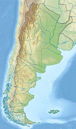
| Location | Catamarca, Argentina |
| Parent range | Andes |
| Geology | |
| Mountain type | Stratovolcano |
| Last eruption | Unknown |
| Climbing | |
| First ascent | Inca, Pre-Columbian (before 1500) |
Antofalla is a large and very remote stratovolcano in Catamarca Province in northwestern Argentina. It is located on the northeastern edge of the Puna de Atacama, a high desert plateau east of the Atacama Desert. It lies just west of the Salar de Antofalla, a large playa over 140 km (87 mi) in length. Inca ruins can be found at the volcano's summit, offering definitive proof of numerous Pre-Columbian ascents.
Geography
Antofalla is located west of the Salar de Antofalla. The salar basin largely predates the volcanic complex and lava flows are largely undisturbed.[2] Antofalla and Potrero Grande are neighbouring towns.[3] The volcano has a diametre of 35 kilometres (22 mi) and covers a surface of 2,100 square kilometres (810 sq mi). The main Antofalla cone is surrounded by smaller stratocones (the highest is over 5,700 metres (18,700 ft) high); beginning from the northeast clockwise around the main cone Conito de Antofalla, Cerro Bayo–Cerro Onas, Cerro de la Aguada, Cerro Cajeros, Cerro Lila, Cerro Patos and Cerro Onas.[2]
Antofalla is located in an area of arid climate. Minimal precipitation primarily in the summit areas allows for some minimal glaciation on the main Antofalla summit since the Pliocene-Pleistocene. The rest of the complex is well preserved with little erosion other than gullying from spring thaw waters. Some ravines bear evidence of flash flood activity, possibly related to the melting of glacier caps at the end of ice ages.[2] Today the snowline lies at about 5,750 metres (18,860 ft) altitude.[4]
Antofalla is situated above the Archibarca lineament, a northwest-southeast trending structure that also encompasses ore deposits and Galán caldera. This lineament may be responsible for the off-axis nature of volcanism in the area; the main arc is located 75 kilometres (47 mi) west of Antofalla.[5]
An old mine Los Jesuitas (Ag-Pb-Zn) lies on the eastern flank of the volcano.[2]
Geology
Antofalla is constructed on Cenozoic sedimentary layers. Sedimentation began in the Eocene, first from Andean sediments. In the Oligocene sedimentation mostly provened from the Sierra de Calalaste south. In the late Miocene, the area became endorheic and deposition centres fragmented. During this time, halite deposits formed.[3]
The volcanic complex is constructed from rhyolitic domes, thick pyroclastic layers and layered dacitic-andesitic lava flows. Lava flows cover some of the cones and extensive areas in the northeast are covered by flows. During the Pleistocene, the Quebrada de las Cuevas valley was filled and the flanking hills covered by pumice by an ignimbrite (1.59 mya) from the Cerro Bayo vent. Between Cerro Lila and Cerro Cajeros and Laguna de los Patos, Quaternary andesites and basaltic andesites of aphyric olivine composition formed small cones and flows. The Conito de las Lagunitas vent erupted andesites 6.07 mya.[2]
Antofalla formed in three stages. In the first stage, basaltic andesites formed cones like Antofalla (13 mya), Cajero (13 mya) and Cerro de la Aguada (12.9 mya). Also, dacitic lava domes (Cerro Lila 10-9 mya), dacitic-rhyolitic ignimbrites (10.9-9.6 mya), andesitic-dacitic lavas (9-8 mya, Lacitic 7.8 mya and Aguas Blancas 9 mya) and basaltic-andesitic lavas were erupted. In the second phase (7-4 mya; Cerro Cajero 4.8-2.5 mya), basalts and basaltic andesites were erupted from flank vents, the margins of the salar and on the older centres. The third stage continued this effusive activity as well as rhyolitic domes like Cerro Botijuela and Las Cuevas (2.5-2.3 mya). Scoria cones and associated lava flows erupted during the Pleistocene (1.5-1.2 and 0.5-0.1 mya) on the margins of the salar.[3][6]
The volcano is still fumarolically active.[7] There are reports of volcanic activity in 1901 and 1911.[8]
Epithermal deposits and deep hydrothermal porphyry deposits are found on the complex and are potentially of economic significance. On the southeast flank of the volcano, epithermal gold was found in the Quebrada de las Minas. Lower in the same valley, galena, quartz and sphalerite were found in hydrothermal veins. On the west flank, erosion has exposed another epithermally altered felsic rock layer with gold mineralization.[2]
The Quebrada de las Minas and Quebrada del Volcán valleys bear traces of debris avalanche activities. A collapse amphitheatre is found in these valleys, possibly because the underlying country rock was destabilized by hydrothermal alteration. Such debris avalanches may have contributed to the formation of alluvial fans in the area, which is otherwise little eroded.[2]
See also
References
- 1 2 3 "Argentina and Chile North: Ultra-Prominences" Peaklist.org. Retrieved 2013-02-25.
- 1 2 3 4 5 6 7 Richards, Jeremy P.; Ullrich, Thomas; Kerrich, Robert (2006). "The Late Miocene–Quaternary Antofalla volcanic complex, southern Puna, NW Argentina: Protracted history, diverse petrology, and economic potential". Journal of Volcanology and Geothermal Research. 152 (3-4): 197–239. doi:10.1016/j.jvolgeores.2005.10.006. ISSN 0377-0273.
- 1 2 3 Kay, Suzanne Mahlburg; Coira, Beatriz; Mpodozis, Constantino (2008). "Field trip guide: Neogene evolution of the central Andean Puna plateau and southern Central Volcanic Zone". 13: 117–181. doi:10.1130/2008.0013(05).
- ↑ Haselton, Kirk; Hilley, George; Strecker, Manfred R. (March 2002). "Average Pleistocene Climatic Patterns in the Southern Central Andes: Controls on Mountain Glaciation and Paleoclimate Implications". The Journal of Geology. 110 (2): 211–226. doi:10.1086/338414. Retrieved 14 September 2015.
- ↑ Richards, J.P.; Jourdan, F.; Creaser, R.A.; Maldonado, G.; DuFrane, S.A. (2013). "Geology, geochemistry, geochronology, and economic potential of Neogene volcanic rocks in the Laguna Pedernal and Salar de Aguas Calientes segments of the Archibarca lineament, northwest Argentina". Journal of Volcanology and Geothermal Research. 258: 47–73. doi:10.1016/j.jvolgeores.2013.04.004. ISSN 0377-0273.
- ↑ Coira, B.; Kay, S. Mahlburg; Viramonte, J. (1993). "UPPER CENOZOIC MAGMATIC EVOLUTION OF THE ARGENTINE PUNA—A MODEL FOR CHANGING SUBDUCTION GEOMETRY". International Geology Review. 35 (8): 677–720. doi:10.1080/00206819309465552. ISSN 0020-6814.
- ↑ Jay, J. A.; Welch, M.; Pritchard, M. E.; Mares, P. J.; Mnich, M. E.; Melkonian, A. K.; Aguilera, F.; Naranjo, J. A.; Sunagua, M.; Clavero, J. (2013). "Volcanic hotspots of the central and southern Andes as seen from space by ASTER and MODVOLC between the years 2000 and 2010". Geological Society, London, Special Publications. 380 (1): 161–185. doi:10.1144/SP380.1. ISSN 0305-8719.
- ↑ Sigurdsson, Haraldur; Houghton, Bruce; Rymer, Hazel; Stix, John; McNutt, Steve (2000). Encyclopedia of Volcanoes (4. print ed.). San Diego: Academic Press. p. 1381. ISBN 978-0-12-385938-9. Retrieved 11 October 2015.
Sources
- Biggar, John (2005). The Andes: A Guide for Climbers (3rd ed.). Andes Publishing (Scotland). ISBN 0-9536087-2-7.