Antelope Creek Bridge
|
Antelope Creek Covered Bridge | |
|
Antelope Covered Bridge in 2008 | |
  Location of the bridge in Jackson County, Oregon | |
| Nearest city | Eagle Point, Oregon |
|---|---|
| Coordinates | 42°28′19.1″N 122°48′00.8″W / 42.471972°N 122.800222°WCoordinates: 42°28′19.1″N 122°48′00.8″W / 42.471972°N 122.800222°W |
| Built | 1922[1] (1987)[2] |
| Built by | Lyle and Wes Hartman[3] |
| Architectural style | Queen post truss, modified |
| MPS | Oregon Covered Bridges TR |
| NRHP Reference # | 79002071[4] |
| Added to NRHP | 2012 (1979) |
_(jacDA0027).jpg)
The Antelope Creek Bridge is a wooden covered bridge, 58 feet (18 m) long, spanning Little Butte Creek in Eagle Point in the U.S. state of Oregon. Constructed in 1922 by brothers Wes and Lyle Hartman, it originally spanned Antelope Creek, north of Medford.[3] Antelope Creek is a tributary of Little Butte Creek, which it enters about 2 miles (3 km) downstream of Eagle Point.[5] According to Oregon's Covered Bridges, at its original location the bridge carried "the old Medford – Crater Lake Road" over Antelope Creek.[6]
After a newer span replaced the bridge at its original location, it was no longer used by vehicles, and it deteriorated.[7] Even so, it was listed on the National Register of Historic Places (NRHP) in 1979.[3]
In 1987, to save the bridge, volunteers took it down and reassembled it over Little Butte Creek in Eagle Point.[8] Since then it has served as a pedestrian bridge[3] in Covered Bridge Park, adjacent to the veterans' memorial.[9]
In 1988, after its move to Eagle Point, the bridge was temporarily delisted because restoration work had created side windows that were not part of the original. In 2012, after correction of those alterations, the bridge was re-added to the NRHP.[3]
Notable features of the bridge include its queenpost truss modified by addition of a kingpost, its ribbon openings under the eaves, and its cantilevered buttresses.[7] The bridge has a cedar roof, semi-circular portals, and board siding without battens.[3]
See also
- List of bridges on the National Register of Historic Places in Oregon
- List of covered bridges in Oregon
References
- ↑ Young, Amalie (July 8, 2001). "The Bridges in Our Own Back Yard". Eugene Register-Guard. pp. 3H. Retrieved April 30, 2015.
- ↑ "Little Butte Creek (Antelope Creek) Covered Bridge" (PDF). Oregon Department of Transportation. Retrieved March 29, 2016.
- 1 2 3 4 5 6 "2013 Oregon's Historic Bridge Field Guide: Antelope Creek, Pedestrian" (PDF). Oregon State Library. 2013. p. 109. Retrieved March 29, 2016.
- ↑ National Park Service (2008-04-15). "National Register Information System". National Register of Historic Places. National Park Service.
- ↑ "United States Topographic Map". United States Geological Survey. Retrieved March 29, 2016 – via Acme Mapper.
- ↑ Cockrell, Bill (2008). Oregon's Covered Bridges. Charleston, S.C.: Arcadia Publishing. p. 65. ISBN 978-0-7385-5818-9.
- 1 2 Smith, Dwight A.; Norman, James B.; Dykman, Pieter T. (1989) [1986]. Historic Highway Bridges of Oregon (2nd ed.). Portland: Oregon Historical Society Press. p. 175. ISBN 0-87595-205-4.
- ↑ McKechnie, Ralph (October 15, 2012). "Eagle Point Covered Bridge to Go Back on National Historic Register". Upper Rogue Independent. Retrieved March 29, 2016.
- ↑ "Covered Bridge Park". City of Eagle Point. Retrieved March 29, 2016.
| Lists by county |  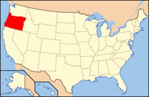 | |
|---|---|---|
| Portland lists | ||
| Other lists |
| |