Anna, Texas
| Anna, Texas | |
|---|---|
| City | |
| Motto: "Y{our} Hometown" | |
 Location of Anna in Collin County, Texas | |
| Coordinates: 33°21′1″N 96°33′3″W / 33.35028°N 96.55083°WCoordinates: 33°21′1″N 96°33′3″W / 33.35028°N 96.55083°W | |
| Country | United States |
| State | Texas |
| County | Collin |
| Government | |
| • Type | Council-Manager |
| • Mayor | Mike Crist |
| • City Manager | Philip Sanders |
| • City Attorney | Clark McCoy |
| Area | |
| • Total | 14.1 sq mi (36.6 km2) |
| • Land | 14.1 sq mi (36.4 km2) |
| • Water | 0.08 sq mi (0.2 km2) |
| Elevation | 712 ft (217 m) |
| Population (2010)[1] | |
| • Total | 8,249 |
| • Estimate (2014)[2] | 10,571 |
| • Density | 752/sq mi (290.4/km2) |
| Time zone | Central (CST) (UTC-6) |
| • Summer (DST) | CDT (UTC-5) |
| ZIP code | 75409 |
| Area code(s) | 972 |
| FIPS code | 48-03300 |
| GNIS feature ID | 1351131[3] |
| Website |
www |
Anna is a city in Collin County, Texas, United States. The population was 8,249 at the 2010 census,[4] with an estimated population in 2014 of 10,571.[2]
Geography
Anna is located in northern Collin County at 33°21′01″N 96°33′03″W / 33.350308°N 96.550762°W.[5] The U.S. Route 75 freeway passes through the west side of the city and leads 45 miles (72 km) southwest to the center of Dallas and 32 miles (51 km) north to Denison.
According to the United States Census Bureau, the city of Anna has a total area of 14.1 square miles (36.6 km2), of which 14.1 square miles (36.4 km2) is land and 0.1 square miles (0.2 km2), or 0.46%, is water.[4] According to the City of Anna website, the city has a total area of approximately 15 square miles (39 km2) in its city limits and approximately 60 square miles (160 km2) in its planning area.[6]
Demographics
| Historical population | |||
|---|---|---|---|
| Census | Pop. | %± | |
| 1920 | 538 | — | |
| 1930 | 467 | −13.2% | |
| 1940 | 509 | 9.0% | |
| 1950 | 525 | 3.1% | |
| 1960 | 639 | 21.7% | |
| 1970 | 736 | 15.2% | |
| 1980 | 855 | 16.2% | |
| 1990 | 904 | 5.7% | |
| 2000 | 1,225 | 35.5% | |
| 2010 | 8,249 | 573.4% | |
| Est. 2015 | 11,463 | [7] | 39.0% |
| U.S. Decennial Census[8] 2012 Estimate[9] | |||
As of the 2010 census, there were 8,249 people, 2,576 households residing in the city. The racial makeup of the city was 78.4.% White, 7.7% African American, 1.1% Native American, 0.8% Asian, 8.6% from other races, and 3.3% from two or more races. Hispanic or Latino of any race were 20.9% of the population.
According to the United States Census Bureau 2010, the city of Anna has a population of 8249. There were 2776 households out of which 49.1% had children under the age of 18 living with them, 64.4% were married couples living together, 11.7% had a female householder with no husband present, 4.8% had a male householder with no wife present and 19.1% were non-families, 14.3% of all households were made up of individuals and 13.2% had someone living alone who was 65 years of age or older. The average household size was 3.15 and the average family size was 3.48.
The percentage of population under the age of 19 was 35.8%, 13.7% from 20 to 29, 27.9% from 30 to 44, 16.6% from 45 to 65, and 5.6% who were 65 years of age or older. The median age was 30 years.
The male population accounts for 49.4% and the female 50.6%.
The median income for a household in the city was $58,730, and the median income for a family was $59,899. Males had a median income of $41,989 versus $40,184 for females. The per capita income for the city was $23,475. About 8.5% of families and 11.9% of the population were below the poverty line.
Recent estimates put Anna city limits around 8,300 people (2011).
History
Anna is located on State Highway 5, Farm Road 455, and U.S. Highway 75, 11 miles (18 km) northeast of McKinney in north-central Collin County. Although Collin McKinney settled within a few miles of the future townsite in 1846, John L. Greer, who arrived in 1867, is credited with building the first home and store in the new community. The Houston and Texas Central Railway, at that time built between Dallas and Denison, passed through the area in 1873. By the time Anna was platted in 1883, it had a population of 20, two stores, a steam gristmill, and a Baptist church. A post office also opened in that year. By 1890 the town had a population of 100 to 200. Anna was incorporated in 1913, with Matt McAllister as first mayor.
Local historian Chester A. Howell compiled a brief history of Anna for inclusion in a book that was given to those who attended the Anna school homecoming on October 19, 1985. A one-page "errata" to correct some minor errors was added in 1989. Mr. Howell's history, A Town Named Anna, is one of the most authoritative and complete descriptions of the history of the community.
On May 9, 2006, a storm producing two tornadoes swept across Anna, with the first tornado (F0) passing 2.5 miles (4.0 km) east of the high school, barely missing the incorporated city limits. The tornado (F3) touched down in neighboring Westminster and Whitewright, destroying many homes and killing three. During the disaster, several volunteers from Collin County Amateur Radio Services worked with the National Weather Service in a Skywarn net. The Anna police and fire departments along with the American Red Cross opened Anna High School up as a shelter to the "walking wounded" and anyone who needed a place to stay due to the road blockages and damage in that area. The tornadoes could be seen from Anna, Van Alstyne, and Melissa, and power was knocked out to several homes in the area.
Climate
The climate in this area is characterized by relatively high temperatures and evenly distributed precipitation throughout the year. The Köppen Climate System describes the weather as humid subtropical, and uses the abbreviation Cfa.[10]
| Climate data for Anna, Texas | |||||||||||||
|---|---|---|---|---|---|---|---|---|---|---|---|---|---|
| Month | Jan | Feb | Mar | Apr | May | Jun | Jul | Aug | Sep | Oct | Nov | Dec | Year |
| Average high °C (°F) | 13 (55) |
14 (58) |
20 (68) |
26 (78) |
29 (84) |
36 (96) |
36 (96) |
36 (96) |
31 (88) |
26 (79) |
19 (66) |
12 (53) |
24 (76) |
| Average low °C (°F) | 0 (32) |
1 (33) |
6 (43) |
10 (50) |
16 (60) |
20 (68) |
21 (69) |
21 (69) |
18 (64) |
11 (52) |
6 (42) |
−1 (31) |
11 (51) |
| Average precipitation mm (inches) | 56 (2.2) |
71 (2.8) |
84 (3.3) |
81 (3.2) |
145 (5.7) |
117 (4.6) |
64 (2.5) |
50 (2) |
99 (3.9) |
119 (4.7) |
86 (3.4) |
80 (3) |
1,046 (41.2) |
| Source: Weatherbase [11] | |||||||||||||
Notable people
- Ralph Fults (1911–93), outlaw and associate of the Barrow Gang
- Curley Johnson (b. 1935), American football player
References
- ↑ "State and County Quick Facts". United States Census Bureau. Retrieved March 3, 2015.
- 1 2 "Annual Estimates of the Resident Population for Incorporated Places: April 1, 2010 to July 1, 2014". Retrieved June 4, 2015.
- ↑ "US Board on Geographic Names". United States Geological Survey. 2007-10-25. Retrieved 2008-01-31.
- 1 2 "Geographic Identifiers: 2010 Census Summary File 1 (G001): Anna city, Texas". U.S. Census Bureau, American Factfinder. Retrieved July 30, 2015.
- ↑ "US Gazetteer files: 2010, 2000, and 1990". United States Census Bureau. 2011-02-12. Retrieved 2011-04-23.
- ↑ City of Anna official website
- ↑ "Annual Estimates of the Resident Population for Incorporated Places: April 1, 2010 to July 1, 2015". Retrieved July 2, 2016.
- ↑ United States Census Bureau. "Census of Population and Housing". Archived from the original on May 11, 2015. Retrieved February 24, 2014.
- ↑ "Annual Estimates of the Resident Population: April 1, 2010 to July 1, 2012". Retrieved February 24, 2014.
- ↑ Climate Summary for Anna, Texas
- ↑ "Weatherbase.com". Weatherbase. 2013. Retrieved on September 6, 2013.
External links
- City of Anna official website
- Anna, TX from the Handbook of Texas Online
Municipalities and communities of Collin County, Texas, United States | ||
|---|---|---|
| Cities | 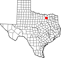 | |
| Towns | ||
| CDP | ||
| Other unincorporated communities |
| |
| Historical communities | ||
| Ghost towns | ||
| Footnotes | ‡This populated place also has portions in an adjacent county or counties | |