Anna, Ohio
| Anna, Ohio | |
|---|---|
| Village | |
|
| |
| Nickname(s): The Earthquake Capital of Ohio | |
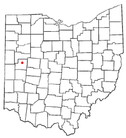
 Location of Anna, Ohio | |
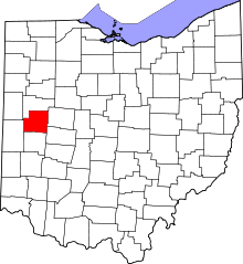
 Location of Anna in Shelby County | |
| Coordinates: 40°23′43″N 84°10′25″W / 40.39528°N 84.17361°WCoordinates: 40°23′43″N 84°10′25″W / 40.39528°N 84.17361°W | |
| Country | United States |
| State | Ohio |
| County | Shelby |
| Government | |
| • Mayor | Mark Pulfer |
| Area[1] | |
| • Total | 1.03 sq mi (2.67 km2) |
| • Land | 1.03 sq mi (2.67 km2) |
| • Water | 0 sq mi (0 km2) |
| Elevation[2] | 1,033 ft (315 m) |
| Population (2010)[3] | |
| • Total | 1,567 |
| • Estimate (2012[4]) | 1,552 |
| • Density | 1,521.4/sq mi (587.4/km2) |
| Time zone | Eastern (EST) (UTC-5) |
| • Summer (DST) | EDT (UTC-4) |
| ZIP code | 45302 |
| Area code(s) | 937 |
| FIPS code | 39-02092[5] |
| GNIS feature ID | 1064331[2] |
| Website | http://villageofannaoh.com/ |
Anna is a village in Shelby County, Ohio, United States. The population was 1,567 at the 2010 census.
Anna is the location of a Honda of America Manufacturing (HAM) Plant that produces engines and other components for a range of Honda vehicles.
Anna is home to the Anna Local Schools, located in two separate buildings. Elementary in one and Middle and High school in the other. The Anna Rockets sports teams include male and female basketball and track and field. Other sports consist of football, soccer, baseball, volleyball and golf.
History
Pre-historical period
The Teays River is prehistoric river that ran through modern day Anna, OH about 2 million years ago. the Teays river deposited loose sediment on the Greenville fault line which created a major earthquake center.
Native American period
According to the Native Americans Tecumseh tried to start his alliances in the modern day Anna Ohio. Most of the native Shawnee and Miami tribes refused the offer, he supposedly put a curse on the land. The curse stated that the land shall be ever plagued with the trembling of the earth.[6]
Settlement
The first white settlement at Anna was made in the 1830s.[7] Anna was platted in 1868, and named for Anna Thirkield. The village was incorporated in 1877.[8]
1937 earthquakes
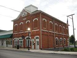
On 9 March 1937, the largest recorded earthquake in Ohio occurred under the present day high school and middle school. It was measured at 5.4 on the Richter scale, while damage was at intensity VIII according to the Mercalli intensity scale. The shock was felt as far away as Chicago, Illinois, and Toronto, Ontario. The shaking followed a similar but somewhat weaker event that happened a week earlier on 2 March of the same year. The Lutheran and Methodist Churches were heavily damaged and since then the Lutheran Church put metal braces in their attic to protect it from future earthquakes. The partially damaged school became a total loss for the town and they had to rebuild it. The town hall was so badly damaged that the upper story was condemned and has not been used since.The Shelby County area has experienced at least 40 earthquakes since 1875.
Geography
Anna is located at 40°23′43″N 84°10′25″W / 40.39528°N 84.17361°W (40.395352, −84.173744).[9]
According to the United States Census Bureau, the village has a total area of 1.03 square miles (2.67 km2), all land.[1]
Government
- Mark Pulfer – Mayor
- Nancy Benroth – Village Administrator
- Scott Evans – Chief of Police (sworn in July 14, 2010)
- Brian Strunk - Deputy of Police & D.A.R.E. Officer
- Village Council
- Kathleen Eshleman
- Gary Strasser
- Richard Eshleman
- Kurt Ehemann
- Richard Steinke
- Jenni Shoffner
- Tyler Martin
- Andrew Bixler – Superintendent of Schools
Demographics
| Historical population | |||
|---|---|---|---|
| Census | Pop. | %± | |
| 1880 | 266 | — | |
| 1890 | 527 | 98.1% | |
| 1900 | 451 | −14.4% | |
| 1910 | 460 | 2.0% | |
| 1920 | 463 | 0.7% | |
| 1930 | 462 | −0.2% | |
| 1940 | 485 | 5.0% | |
| 1950 | 554 | 14.2% | |
| 1960 | 701 | 26.5% | |
| 1970 | 792 | 13.0% | |
| 1980 | 1,038 | 31.1% | |
| 1990 | 1,164 | 12.1% | |
| 2000 | 1,319 | 13.3% | |
| 2010 | 1,567 | 18.8% | |
| Est. 2015 | 1,545 | [10] | −1.4% |
2000 census
As of the census[5] of 2000, there were 1,319 people, 474 households, and 365 families residing in the village. The population density was 1,576.7 people per square mile (606.3/km²). There were 483 housing units at an average density of 577.4 per square mile (222.0/km²). The racial makeup of the village was 96.59% White, 0.38% African American, 0.15% Native American, 1.36% Asian, 0.23% Pacific Islander, 0.23% from other races, and 1.06% from two or more races. Hispanic or Latino of any race were 0.53% of the population.
There were 474 households out of which 46.2% had children under the age of 18 living with them, 62.0% were married couples living together, 11.4% had a female householder with no husband present, and 22.8% were non-families. 19.6% of all households were made up of individuals and 6.3% had someone living alone who was 65 years of age or older. The average household size was 2.78 and the average family size was 3.20.
In the village the population was spread out with 32.3% under the age of 18, 7.6% from 18 to 24, 33.5% from 25 to 44, 19.3% from 45 to 64, and 7.4% who were 65 years of age or older. The median age was 31 years. For every 100 females there were 99.8 males. For every 100 females age 18 and over, there were 94.1 males.
The median income for a household in the village was $48,676, and the median income for a family was $51,797. Males had a median income of $36,250 versus $25,463 for females. The per capita income for the village was $19,835. About 3.4% of families and 3.6% of the population were below the poverty line, including 2.7% of those under age 18 and 3.8% of those age 65 or over.
2010 census
As of the census[3] of 2010, there were 1,567 people, 551 households, and 429 families residing in the village. The population density was 1,521.4 inhabitants per square mile (587.4/km2). There were 589 housing units at an average density of 571.8 per square mile (220.8/km2). The racial makeup of the village was 97.4% White, 0.4% African American, 0.4% Native American, 0.2% Asian, 0.1% from other races, and 1.5% from two or more races. Hispanic or Latino of any race were 0.6% of the population.
There were 551 households of which 47.5% had children under the age of 18 living with them, 57.4% were married couples living together, 13.8% had a female householder with no husband present, 6.7% had a male householder with no wife present, and 22.1% were non-families. 18.0% of all households were made up of individuals and 6.7% had someone living alone who was 65 years of age or older. The average household size was 2.84 and the average family size was 3.20.
The median age in the village was 31.1 years. 33.4% of residents were under the age of 18; 7.2% were between the ages of 18 and 24; 30.5% were from 25 to 44; 21.9% were from 45 to 64; and 7.1% were 65 years of age or older. The gender makeup of the village was 48.4% male and 51.6% female.
References
- 1 2 "US Gazetteer files 2010". United States Census Bureau. Archived from the original on 2012-01-24. Retrieved 2013-01-06.
- 1 2 "US Board on Geographic Names". United States Geological Survey. 2007-10-25. Retrieved 2008-01-31.
- 1 2 "American FactFinder". United States Census Bureau. Retrieved 2013-01-06.
- ↑ "Population Estimates". United States Census Bureau. Archived from the original on 2013-06-17. Retrieved 2013-06-17.
- 1 2 "American FactFinder". United States Census Bureau. Archived from the original on 2013-09-11. Retrieved 2008-01-31.
- ↑ "Earthquake". www.anna.k12.oh.us. Retrieved 2016-02-12.
- ↑ Overman, William Daniel (1958). Ohio Town Names. Akron, OH: Atlantic Press. p. 4.
- ↑ Hitchcock, Almon Baldwin Carrington (1913). History of Shelby County, Ohio, and representative citizens. p. 340.
- ↑ "US Gazetteer files: 2010, 2000, and 1990". United States Census Bureau. 2011-02-12. Retrieved 2011-04-23.
- ↑ "Annual Estimates of the Resident Population for Incorporated Places: April 1, 2010 to July 1, 2015". Retrieved July 2, 2016.
- ↑ "Census of Population and Housing". Census.gov. Archived from the original on May 11, 2015. Retrieved June 4, 2015.

