Ann Arbor Charter Township, Michigan
| Ann Arbor Charter Township | ||
|---|---|---|
| Charter township | ||
|
| ||
| ||
 Ann Arbor Charter Township Location within the state of Michigan | ||
| Coordinates: 42°17′47″N 83°43′13″W / 42.29639°N 83.72028°WCoordinates: 42°17′47″N 83°43′13″W / 42.29639°N 83.72028°W | ||
| Country | United States | |
| State | Michigan | |
| County | Washtenaw | |
| Area | ||
| • Total | 16.9 sq mi (43.7 km2) | |
| • Land | 16.7 sq mi (43.3 km2) | |
| • Water | 0.2 sq mi (0.4 km2) | |
| Elevation | 945 ft (288 m) | |
| Population (2010) | ||
| • Total | 4,361 | |
| • Density | 260/sq mi (100/km2) | |
| Time zone | Eastern (EST) (UTC-5) | |
| • Summer (DST) | EDT (UTC-4) | |
| Area code(s) | 734 | |
| FIPS code | 26-03020[1] | |
| GNIS feature ID | 1625838[2] | |
| Website |
www | |

Ann Arbor Charter Township is a charter township of Washtenaw County in the U.S. state of Michigan. As of the 2010 census, the township population was 4,361.[3] The city of Ann Arbor is adjacent to the township on the south and west sides. Small islands of the township also lie within the boundaries of the city of Ann Arbor. Under a 1994 boundary agreement with the city of Ann Arbor, eventually all of these islands will be permitted to be annexed by the city.
History
The Township of Ann Arbour was organized in 1827 by the Legislative Council of the Michigan Territory and the Village of Ann Arbour, which later became the City of Ann Arbor, was organized in 1833. As villages remain part of the township, the village of Ann Arbour did not become completely detached from the township until it reorganized as the city of Ann Arbor.
The now defunct unincorporated community of Osmer lay in the township. The town was a stop on the Tuscola and Saginaw Bay Railway. Another community Cornwell centered around Cornwell Mills, was begun in the township in 1877.[4]
Geography
According to the United States Census Bureau, the township has a total area of 16.9 square miles (43.7 km2), of which 16.7 square miles (43.3 km2) is land and 0.15 square miles (0.4 km2), or 0.86%, is water.[5] The city of Ann Arbor was established within the borders of Ann Arbor Township. Over the years, the city expanded, annexing portions of the township as the city grew and reducing the land area of the township. Under a 1994 boundary agreement with the City of Ann Arbor, those areas of the Township lying within the future boundaries of the city will be subject to annexation by the city.
To the east of Ann Arbor Township lies Superior Township, to the west lies Scio Township, to the south lies Pittsfield Township, and to the north lies Northfield Township.
Demographics
As of the census[1] of 2000, there were 4,720 people, 1,972 households, and 1,317 families residing in the township. The population density was 267.5 per square mile (103.3/km²). There were 2,034 housing units at an average density of 115.3 per square mile (44.5/km²). The racial makeup of the township was 81.21% White, 2.25% African American, 0.17% Native American, 13.58% Asian, 0.06% Pacific Islander, 0.85% from other races, and 1.89% from two or more races. Hispanic or Latino of any race were 2.22% of the population.
There were 1,972 households out of which 27.7% had children under the age of 18 living with them, 61.0% were married couples living together, 4.4% had a female householder with no husband present, and 33.2% were non-families. 26.7% of all households were made up of individuals and 4.8% had someone living alone who was 65 years of age or older. The average household size was 2.32 and the average family size was 2.84.
In the township the population was spread out with 21.1% under the age of 18, 4.6% from 18 to 24, 30.9% from 25 to 44, 28.1% from 45 to 64, and 15.2% who were 65 years of age or older. The median age was 41 years. For every 100 females there were 95.4 males. For every 100 females age 18 and over, there were 93.7 males.
The median income for a household in the township was $86,797, and the median income for a family was $103,102. Males had a median income of $75,176 versus $45,320 for females. The per capita income for the township was $56,084. About 1.2% of families and 3.2% of the population were below the poverty line, including 1.7% of those under age 18 and 1.6% of those age 65 or over.
Economy

Domino's Pizza has its headquarters in the township.[6][7]
In 2007 Toyota employed 932 people at the Toyota Technical Center in Ann Arbor Township.[8] Calty Design Research Inc., a Toyota design firm, has the Calty Design Research at Ann Arbor in the township.[8][9] Con-way moved its headquarters from San Mateo, California to Ann Arbor Township in 2011.[10]
Education
The main Washtenaw Community College campus is in Ann Arbor Township.[11][7]
Gallery
-

Earhart Road
-

Township office
-

Fire Station #2
-

NSK Americas headquarters, Goss Rd.
-

Toyota Technical Center, Woodridge Ave.
References
- 1 2 "American FactFinder". United States Census Bureau. Archived from the original on 2013-09-11. Retrieved 2008-01-31.
- ↑ U.S. Geological Survey Geographic Names Information System: Ann Arbor Charter Township, Michigan
- ↑ "Profile of General Population and Housing Characteristics: 2010 Demographic Profile Data (DP-1): Ann Arbor charter township, Washtenaw County, Michigan". U.S. Census Bureau, American Factfinder. Archived from the original on September 11, 2013. Retrieved July 6, 2012.
- ↑ Walter Romig, Michigan Place Names, p. 134
- ↑ "Geographic Identifiers: 2010 Demographic Profile Data (G001): Ann Arbor charter township, Washtenaw County, Michigan". U.S. Census Bureau, American Factfinder. Archived from the original on September 11, 2013. Retrieved July 6, 2012.
- ↑ "Contact Us." Domino's Pizza. Retrieved on March 11, 2011. "How do I contact the Domino's Pizza World Resource Center? Domino's Pizza LLC 30 Frank Lloyd Wright Drive Ann Arbor MI 48106-0997"
- 1 2 "Zoning Map." (Archive) Ann Arbor Township, Michigan. Retrieved on December 7, 2012.
- ↑ "Calty Design Research, Inc." Toyota. Retrieved on May 18, 2010.
- ↑ Q-and-a: Why Con-way Inc. moved its headquarters from Silicon Valley to Ann Arbor area
- ↑ "Visiting." Washtenaw Community College. Retrieved on July 5, 2015.
External links
Municipalities and communities of Washtenaw County, Michigan, United States | ||
|---|---|---|
| Cities | 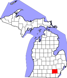 | |
| Villages | ||
| Charter townships | ||
| General law townships | ||
| CDPs | ||
| Unincorporated communities | ||
| Footnotes | ‡This populated place also has portions in an adjacent county or counties | |