Aniva
| Aniva (English) Анива (Russian) | |
|---|---|
| - Town[1] - | |
 A typical view of Aniva | |
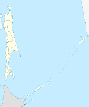
.svg.png) Location of Sakhalin Oblast in Russia | |
 Aniva | |
|
| |
| Administrative status (as of December 2011) | |
| Country | Russia |
| Federal subject | Sakhalin Oblast[1] |
| Administrative district | Anivsky District[1] |
| Administrative center of | Anivsky District[1] |
| Municipal status (as of July 2012) | |
| Urban okrug | Anivsky Urban Okrug[2] |
| Administrative center of | Anivsky Urban Okrug[2] |
| Head | Nikolay Petrov |
| Statistics | |
| Population (2010 Census) | 9,115 inhabitants[3] |
| Time zone | MAGT (UTC+11:00)[4] |
| Founded | 1886[5] |
| Town status since | 1946 |
| Postal code(s)[6] | 694030 |
| Dialing code(s) | +7 42441[7] |
|
| |
| Aniva on Wikimedia Commons | |
Aniva (Russian: Ани́ва) is a coastal town and the administrative center of Anivsky District of Sakhalin Oblast, Russia, located on the coast of Aniva Bay in southern Sakhalin Island on the Lyutoga River, 37 kilometers (23 mi) south of Yuzhno-Sakhalinsk. Population: 9,115 (2010 Census);[3] 8,084 (2002 Census);[8] 8,905 (1989 Census).[9]
History
It was founded in 1886[5] as the village of Lyutoga (Лютога). In 1905, it was ceded to Japan with the rest of the southern part of Sakhalin by the Treaty of Portsmouth and renamed Rūtaka (留多加) by the Japanese. The village was recaptured by the Soviet Union in 1945; it was granted town status and renamed Aniva in 1946.
Administrative and municipal status
Within the framework of administrative divisions, Aniva serves as the administrative center of Anivsky District and is subordinated to it.[1] As a municipal division, the town of Aniva and fifteen rural localities of Anivsky District are incorporated as Anivsky Urban Okrug.[2]
Economy
The town's economy relies mainly on fishing, particularly salmon.
References
Notes
- 1 2 3 4 5 Law #25-ZO
- 1 2 3 Law #524
- 1 2 Russian Federal State Statistics Service (2011). "Всероссийская перепись населения 2010 года. Том 1" [2010 All-Russian Population Census, vol. 1]. Всероссийская перепись населения 2010 года (2010 All-Russia Population Census) (in Russian). Federal State Statistics Service. Retrieved June 29, 2012.
- ↑ Правительство Российской Федерации. Федеральный закон №107-ФЗ от 3 июня 2011 г. «Об исчислении времени», в ред. Федерального закона №271-ФЗ от 03 июля 2016 г. «О внесении изменений в Федеральный закон "Об исчислении времени"». Вступил в силу по истечении шестидесяти дней после дня официального опубликования (6 августа 2011 г.). Опубликован: "Российская газета", №120, 6 июня 2011 г. (Government of the Russian Federation. Federal Law #107-FZ of June 31, 2011 On Calculating Time, as amended by the Federal Law #271-FZ of July 03, 2016 On Amending Federal Law "On Calculating Time". Effective as of after sixty days following the day of the official publication.).
- 1 2 Энциклопедия Города России. Moscow: Большая Российская Энциклопедия. 2003. p. 22. ISBN 5-7107-7399-9.
- ↑ Почта России. Информационно-вычислительный центр ОАСУ РПО. (Russian Post). Поиск объектов почтовой связи (Postal Objects Search) (Russian)
- ↑ Телефонные коды Сахалина - Dialing codes of Sakhalin (Russian)
- ↑ Russian Federal State Statistics Service (May 21, 2004). "Численность населения России, субъектов Российской Федерации в составе федеральных округов, районов, городских поселений, сельских населённых пунктов – районных центров и сельских населённых пунктов с населением 3 тысячи и более человек" [Population of Russia, Its Federal Districts, Federal Subjects, Districts, Urban Localities, Rural Localities—Administrative Centers, and Rural Localities with Population of Over 3,000] (XLS). Всероссийская перепись населения 2002 года [All-Russia Population Census of 2002] (in Russian). Retrieved August 9, 2014.
- ↑ Demoscope Weekly (1989). "Всесоюзная перепись населения 1989 г. Численность наличного населения союзных и автономных республик, автономных областей и округов, краёв, областей, районов, городских поселений и сёл-райцентров" [All Union Population Census of 1989: Present Population of Union and Autonomous Republics, Autonomous Oblasts and Okrugs, Krais, Oblasts, Districts, Urban Settlements, and Villages Serving as District Administrative Centers]. Всесоюзная перепись населения 1989 года [All-Union Population Census of 1989] (in Russian). Институт демографии Национального исследовательского университета: Высшая школа экономики [Institute of Demography at the National Research University: Higher School of Economics]. Retrieved August 9, 2014.
Sources
- Сахалинская областная Дума. Закон №25-ЗО от 23 марта 2011 г. «Об административно-территориальном устройстве Сахалинской области», в ред. Закона №62-ЗО от 27 июня 2013 г. «О внесении изменения в статью 10 Закона Сахалинской области "Об административно-территориальном устройстве Сахалинской области"». Вступил в силу 9 апреля 2011 г.. Опубликован: "Губернские ведомости", №55(3742), 29 марта 2011 г. (Sakhalin Oblast Duma. Law #25-ZO of March 23, 2011 On the Administrative-Territorial Structure of Sakhalin Oblast, as amended by the Law #62-ZO of June 27, 2013 On Amending Article 10 of the Law of Sakhalin Oblast "On the Administrative-Territorial Structure of Sakhalin Oblast". Effective as of April 9, 2011.).
- Сахалинская областная Дума. Закон №524 от 21 июля 2004 г. «О границах и статусе муниципальных образований в Сахалинской области», в ред. Закона №45-ЗО от 27 мая 2013 г. «О внесении изменения в Закон Сахалинской области "О границах и статусе муниципальных образований в Сахалинской области"». Вступил в силу 1 января 2005 г. Опубликован: "Губернские ведомости", №175–176(2111–2112), 31 июля 2004 г. (Sakhalin Oblast Duma. Law #524 of July 21, 2004 On the Borders and Status of the Municipal Formations in Sakhalin Oblast, as amended by the Law #45-ZO of May 27, 2013 On Amending the Law of Sakhalin Oblast "On the Borders and Status of the Municipal Formations in Sakhalin Oblast". Effective as of January 1, 2005.).
| Cities and towns | |||
|---|---|---|---|
| Administrative districts | |||