Angledool
| Angledool New South Wales | |
|---|---|
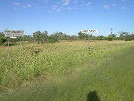 Boundary signs at (New) Angledool, NSW. | |
|
Angledool | |
| Coordinates | 29°06′14″S 147°55′04″E / 29.10389°S 147.91778°ECoordinates: 29°06′14″S 147°55′04″E / 29.10389°S 147.91778°E |
| Population | 84 (2006 census)[1] |
| Elevation | 150 m (492 ft) |
| Location | 45 km (28 mi) N of Lightning Ridge |
| LGA(s) | Walgett Shire and Brewarrina Shires |
| County | Narran |
| State electorate(s) | Barwon |
Angledool is a locality in upper western New South Wales near the southern border of Queensland, one kilometre east of the Castlereagh Highway and approximately 45 kilometres north of Lightning Ridge. At the 2006 census, Angledool had a population of 84 people.[1]
History

Angledool was previously known as New Angledool when it was established in the 1870s.
In 1873 Robert Moore, the manager of the pastoral property, Muggarie Station, later known as Angledool Station, discovered opals. Charlie Dunstan in 1908 found two large opals the "Fire Queen" and "Queen of the Earth", at the Angledool diggings.[2]
The nearby Narran River has led to flooding of the Angledool area in 1890, 1956, 1990, 1996 and again in March 2010. The 1956 flood was the biggest one that has been recorded.[3] In March 2010 the Narran River at Angledool flooded the nearby, Angledool Lake, which covers an area of around 1,100 hectares when full.[4] The lake then spilled into Weetalabah Creek that crosses the Castlereagh Highway, thus filling the Coocoran Lake, near Lightning Ridge.[5]
Prior to World War II Angledool had a bakery, several hotels, a post office, court house and a general store. The village now has an old cemetery, a church, a few houses and several buildings that are over 120 years old. The town hall made from locally made mud bricks is a classic example of early local architecture.[6]
References
- 1 2 Australian Bureau of Statistics (25 October 2007). "Angledool (State Suburb)". 2006 Census QuickStats. Retrieved 2010-05-05.
- ↑ Lightning Ridge Year by Year History 1900 to 1910
- ↑ "Angledool flooding". "I think its a bit bigger than the floods on 1990 and 1996, but not as big as the flood in 1956, which was the biggest recorded. Anecdotally the 1890 flood is believed to be the biggest since European settlement.". ABC. Retrieved 17 January 2013.
- ↑ Bonzle maps Retrieved 2010-5-5
- ↑ "FLOODING OF THE COOCORAN LAKE-2010". You News. Retrieved 16 January 2013.
- ↑ "Angledool Village". Brewarrina Shire Council. Retrieved 15 January 2013.
External links
Goodall, H; Flick, K (1996), Angledool stories, retrieved 15 January 2013