Anchuras
| Anchuras | ||
|---|---|---|
| Municipality | ||
|
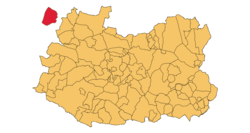
Ciudad Real Province with the enclave of Anchuras on the west | ||
| ||
 Anchuras Location in Spain | ||
| Coordinates: 39°29′N 4°50′W / 39.483°N 4.833°WCoordinates: 39°29′N 4°50′W / 39.483°N 4.833°W | ||
| Country |
| |
| Autonomous community | Castile-La Mancha | |
| Province | Ciudad Real | |
| Comarca | La Jara | |
| Government | ||
| • Alcalde | Santiago Martín Campos (2007) (PSOE) | |
| Area | ||
| • Total | 231.05 km2 (89.21 sq mi) | |
| Elevation | 560 m (1,840 ft) | |
| Population (2014) | ||
| • Total | 342 | |
| • Density | 1.5/km2 (3.8/sq mi) | |
| Demonym(s) | Anchureño/a | |
| Time zone | CET (UTC+1) | |
| • Summer (DST) | CEST (UTC+2) | |
| Postal code | 13117 | |

Anchuras (also known as Rincón de Anchuras) is a municipality in Ciudad Real Province, Castile-La Mancha, Spain. It has a population of 342. According to the 2014 census,[1] Anchuras municipality has a population of 202 inhabitants.
The municipality's territory is located in the Montes de Toledo and forms an enclave between Toledo Province and Badajoz Province.[2]
Villages
- Anchuras, main population centre.
- Encinacaída
- Enjambre
- Las Huertas
- Gamonoso
See also
References
External links
 Media related to Anchuras at Wikimedia Commons
This article is issued from Wikipedia - version of the 1/24/2016. The text is available under the Creative Commons Attribution/Share Alike but additional terms may apply for the media files.