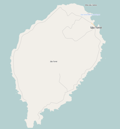
Ana Chaves Bay
| Ana Chaves Bay Baía Ana Chaves | |
|---|---|
 Satellite image of the city of São Tomé and Ana Chaves Bay | |
 Ana Chaves Bay Ana Chaves Bay at the northeast of São Tomé Island | |
| Location | São Tomé and Príncipe |
| Coordinates | 0°20′52.4″N 6°43′42.6″E / 0.347889°N 6.728500°E |
| Type | Bay |
| Ocean/sea sources | Atlantic Ocean |
| Max. depth | .3 miles (0.48 km) |
| Settlements | São Tomé |
Ana Chaves Bay (Portuguese: Baía Ana Chaves) is the harbour and port to the capital city of São Tomé in São Tomé and Príncipe. It ranges from the runway of São Tomé International Airport at the north to Ponta São Tomé at the south. Forte de São Sebastião, now part of São Sebastião Museum, formerly occupied Ponta São Tomé, but reclaimed land now extends .2 miles (0.32 km) past the point. The bay ranges in depth from 2 metres (6.6 ft) near shore to .3 miles (0.48 km) seaward. The bay provides safe anchorage to small vessels; those drawing more than 10 feet (3.0 m) cannot enter the bay.[1]
In 2011, the government of São Tomé and Príncipe granted a long-term concession to Angolan state oil company Sonangol to control and develop the port in which Sonangol have been reported to have invested US$30 million in developing a free trade zone.[2]
References
- ↑ No. 23: Sailing Directions (Enroute) , Southwest Coast Of Africa (PDF) (15 ed.). Springfield, Virginia: National Geospatial-Intelligence Agency. 2014. pp. 70–71. Retrieved 2016-09-14.
- ↑ "Concession awarded in São Tomé". World Cargo News. 25 January 2011. Retrieved 11 November 2011.