Pua District
| Pua ปัว | |
|---|---|
| Amphoe | |
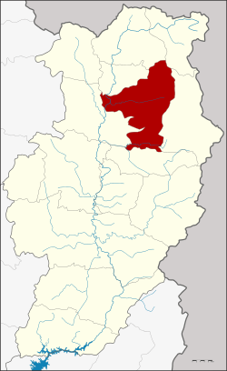 Amphoe location in Nan Province | |
| Coordinates: 19°10′27″N 100°55′0″E / 19.17417°N 100.91667°ECoordinates: 19°10′27″N 100°55′0″E / 19.17417°N 100.91667°E | |
| Country |
|
| Province | Nan |
| Government | |
| • Marshal | Kamthorn Su-Arun |
| Area | |
| • Total | 657.363 km2 (253.809 sq mi) |
| Population (2015) | |
| • Total | 64,813 |
| • Density | 99/km2 (260/sq mi) |
| Time zone | ICT (UTC+7) |
| Postal code | 55120 |
| Geocode | 5505 |
Pua (Thai: ปัว, pronounced [pūa̯]) is a district (amphoe) in the central part of Nan Province, northern Thailand.
Geography
Neighboring districts are, from the north clockwise, Chiang Klang, Thung Chang, Chaloem Phra Kiat, Bo Kluea, Santi Suk, and Tha Wang Pha.
Doi Phu Kha National Park is Thailand's largest national park, covering several districts of Nan Province. The national park office as well as the 1,980 m high Doi Phu Kha in the Luang Prabang Range itself are within Pua District.[1]
Administration
Central administration
The district Pua is subdivided into 12 subdistricts (Tambon), which are further subdivided into 107 administrative villages (Muban).
| No. | Name | Thai | Villages | Pop.[2] |
|---|---|---|---|---|
| 1. | Pua | ปัว | 8 | 7,302 |
| 2. | Ngaeng | แงง | 7 | 4,843 |
| 3. | Sathan | สถาน | 13 | 6,074 |
| 4. | Sila Laeng | ศิลาแลง | 8 | 3,968 |
| 5. | Sila Phet | ศิลาเพชร | 10 | 4,567 |
| 6. | Uan | อวน | 11 | 4,990 |
| 9. | Chai Watthana | ไชยวัฒนา | 8 | 4,232 |
| 10. | Chedi Chai | เจดีย์ชัย | 9 | 6,908 |
| 11. | Phu Kha | ภูคา | 14 | 4,902 |
| 12. | Sakat | สกาด | 4 | 2,903 |
| 13. | Pa Klang | ป่ากลาง | 7 | 8,300 |
| 14. | Wora Nakhon | วรนคร | 8 | 5,824 |
Missing numbers belong to tambon which are now part of Bo Kluea district.
Local administration
There are 2 subdistrict municipalities (Thesaban Tambon) in the district:
- Pua (Thai: เทศบาลตำบลปัว) consisting of the complete subdistrict Pua and parts of the subdistricts Sathan, Chai Watthana, Wora Nakhon.
- Sila Laeng (Thai: เทศบาลตำบลศิลาแลง) consisting of the complete subdistrict Sila Laeng.
There are 10 subdistrict administrative organizations (SAO) in the district:
- Ngaeng (Thai: องค์การบริหารส่วนตำบลแงง) consisting of the complete subdistrict Ngaeng.
- Sathan (Thai: องค์การบริหารส่วนตำบลสถาน) consisting of parts of the subdistrict Sathan.
- Sila Phet (Thai: องค์การบริหารส่วนตำบลศิลาเพชร) consisting of the complete subdistrict Sila Phet.
- Uan (Thai: องค์การบริหารส่วนตำบลอวน) consisting of the complete subdistrict Uan.
- Chai Watthana (Thai: องค์การบริหารส่วนตำบลไชยวัฒนา) consisting of parts of the subdistrict Chai Watthana.
- Chedi Chai (Thai: องค์การบริหารส่วนตำบลเจดีย์ชัย) consisting of the complete subdistrict Chedi Chai.
- Phu Kha (Thai: องค์การบริหารส่วนตำบลภูคา) consisting of the complete subdistrict Phu Kha.
- Sakat (Thai: องค์การบริหารส่วนตำบลสกาด) consisting of the complete subdistrict Sakat.
- Pa Klang (Thai: องค์การบริหารส่วนตำบลป่ากลาง) consisting of the complete subdistrict Pa Klang.
- Wora Nakhon (Thai: องค์การบริหารส่วนตำบลวรนคร) consisting of parts of the subdistrict Wora Nakhon.
Economy
Pua District is heavily agricultural. It is a significant maize-growing area. Farmer's zeal to clear more land for maize cultivation has led to deforestation of vast tracts of hillsides, resulting in "bald mountains" (Thai: เขา้หัวล้าน; rtgs: khao hua lan). A by-product of the land clearing is smoke from field burning, contributing to the northern region's significant air pollution. Charoen Pokphand (CP) Group, Thailand's largest agro-industrial and food conglomerate, and the leading purchaser of Pua District maize, in March 2016 announced an "agricultural social enterprise" to steer district villagers away from maize farming. CP Group has incurred criticism for the way it purchases maize harvests for animal feed from farmers in Nan and other provinces. Suphachai Chearavanont, vice-chairman of CP Group, said that corn planters will be encouraged to grow cash crops such as coffee, which requires less farmland and makes a higher profit than maize. Not only will this address the bald-mountain problem, he said, but it will also help reduce the spring haze in the north which is caused by slash-and-burn practices to prepare land for the next maize season. Mr Suphachai said crops like coffee take about three-and-a-half years to show a yield, but stated that CP Group would stand by farmers and provide assistance in the meantime.[3]
Gallery
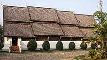 Wat Rong Ngae
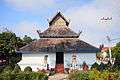 Wat Ban Ton Laeng
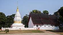 Wat Phra That Bueng Sakat
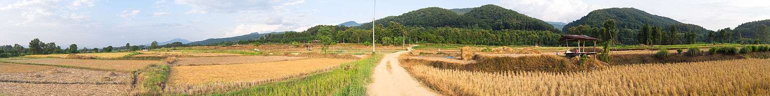
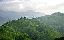 Road number 1256 on a ridge near Doi Phu Kha
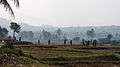 Countryside east of Pua
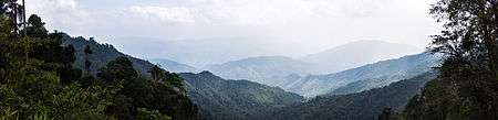 The mountains of Doi Phu Kha National Park
References
- ↑ ดร.กระมล ทองธรรมชาติ และคณะ, สังคมศึกษา ศาสนาและวัฒนธรรม ม.1, สำนักพิมพ์ อักษรเจริญทัศน์ อจท. จำกัด, 2548, หน้า 24-25
- ↑ "Population statistics 2015" (in Thai). Department of Provincial Administration. Retrieved 2016-06-09.
- ↑ Charoensuthipan, Penchan (2016-03-28). "CP stung by bald mountain accusations". Bangkok Post. Retrieved 28 March 2016.
External links
| Wikimedia Commons has media related to Pua District. |
- amphoe.com (Thai)