Ambaji
| Ambaji અંબાજી Arasur, Amba Bhavani | |
|---|---|
| city | |
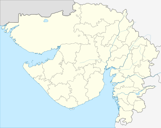 Ambaji  Ambaji Location in Gujarat, India | |
| Coordinates: 24°20′N 72°51′E / 24.33°N 72.85°ECoordinates: 24°20′N 72°51′E / 24.33°N 72.85°E | |
| Country |
|
| State | Gujarat |
| District | Banas Kantha |
| Population (2001) | |
| • Total | 13,702 |
| Languages | |
| • Official | Gujarati, Hindi |
| Time zone | IST (UTC+5:30) |
| PIN code | 385110 |
| Telephone code | 91-02749 |
| Vehicle registration | GJ-8 |
| Website | Ambaji Gujarat |
Ambaji ( Gujarati: અંબાજી, Hindi: अम्बाजी, Ambājī) is a census town in Banaskantha district in the state of Gujarat, India. It is known for its historical and mythological connections with sites of cultural heritage.
Geography
Ambaji[1] is a town within taluka Danta of District Banaskantha, North Gujarat.India. It is located at 24°20′N 72°51′E / 24.33°N 72.85°E.[2] It is at altitude of 480 metres (1,570 ft). It is surrounded by Araveli Hill range . Ambaji is within the Aravali Range[3] (हिन्दी, संस्कृत= अरावली) literally meaning 'line of peaks',[4] is a range of mountains in western India running approximately 800 km in a northeastern direction across Indian states of Gujarat, Rajasthan, Haryana and Delhi.[5][6][7] It is also called Mewat hills locally. Ambaji town also in between the borders of North Gujarat and Abu Road of Rajasthan.
Demographics
As of 2001 India census,[8] Ambaji had a population of 13,702. Males constitute 53% of the population and females 47%. Ambaji has an average literacy rate of 66%, higher than the national average of 59.5%, with 60% of the males and 40% of females literate. 14% of the population is under 6 years of age.
Climate
Ambaji enjoys all types of weather. In Summer, it's hot and humid and temperature remains between 26-46 °C Degrees with hot winds. In Winter, the temperature ranges between 10 and 36 degrees Celsius during this period, which is quite cold and best time and in Monsoon Season, the average rainfall is about 15 to 30 inches per season, sometimes even heavy rainfall. Amabaji is at Altitude: 480 m. Therefore, weather remains relatively pleasant through out the year.
Banks
Ambaji town has branches of the State Bank of India, Bank of Baroda, HDFC Bank and Dena Bank with ATM facility.
About the Temple
| Ambaji temple of amba Mata | |
|---|---|
|
image of temple at night | |
| Name | |
| Other names | અંબાજી |
| Proper name | Ambaji |
| Devanagari | अम्बाजी, अरासुरी अम्बा भवानी मंदिर |
| Tamil | அம்பாஜீ |
| Bengali | অম্বাজী |
| Geography | |
| Country | India |
| State | Gujarat |
| District | Banaskantha |
| Location | Arasur, Banaskantha district |
| Elevation | 61 m (200 ft) |
| Culture | |
| Primary deity | Ambaji Mata (Shakti) |
| Architecture | |
| Architectural styles | Hindu |
| History and governance | |
| Temple board | Shri Arasuri Ambaji Mata Devasthan Trust (SAAMDT), 1963 |
| Website |
www www |
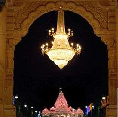
Ambaji is an important temple town with millions of devotees visiting the Ambaji temple every year. It is one of the 51 Shakti Peethas. Ambaji mata temple is a major Shakti Peeth of India. It is situated at a distance of approximately 65 kilometres from Palanpur, 45 kilometres from Mount Abu and 20 kilometres from Abu Road and 185 kilometres from Ahmedabad 50 kilometer from Kadiyadra near the Gujarat and Rajasthan border.
In the holy temple of "Arasuri Ambaji", there is no image or statue of goddess the holy "Shree Visa Yantra" is worshiped as the main deity. No one can see the Yantra with naked eye. The photography of the Yantra is prohibited.
The original seat of Ambaji mata is on gabbar hilltop in the town. A large number of devotees visit the temple every year specially on Purnima days. A large mela on Bhadarvi poornima (full moon day) is held. Every Year from all over the country people come here walking all over from their native place just to worship MAA AMBE in September.The whole Ambaji is lighted up as the whole nation lights up at the festive time of Diwali.
The temple is open from 7.00 am to 11.30 am, 12.30 pm to 4.30 pm and 6.30 pm to 9.00 pm.
The Ambaji Mata Temple as a Shakti Peeth
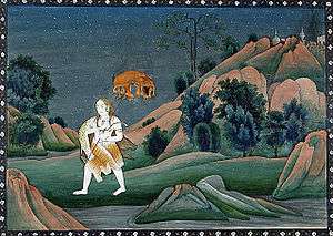
The shrine of Amba is regarded as a revered shrine by the Shakta Shaktism sect of Hinduism. It is believed that the Heart of Sati Devi has fallen here. The origin of the Shakti Peetha status temple is from the mythology of Daksha yaga and Sati's self immolation. Shakti Peethas were believed to have been formed when the body parts of the corpse of Sati Devi fell into different regions when Lord Shiva carried her corpse in sorrow after her death. The shrines are considered as highly revered by Shaivist (Shaivism) sect in Hinduism. The Shakti Peethas are mostly worshiped by tantra practitioners.[9] Each Shakti Peetha has a Kalabhairava shrine associated with it the Kalabhairava of The Amba Matha Temple is Batuk Bhairav.[10][11]
Mythical History
Ambaji is one of the 51 ancient Shakti Peetha Tirth in India. There are 12 main Shakti Pith Tirth, significant places of pilgrimage for the worship of Shakti, namely, Ma Bhagwati Mahakali Maha Shakti at Ujjain, Ma Kamakshi at Kanchipuram, Mata Bramaramba at Srisailam, Shri Kumarika at Kanyakumari, Mataji Ambaji at AnarGujarat, Mata Mahalaxmidevi at Kolhapur, Devi Lalita at Prayag, Vindhya Vasini at Vindhya, Vishalakshi at Varanasi, Mangalavati at Gaya and Sundari at Bangal & Guhyeshwari Temple in Nepal.
There is no idol or picture in the temple but a simple cave like Gokh in the inner wall, in which A Gold Plated Holy Shakti Visa Shree Yantra having kurma back convex shape and 51 Bij letters therein, connected with that of the original Yantras of Nepal and Ujjain Shakti Piths, is also ritually installed in such a way it can be visible for devotion, but never photographed in past nor can be so done in future. The worship of this Visa Shree Yantra is done only after tying a bandage on the eyes.
Places Near Ambaji Town
Gabbar Hill

Just about 4. 5 km Gabbar hill is situated on the border of Gujarat and Rajasthan, near the flow of the origin of the famous Vedic virgin river Sarasvati, on the hills of Arasur in forest, towards south-west side to ancient hills of Arawali, at the altitude of about 480 meters, at about 1,600 feet (490 m) high from sea level, having at 8.33 km2 (3.22 sq mi) area as a whole, and it is in fact One of the 51 famous Ancient Shakti Peeths and it is place of where the heart of the dead Devi Sati fell at the top of hill of Gabbar as per the legend narrated in the "Tantra Chudamani". The Mountain or Hill of Gabbar has also a small temple fortified from the western side and there are 999 steps to go up to the mountain and reach this holy temple at the top of Gabbar Hill. A Holy Lamp is constantly burning on this hill temple facing exactly in front of Visa Shree Yantra of Nij Mandir of Mata Shri Arasuri Ambica. There are many more beautiful sightseeing Places on Gabbar together with a sunset point, Cave and Swings of Mataji and Trips through a ropeway. As per recent study Ambaji Temple was constructed by the Suriyavans Emperor Arun Sen, the ruler of Vallabhi in 4th Century A.D
Kamakshi Mandir
One kilometre away from Ambaji near Kumbharia Jain Temple on Khedbrahma Highway, there is the Kamakshidevi Temple Complex. All 51 Shakti Pith, the centre of cosmic power, are reconstructed and installed in a single complex so as to give total information to the visitors and devotees of the great Shakti Sampraday about the various incarnations of Adhya Shakti mata.
Kailash Hill Sunset
A picnic cum pilgrimage place one and half kilometres away from Ambaji on Khedbrahma Highway, there is a beautiful Shivalaya on the top of Kailash tekari, where one can go only by climbing the steps and walking on a hilly area of Kailash Tekari. Moreover, The Temple Trust has recently constructed a big artistic stone gate at the Temple of Mahadev on Kailash Tekari, which is also administered by Shri Arasuri Ambaji Mata Devasthan Trust.
Koteshwar
Just 8 km away from Ambaji near the Origin of the Vedic Virgin River Saraswati, there is an ancient temple of Shri Koteshwar Mahadev, attached with a Holy Kund and the flows of river Saraswati from the Mouth of Cow Gaumukh, incurved in a rock. As per a legend there was an Ashram of Rushi Valmiki, the author of Ramayana, near Valmiki Mahadev temple and the King of Mevad, Maha Rana Pratap had renovated this holy temple, It is said that during the Mutiny of Independence in 1857, Nana Saheb Peshwa had taken his abode in the cave of this temple. This Place is a beautiful & peaceful in forest.
Kumbhariya
One and a half kilometers away from Ambaji Temple Town. The nearest railway station is the Abu Road about 24 Kilometer and the nearest bus stand 1.5 Kilometer of the Ambaji. It has historical Jain temple of Shri Neminatha Bhagwan which dates back to 13th century.[12] The Kumbhariya Jain temple of Shri Neminatha Bhagwan is now heritage center in Gujarat.[13] The village Kumbhariya also houses educational institute Shree Ambaji Arts College managed by Shree Arasuri Ambaji Mata Devasthan Trust, Ambaji established in 1991 [14]
Mansarovar
Man Sarovar is behind the main temple. It is said to have been constructed by Shri Tapishanker, a Nager Devotee of Ambaji from Ahmedabad, from 1584 to 1594. There are two temples on two sides of this holy tank, one is of Mahadev and another is Ajay Devi, who is believed to be the sister of Mata Ambaji. The visitors and devotees use to take holy bath in this Man Sarovar. It is also an important source of history of Ambaji that there is an ancient Monument of Scripts Writings and Old Carvings on Rock Stone "Shilalekh" of Raja Maldev, dated Hindu Calendar Samvat year 1415, in Ajay Devi Mandir. The Temple Trust has also undertaken the renovation projects in respect of Holy Man Sarovar, and its temples and surroundings, behind the main Temple.
Gabbar Parikrama Path

Shri Arasuri Ambaji Mata Devsthan Trust has developed a parikrama way circulating the Gabbar hill. The 51 shaktipeeth temples are constructed on this Parikrama marg. The temples are made as same as they are at their original locations. One can darshan all 51 shaktipeeth by doing Parikrama of Gabbar hill.
Education
Ambaji Town has educational institutions from primary education to higher education.
Higher education
- Shree Ambaji Arts College
- B. D. Mehta B.C.A., College ( now defunct ).
Schools
- A G P High School
- Adarsh Nivashi Secondary School
- Arasuri Ambaji Sanskrit Pathshala
- B.D.Maheta Arasuri Girls High Secondary School
- Bal Mandir, Ambaji
- Carmel English High School
- Government Gujarati School
- L. J. Thakur English Medium School
- Sarswati Hindi Medium High Secondary School
- Shri B.D. Mehta Arasuri Kanya Vidhyalay primary school
Transportation
There is a bus-station of Gujarat State Transport (GSRTC) connecting to all major cities of India, and a railway station is at Palanpur of District Banaskantha, North Gujarat.India.
Road
Ambaji can be reached through Himatnagar road which is connected with National Highway No.8 (Mumbai to Delhi).The other road which Passes through Palanpur and Danta and connects with State Highway SH 56 to reach Ambaji.
Rail
The nearest Railway station of Gujarat is at Palanpur Junction which comes under the administrative control of Western Railway zone of the Indian Railways. It has direct rail links on the broad gauge to the cities of Ajmer Chennai, Thiruvananthapuram, Mysore, Bangalore, Pune, Mumbai, Jaipur, Jodhpur, Delhi, Dehradun, Muzaffarpur, Bareilly and Jammu. It is connected to most of the cities and towns in Gujarat such as Ahmedabad, Surat, Vadodara, Bhuj, Rajkot, Jamnagar and Porbandar.Indian Railways’ proposal to double the broad gauge line between Palanpur and Samakhiali has received government backing.The doubling will benefit the districts of Kutch, Patan and Banaskantha in the state of Gujarat. The other way of nearest Railway station is at Abu Road which is 22 kilometers away from Ambaji.
Air
The nearest Airport is the Deesa Airport (also spelled Disa Airport), an airport in Deesa, Gujarat but this airport is not working nowadays,originally built for Palanpur.[15] it is just 82 km from Palanpur city. The nearest International Airport is Sardar Vallabhbhai Patel International Airport, Ahemdabad which is 179 km far from Ambaji Temple Town.
Distance from Places
From surat it is 435 km away.
From Ahmedabad it is 184 km away.
From Palanpur it is 65 km away.
From Abu Road it is 20 km away.
Surrounding Cites
 |
Deesa | Abu Road, Mount Abu | Udaipur | |
| Palanpur | |
Idar | ||
| ||||
| | ||||
| Patan | Himmatnagar, Ahmedabad | Danta |
References
- ↑ Important Temple Town in North Gujarat.
- ↑ - Ambaji
- ↑ Aravali Biodiversity Park, Gurgaon, website
- ↑ The Geography of British India, Political & Physical, by George Smith. Published by J. Murray, 1882. Page 23..
- ↑ Kohli, M.S. (2004), Mountains of India: Tourism, Adventure, Pilgrimage, Indus Publishing, pp. 29–, ISBN 978-81-7387-135-1
- ↑ Aravali Range Students' Britannica India, by Dale Hoiberg, Indu Ramchandani. Published by Popular Prakashan, 2000. ISBN 0-85229-760-2. Page 92-93.
- ↑ Aravali Range Britannica.com.
- ↑ "Census of India 2001: Data from the 2001 Census, including cities, villages and towns (Provisional)". Census Commission of India. Archived from the original on 2004-06-16. Retrieved 2008-11-01.
- ↑ (Translator), F. Max Muller (June 1, 2004). The Upanishads, Vol I. Kessinger Publishing, LLC. ISBN 1419186418. Retrieved 7 August 2013.
- ↑ (Translator), F. Max Muller (July 26, 2004). The Upanishads Part II: The Sacred Books of the East Part Fifteen. Kessinger Publishing, LLC. ISBN 1417930160.
- ↑ "Kottiyoor Devaswam Temple Administration Portal". http://kottiyoordevaswom.com/. Kottiyoor Devaswam. Retrieved 20 July 2013. External link in
|work=(help) - ↑ .Jain Temple in Kumbhariya, Ambaji
- ↑ Jain Heritage centre at village Kumbhariya, Near Ambaji .
- ↑ .Education Institution Shree Ambaji Arts College in village Kumbhariya, Ambaji
- ↑ "Helipad in every taluka headquaters [sic]". The Times of India. 28 December 2011. Retrieved 23 January 2012.
External links
| Wikivoyage has a travel guide for Ambaji. |
- Ambaji Temple web site
- Ambaji Mandir Of USA web site
- Gujarat State Road Transport Corporation
- Ambaji's arti in Shehnai tune online on DeshGujarat.Com
- Mahadeva Temple, Kerala