Amaxac de Guerrero (municipality)
| Amaxac de Guerrero (municipality) | |
|---|---|
| Municipality | |
|
Church of San Bernabé | |
| Country |
|
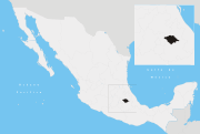
| State | Tlaxcala |
| Time zone | Central Standard Time (UTC-6) |
| • Summer (DST) | Central Daylight Time (UTC-5) |

Amaxac de Guerrero (municipality) is a municipality in Tlaxcala in south-eastern Mexico.[1]
Climate
| Climate data for Amaxac de Guerrero (1951–2010) | |||||||||||||
|---|---|---|---|---|---|---|---|---|---|---|---|---|---|
| Month | Jan | Feb | Mar | Apr | May | Jun | Jul | Aug | Sep | Oct | Nov | Dec | Year |
| Record high °C (°F) | 29.5 (85.1) |
31.0 (87.8) |
35.0 (95) |
37.0 (98.6) |
39.5 (103.1) |
40.5 (104.9) |
31.5 (88.7) |
31.0 (87.8) |
31.0 (87.8) |
31.0 (87.8) |
32.0 (89.6) |
29.0 (84.2) |
40.5 (104.9) |
| Average high °C (°F) | 23.6 (74.5) |
25.3 (77.5) |
26.7 (80.1) |
27.4 (81.3) |
27.7 (81.9) |
26.0 (78.8) |
24.7 (76.5) |
24.6 (76.3) |
24.2 (75.6) |
24.1 (75.4) |
24.2 (75.6) |
23.4 (74.1) |
25.2 (77.4) |
| Daily mean °C (°F) | 12.4 (54.3) |
14.0 (57.2) |
15.7 (60.3) |
16.8 (62.2) |
17.4 (63.3) |
17.3 (63.1) |
16.1 (61) |
15.9 (60.6) |
15.7 (60.3) |
14.9 (58.8) |
13.9 (57) |
12.6 (54.7) |
15.2 (59.4) |
| Average low °C (°F) | 1.3 (34.3) |
2.8 (37) |
4.7 (40.5) |
6.2 (43.2) |
7.2 (45) |
8.7 (47.7) |
7.6 (45.7) |
7.3 (45.1) |
7.3 (45.1) |
5.7 (42.3) |
3.6 (38.5) |
1.7 (35.1) |
5.3 (41.5) |
| Record low °C (°F) | −6.0 (21.2) |
−4.0 (24.8) |
−3.5 (25.7) |
1.0 (33.8) |
0.0 (32) |
1.0 (33.8) |
1.0 (33.8) |
2.0 (35.6) |
0.0 (32) |
−2.5 (27.5) |
−6.0 (21.2) |
−7.0 (19.4) |
−7.0 (19.4) |
| Average precipitation mm (inches) | 10.3 (0.406) |
6.1 (0.24) |
11.5 (0.453) |
33.5 (1.319) |
68.9 (2.713) |
143.1 (5.634) |
134.6 (5.299) |
131.1 (5.161) |
131.9 (5.193) |
61.9 (2.437) |
12.7 (0.5) |
6.6 (0.26) |
752.2 (29.614) |
| Average precipitation days (≥ 0.1 mm) | 1.3 | 1.1 | 2.0 | 4.8 | 9.3 | 13.4 | 14.7 | 14.7 | 13.3 | 6.8 | 1.8 | 0.7 | 83.9 |
| Source: Servicio Meteorologico Nacional[2][3] | |||||||||||||
Municipal Presidency
It was built around 60 years. Initially there only was a plant, but with the time and the population growth it was extended to a second floor that lodges the administrative offices of the municipal presidency. The division of the second plant of the building is done of stave material. At its interior there is a photographic gallery of municipal ex-presidents. Besides that at the entrance of the building it is located the municipal library that counts with more than five thousand books of consultation and calculation services with internet access. At the opposite site is located the municipality logo.
Localities
- Amaxac
- San Damián Tlacocalpan
References
- ↑ "-". Enciclopedia de los Municipios de México. Instituto Nacional para el Federalismo y el Desarrollo Municipal. Retrieved January 4, 2009.
- ↑ "Estado de Tlaxcala-Estacion: Amaxac de Guerrero". Normales Climatologicas 1951–2010 (in Spanish). Servicio Meteorologico Nacional. Retrieved 27 April 2015.
- ↑ "Extreme Temperatures and Precipitation for Amaxac de Guerrero 1980–2005" (in Spanish). Servicio Meteorológico Nacional. Retrieved 27 April 2015.
Coordinates: 19°22′N 98°11′W / 19.367°N 98.183°W
This article is issued from Wikipedia - version of the 6/26/2016. The text is available under the Creative Commons Attribution/Share Alike but additional terms may apply for the media files.