Amanda, Ohio
| Amanda, Ohio | |
|---|---|
| Village | |
|
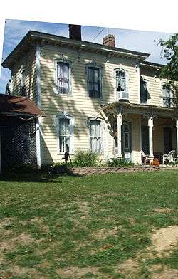
Barr House | |
 Location of Amanda in Ohio | |
 Location of Amanda in Fairfield County | |
| Coordinates: 39°39′00″N 082°44′36″W / 39.65000°N 82.74333°WCoordinates: 39°39′00″N 082°44′36″W / 39.65000°N 82.74333°W | |
| Country | United States |
| State | Ohio |
| County | Fairfield County |
| Township | Amanda Township |
| Government | |
| • Mayor[1] | Mark Moore |
| Area[2] | |
| • Total | 0.30 sq mi (0.78 km2) |
| • Land | 0.30 sq mi (0.78 km2) |
| • Water | 0 sq mi (0 km2) |
| Elevation[3] | 922 ft (281 m) |
| Population (2010)[4] | |
| • Total | 737 |
| • Estimate (2012[5]) | 741 |
| • Density | 2,456.7/sq mi (948.5/km2) |
| Time zone | Eastern (EST) (UTC-5) |
| • Summer (DST) | EDT (UTC-4) |
| ZIP code | 43102 |
| Area code(s) | 740 |
| FIPS code[6] | 39-01630 |
| GNIS feature ID[3] | 1048458 |
| Website |
villageofamanda |
Amanda is a village in Fairfield County, Ohio, United States. The population was 737 at the 2010 census. Amanda was the birthplace of Thomas Sterling, a Republican in the United States Senate from 1913 to 1925.
History
Amanda was founded around 1830, but development would not begin in earnest until 1850 when the railroad was extended to that point.[7] A post office has been in operation at Amanda since 1832.[8]
Geography
Amanda is located at 39°39′0″N 82°44′36″W / 39.65000°N 82.74333°W (39.650042, -82.743199).[9]
According to the United States Census Bureau, the village has a total area of 0.30 square miles (0.78 km2), all land.[2]
Demographics
| Historical population | |||
|---|---|---|---|
| Census | Pop. | %± | |
| 1850 | 181 | — | |
| 1880 | 375 | — | |
| 1890 | 469 | 25.1% | |
| 1910 | 484 | — | |
| 1920 | 531 | 9.7% | |
| 1930 | 557 | 4.9% | |
| 1940 | 561 | 0.7% | |
| 1950 | 587 | 4.6% | |
| 1960 | 732 | 24.7% | |
| 1970 | 788 | 7.7% | |
| 1980 | 720 | −8.6% | |
| 1990 | 729 | 1.3% | |
| 2000 | 707 | −3.0% | |
| 2010 | 737 | 4.2% | |
| Est. 2015 | 747 | [10] | 1.4% |
2010 census
As of the census[4] of 2010, there were 737 people, 270 households, and 205 families residing in the village. The population density was 2,456.7 inhabitants per square mile (948.5/km2). There were 295 housing units at an average density of 983.3 per square mile (379.7/km2). The racial makeup of the village was 96.6% White, 0.9% African American, 0.1% Pacific Islander, 0.5% from other races, and 1.8% from two or more races. Hispanic or Latino of any race were 1.4% of the population.
There were 270 households of which 43.3% had children under the age of 18 living with them, 56.7% were married couples living together, 11.5% had a female householder with no husband present, 7.8% had a male householder with no wife present, and 24.1% were non-families. 21.1% of all households were made up of individuals and 8.9% had someone living alone who was 65 years of age or older. The average household size was 2.73 and the average family size was 3.10.
The median age in the village was 37 years. 30% of residents were under the age of 18; 7.5% were between the ages of 18 and 24; 26.4% were from 25 to 44; 23.6% were from 45 to 64; and 12.6% were 65 years of age or older. The gender makeup of the village was 51.6% male and 48.4% female.
2000 census
As of the census[6] of 2000, there were 707 people, 256 households, and 203 families residing in the village. The population density was 2,160.6 people per square mile (827.2/km²). There were 269 housing units at an average density of 822.1 per square mile (314.7/km²). The racial makeup of the village was 98.59% White, 0.28% Native American, and 1.13% from two or more races. Hispanic or Latino of any race were 0.71% of the population.
There were 256 households out of which 40.2% had children under the age of 18 living with them, 67.6% were married couples living together, 8.6% had a female householder with no husband present, and 20.7% were non-families. 19.1% of all households were made up of individuals and 8.2% had someone living alone who was 65 years of age or older. The average household size was 2.76 and the average family size was 3.09.
In the village the population was spread out with 29.1% under the age of 18, 5.5% from 18 to 24, 33.0% from 25 to 44, 18.4% from 45 to 64, and 14.0% who were 65 years of age or older. The median age was 34 years. For every 100 females there were 90.6 males. For every 100 females age 18 and over, there were 91.2 males.
The median income for a household in the village was $40,114, and the median income for a family was $43,750. Males had a median income of $36,563 versus $21,176 for females. The per capita income for the village was $16,208. About 3.6% of families and 3.6% of the population were below the poverty line, including 2.3% of those under age 18 and 1.8% of those age 65 or over.
References
- ↑ Village of Amanda, official website
- 1 2 "US Gazetteer files 2010". United States Census Bureau. Archived from the original on 2012-01-24. Retrieved 2013-01-06.
- 1 2 "US Board on Geographic Names". United States Geological Survey. 2007-10-25. Retrieved 2008-01-31.
- 1 2 "American FactFinder". United States Census Bureau. Retrieved 2013-01-06.
- ↑ "Population Estimates". United States Census Bureau. Archived from the original on 2013-06-17. Retrieved 2013-06-17.
- 1 2 "American FactFinder". United States Census Bureau. Archived from the original on 2013-09-11. Retrieved 2008-01-31.
- ↑ Miller, Charles Christian (1912). History of Fairfield County, Ohio, and representative citizens. Chicago, Richmond-Arnold Pub. Co. p. 127.
- ↑ "Fairfield County". Jim Forte Postal History. Retrieved 17 December 2015.
- ↑ "US Gazetteer files: 2010, 2000, and 1990". United States Census Bureau. 2011-02-12. Retrieved 2011-04-23.
- ↑ "Annual Estimates of the Resident Population for Incorporated Places: April 1, 2010 to July 1, 2015". Retrieved July 2, 2016.
- ↑ "Census of Population and Housing". Census.gov. Archived from the original on May 11, 2015. Retrieved June 4, 2015.
External links
Municipalities and communities of Fairfield County, Ohio, United States | ||
|---|---|---|
| Cities | 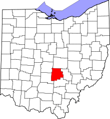 | |
| Villages | ||
| Townships | ||
| CDPs | ||
| Unincorporated communities | ||
| Footnotes | ‡This populated place also has portions in an adjacent county or counties | |