Paute Dam
| Paute Dam | |
|---|---|
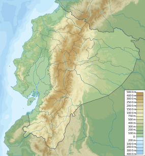 Location of Paute Dam in Ecuador | |
| Location | Paute, Ecuador |
| Coordinates | 02°35′10″S 78°33′30″W / 2.58611°S 78.55833°WCoordinates: 02°35′10″S 78°33′30″W / 2.58611°S 78.55833°W |
| Construction began | 1976 |
| Opening date | 1983 |
| Operator(s) | CELEC |
| Dam and spillways | |
| Type of dam | Arch-gravity dam |
| Impounds | Paute River |
| Height | 1,188,219 m3 (1,554,132 cu yd) |
| Length | 420 m (1,380 ft) |
| Spillway type | Gate-controlled overflow |
| Spillway capacity | 7,724 m3/s (272,800 cu ft/s) |
| Reservoir | |
| Creates | Paute Reservoir |
| Total capacity | 120×106 m3 (97,000 acre·ft) |
| Active capacity | 100×106 m3 (81,000 acre·ft) |
| Power station | |
| Commission date |
Phase AB: 1983 Phase C: 1991 |
| Hydraulic head |
Phase AB: 650 m (2,130 ft) Phase C: 657 m (2,156 ft) |
| Turbines |
Phase AB: 5 x 100 MW (130,000 hp) Pelton-type Phase C: 5 x 115 MW (154,000 hp) Pelton-type |
| Installed capacity | 1,075 MW (1,442,000 hp)[1] |
The Paute Dam, also known as the Daniel Palacios Dam and the Amaluza Dam, is the largest hydroelectric dam in Ecuador. It is located on the Paute River, 125 kilometres (78 mi) from Cuenca. After the privatization of power generation that began in 1996 under the government of Sixto Durán Ballén, the dam passed into the hands of the company Hidropaute SA and then returned to state ownership during the government of Rafael Correa when Hidropaute became part of the Ecuador Electricity Corporation (Corporación Eléctrica del Ecuador, CELEC).
Paute was constructed between 1976 and 1983 on the Paute River and designed on the premise that it would be erected upstream of the Mazar Dam. The Paute Dam's supports to 1,075 megawatts (1,442,000 hp) Molina Power Station. In late 2009, low water levels at the dam were the primary cause of an electricity crisis in Ecuador.
See also
Notes
External links
- History of the Paute Dam (Spanish)