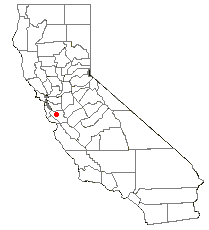
Alviso, San Jose, California
| Alviso | |
|---|---|
| Neighborhood | |
 Location of Alviso, California | |
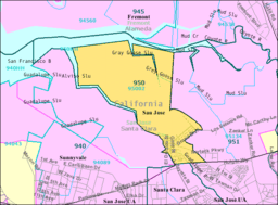 95002 Zip Code Tabulation Area | |
 Alviso Location within San Jose | |
| Coordinates: 37°25′30″N 121°58′0″W / 37.42500°N 121.96667°WCoordinates: 37°25′30″N 121°58′0″W / 37.42500°N 121.96667°W | |
| Country | United States |
| State | California |
| Region | San Francisco Bay Area |
| County |
Santa Clara [4th Supervisor District] |
| Incorporated (City of Alviso) | March 4, 1852 |
| Consolidated with San Jose | March 12, 1968 |
| Population (2000) | |
| • Total | 2,128 |
| Demonym(s) | Alvisans |
| Time zone | Pacific (UTC-8) |
| • Summer (DST) | PDT (UTC-7) |
| ZIP code | 95002 |
| Area codes | 408/669 |
| GNIS feature ID | |
|
Alviso Historic District | |
| Coordinates | 37°25′30″N 121°58′0″W / 37.42500°N 121.96667°W |
| Area | 9 acres (3.6 ha) |
| Built | 1851 |
| NRHP Reference # | 73000449[1] |
| Added to NRHP | October 9, 1973 |
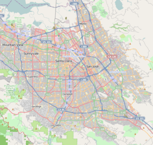
Alviso is a neighborhood in San Jose, Santa Clara County, California, and until 1968, it was an independent city of the same name. It is located approximately 1.5 miles (2.4 km) south of Drawbridge, at the north end of San José where it meets the southern end of the San Francisco Bay and borders the cities of Milpitas, Sunnyvale, and Santa Clara.
The Guadalupe River and Coyote Creek both end at Alviso, emptying into the Bay through Alviso Slough and Mud Slough. Alviso is the lowest point in the San Francisco Bay Area at 13 feet (4.0 m) below sea level.[2] Throughout the 20th Century, Alviso has been victim to severe flooding most recently in 1983 and 1995.[3]
History
Alviso was first settled in the 18th century. The community was named for Ignacio Alviso, the son of Corporal Domingo Alviso, one of the original members of the de Anza expedition. Corporal Alviso lived but a short time after reaching San Francisco and was buried March 11, 1777[4] Alviso's descendants were granted the Rancho Rincon de Los Esteros holding. In 1840, his descendant of the same name, Ignacio Alviso, moved from Mission Santa Clara de Asís to this 3,653 acres (14.78 km2) ranchero. From this port, beaver pelts, cattle hides and tallow went to San Francisco.[5]
The city of Alviso was incorporated on March 4, 1852, as the boating and shipping port of San José and the transportation hub for the Santa Clara Valley to the San Francisco Bay. Steamboats traveled regularly between San Francisco and Alviso. That usage declined with the growth in railroad transportation between San Francisco and San José. In 1864 Alviso was bypassed by the San Francisco and San Jose Railroad, (later part of the Southern Pacific Railroad). However in the 1880s Alviso was a stop on the Newark line of Southern Pacific Railroad between San José and Oakland.
Alviso was the home to a series of several successful business ventures. Alviso Mills, founded in 1853, at its peak produced up to 300 barrels of flour a day. As wheat production in the San Joaquín Valley grew, production in the Santa Clara Valley waned and the Alviso Mills closed in 1885. In 1906, Sai Yin Chew opened the Bayside Canning Company there, and at its peak was the 3rd largest cannery in the United States. During The Depression Alviso was known for its dance halls and gambling establishments. In the 1960s and 1970s a small independent boat building community developed there.[6]
The city ceased to exist when it was consolidated with the City of San Jose on March 12, 1968, following a 189 to 180 vote in favor of consolidation. The city's final census was in 1960 when it recorded a population of 1,174.[7] The United States Postal Service still recognizes "Alviso" as a place name. Mail is not delivered in Alviso, but must be picked up at the post office.
After the 1970s, Alviso was treated like a socioeconomic backwater of the prospering Silicon Valley and struggled to restore its former vitality. On October 9, 1973, 9 acres (3.6 ha) were added to the National Register of Historic Places listings in Santa Clara County, California as site 73000449 under the name Alviso Historic District. The listing cited 11 historic structures and alternative name Embarcadero de Santa Clara, although exact boundaries were not disclosed.[1] The floods of the early 1980s were devastating to Alviso, especially because Alviso is below sea level and is on marshland. Water was as much as 10 feet (3 m) deep in some locations. A number of homes and businesses were destroyed. Some of the picturesque character of the town was lost.
Shipping and industry have left Alviso, leaving it mostly as a small residential neighborhood. Digital video recorder company TiVo and Polycom have their corporate headquarters in Alviso. Many salt evaporation ponds formerly owned by Cargill in the neighborhood are being converted to wetlands as part of the Don Edwards San Francisco Bay National Wildlife Refuge.
Demographics
The Bureau of the Census provides demographic information for the 95002 Zip Code Tabulation Area, which includes the former City of Alviso. (See map of the 95002 Zip Code Tabulation Area.)[8] As of the census[9] of 2000, there were 2,128 people, 506 households, and 400 families residing in the CDP. There were 514 housing units. The racial makeup of the CDP was 40.8% White, 0.6% African American, 1.1% Native American, 2.7% Asian, 50.5% from other races, and 4.3% from two or more races. Hispanic or Latino of any race were 75.4% of the population.
Day on the Bay
On October 16, 2010, Alviso celebrated the opening of the newly renovated marina with their first annual multicultural festival called "Day on the Bay". About 5,000 people were in attendance from all around the county. Activities included kayaking on the water and watching the entertainment on two stages, as well as fun activities for the children. The goals of the event were not limited to promoting the new city attraction but also to attract a diverse crowd to the outdoor recreational setting.[10] With the popularity of the festival, Santa Clara County Supervisor Dave Cortese said he believes the event will be back again next October.[11]
Attractions

Alviso Marina County Park
This 18.9 acres (76,000 m2) bayside park, though small in size, offers a great deal of activities within its boundaries and on into the Wildlife Refuge. A light dredging of the channel, a new boat ramp, two piers and parking lot were completed in time for the start of summer this year, giving boaters access to the bay again after a quarter of a century. Both the pathways and boardwalks of the County Park and trails around the ponds in the adjacent Wildlife Refuge offer fantastic views of the mountains surrounding the bay, and of the wildlife that call these ponds home.
Hiking, biking and bird watching are favorite activities in both the park and the refuge, while picnicking and strolling along the manicured pathways can be enjoyed within the County Park. Dogs are allowed in the County Park's pathways and picnic areas, but are not allowed on the trails, levees and boardwalks. While bikes are allowed on all pathways and trails in the park, please walk your bikes on the boardwalks. The launch ramp provides one of the few clear routes in the San Jose area through the salt marshes out to the open waters of the San Francisco Bay.[12]
Don Edwards San Francisco Bay National Wildlife Refuge
Don Edwards San Francisco Bay National Wildlife Refuge, the first urban National Wildlife Refuge established in the United States, is dedicated to preserving and enhancing wildlife habitat, protecting migratory birds, protecting threatened and endangered species, and providing opportunities for wildlife-oriented recreation and nature study for the surrounding communities.
As of 2004, the Refuge spans 30,000 acres (120 km2) of open bay, salt pond, salt marsh, mudflat, upland and vernal pool habitats located throughout south San Francisco Bay. Located along the Pacific Flyway, the Refuge hosts over 280 species of birds each year. Millions of shorebirds and waterfowl stop to refuel at the Refuge during the spring and fall migration. In addition to its seasonal visitors, the Refuge provides critical habitat to resident species like the endangered Ridgway's rail and salt marsh harvest mouse. Today, hundreds of thousands of people visit the Refuge each year to enjoy its diverse wildlife and habitats.
The Don Edwards San Francisco Bay National Wildlife Refuge is part of a complex made up of six other wildlife refuges in the San Francisco Bay Area. Founded in 1974 and administered by the U.S. Fish and Wildlife Service, It was renamed Don Edwards San Francisco Bay National Wildlife Refuge in 1995 in recognition of Congressman Don Edwards' efforts to protect sensitive wetlands in south San Francisco Bay.[13]
Landmarks
Drawbridge
Alviso has a ghost town which is named Drawbridge.[14] Hunters and fisherman came to the island by train in the 1870s, and many never left. By the 1920s, the autonomous population had grown to more than 400. Of course, since there were no police or no government on the island, it supposedly became a haven for bootleggers, gamblers and brothels, but this has been disputed. And they had to fend for themselves, as there was no electricity or plumbing. But the community gradually faded away, as pollution and urbanization from the burgeoning valley destroyed the hunting and fishing industries.[15][16] Several buildings are visible in the ghost town, though it is steadily sinking into the marshlands.[17] Though there are no roads which lead to the town, it is visible from the side of Don Edwards San Francisco Bay National Wildlife Refuge, and accessible via the Union Pacific Railroad tracks which run through the remains of Drawbridge.

The Geodesic Dome House
A geodesic dome house was built in 1974 before the big flood, when land was more affordable.
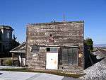
Bayside Canning Company
The Bayside Canning Company has not been used as a cannery since 1936; the building, covered with murals depicting Alviso history, is currently used by the San Francisco Bay Bird Observatory.[15]
Copy from "Five Views: An Ethnic Historic Site Survey for California" http://www.nps.gov/history/history/online_books/5views/5views3h6.htm
The forerunner of the Bay Side Canning Company of Alviso was the Precita Canning Company at Broadway and Sansome streets, San Francisco.
This was founded about 1890 by Sai Yin Chew. Officials and the board of directors were all of Chinese ancestry. After the San Francisco earthquake and fire in 1906, the Precita Canning Company moved to Alviso, and reorganized under the name of the Bay Side Canning Company.
The company rented the Alviso Watch Factory building and later bought the premises. Surrounding land was bought to build warehouses, cabins, and boarding houses for the laborers. A two-story building was built to house 100 Chinese American laborers who came from the San Francisco Bay area.
The Bay Side Canning Company plant at Alviso started operations with primitive canning methods and equipment, of which most was hand-made. Steam was supplied by old, donkey-type boilers; open vats were used in processing fruits and vegetables. Hand seamers and hand soldering were used in canning the processed food.
Thomas Foon Chew, son of Sai Yin Chew, began working for his father in 1906. Due to his progressive ideas, the cannery began a period of rapid growth that made it the third largest cannery in the United States at the time. Only Del Monte and Libby were larger. Chew devised a method for washing tomato boxes before their return to the fields, and he bought a tugboat and a barge to transport goods. He also bought land near Yuba City, Sutter County, to grow peaches, and near Dos Palos, Merced County, for rice. When Thomas Foon Chew died in 1931, his funeral attracted 25,000 people and was said to have been the largest in San Francisco's Chinatown.
Raw products were delivered to the cannery by horses and wagons from the Santa Clara Valley. More distant products came by train or boat from the San Joaquin and Sacramento Delta. Commodities canned at the Alviso plant were spinach, asparagus, cherries, apricots, plums, peaches, pears, tomatoes, catsup, tomato sauce, hot sauce, tomato puree, fish sauce, fruits for salad, vegetables for salad, and fruit cocktail.
The Isleton Plant in Sacramento County was built in 1919 for canning spinach and asparagus, and in 1921, Bay Side began canning green, rather than white, asparagus. The Mayfield Plant in Santa Clara County was built around 1924. The Alviso plant was sold in 1936, but some of the innovative ideas developed by employees of Bay Side Canning Company are still used by most modern canneries.
The Laine Store
The Laine Store at 996 Elizabeth Street, was run by the Tilden family from 1865 to 1912. In the 1920s it became a Chinese gambling hall.[18]
The Tilden-Laine House
An Italianate Victorian home on Elizabeth Street. Still occupied by the Laine family; Thomas Laine and Beverly Laine.
Trivia
Sam Vasquez's 2012 movie Ruben's Place is situated in Alviso which was also the filming location.
References
- 1 2 National Park Service (2009-03-13). "National Register Information System". National Register of Historic Places. National Park Service.
- ↑ Kurhi, Eric (2014-12-11). "San Jose: Overwhelmed pumps led to Alviso flooding; residents say it's a 'wake-up call'". newspaper. Retrieved 2015-02-13.
- ↑ "Flood Control". Guadalupe River Park Conservancy. Retrieved 2015-02-13.
- ↑ Filion, Ron. "Members of the Anza Expedition: Individual Profiles". SFGenealogy.com. Retrieved 2013-06-26.
- ↑ Caroline and Bob Mehaffy (1999). Revised and Expanded Cruising Guide to San Francisco Bay. Arcata, California: Paradise Cay Publications. p. 155. ISBN 978-0-939837-31-1.
- ↑ "History of Alviso". HistorySanJose.org. Retrieved 2013-06-26.
- ↑ "Historical US Census Populations of Places, Towns, and Cities in California". California Department of Finance. Retrieved 2013-06-26.
- ↑ "American FactFinder Fact Sheet for 05002 ZCTA". Bureau of the Census. Retrieved 2013-06-26.
- ↑ "American FactFinder". United States Census Bureau. Archived from the original on 2013-09-11. Retrieved 2008-01-31.
- ↑ "'Day on the Bay' launches in Alviso and draws big, multicultural crowd". San Jose Mercury News. Retrieved 2013-06-26.
- ↑ https://web.archive.org/web/20110715051842/http://milpitas.patch.com/articles/alviso-makes-a-splash-with-outdoor-festival. Archived from the original on July 15, 2011. Retrieved December 1, 2010. Missing or empty
|title=(help) - ↑ "Ideas Wanted! Help create a brand new place to play at Vasona Lake County Park! - Parks and Recreation - County of Santa Clara". ParkHere.org. Retrieved 2013-06-26.
- ↑ "Don Edwards San Francisco Bay". National Wildlife Refuges. U.S. Fish & Wildlife Service. Retrieved 2013-06-26.
- ↑ Horii, Ronald. "Alviso: Town and Slough". Abag.ca.gov. Archived from the original on June 3, 2013. Retrieved 2013-06-26.
- 1 2 "Guide to Free Things to Do in Alviso, California". Alviso.com. July 24, 2003. Retrieved 2013-06-26.
- ↑ "Drawbridge, CA". GhostTown.info. Retrieved 2013-06-26.
- ↑ "Ghost town of Drawbridge is going down into bay". sfgate.com. March 25, 2010. Retrieved 2013-06-26.
- ↑ "Alviso, CA". Ghosttown.info. Retrieved 2013-06-26.
Further reading
- "The Community of Alviso's Timeline". cachis.com. Archived from the original on 2005-05-07. Retrieved 2008-10-17.
Information posted here is gathered from old newspaper clippings, books, and reference materials found at the Alviso Branch of the San Jose Library.
- Boncher, Clarence R. (January 3, 1996). "South Bay Yacht Club". cachis.com. Archived from the original on 2005-02-05. Retrieved 2008-10-17.
The SBYC club house itself stands as a prominent landmark in Alviso with her tall flag staff and yard arm proudly displaying the South Bay Burgee.
- Douglas, Jack. "Historical Footnotes of the Santa Clara Valley". cachis.com. Archived from the original on 2005-06-12. Retrieved 2008-10-17.
Settled at the south end of San Francisco Bay in the 1700s, this little town was the junction for the transportation of goods and people going north and south.
External links
| Wikimedia Commons has media related to |
- City of San José, Council District 4
- Alviso branch of San José Public Library system
- History of Alviso and Alviso Schools
- History of the Alviso Neighborhood