Alum Bay

Alum Bay is a bay near the westernmost point of the Isle of Wight, England, within close sight of the Needles rock formation. Of geological interest and a tourist attraction, the bay is noted for its multi-coloured sand cliffs.
Geology
Alum Bay is the location of a classic sequence of upper Paleocene and Eocene beds of soft sands and clays, separated by an unconformity from the underlying Cretaceous Chalk Formation that forms the adjoining headland of West High Down. Due to geological folding of the Alpine orogeny, the strata in the main section of the bay are near vertical, with younger rocks with progressively lower dips to the west.[1] The sands are coloured due to oxidised iron compounds formed under different conditions.[2]
Alum Bay Chine begins as a small wooded valley descending eastward from the junction of the B3322 and the road to Headon Hall. It soon broadens into the clay ravine through which the path and chairlift from Needles Park descend to the beach.
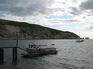
Tourism
On the clifftop there is an amusement park with fairground rides, souvenir shops and a cafe. During the summer season a chair lift takes tourists to and from the pebble beach below. Alternatively, a footpath leads to the beach via Alum Bay Chine. From the beach boat trips frequently leave to tour the Needles.
Alum Bay Sands
A traditional product of Alum Bay, and a fixture of Isle of Wight tourist shops, is the creation of ornaments using the coloured sands layered in vials and jars.[3] The sands also were used for pictures,[4] a popular craft in Victorian times known as marmotinto. In the past, visitors to the bay could climb the foot of the cliffs and dig out the sand themselves, but are now discouraged from doing so because of Health and Safety restrictions. The Needles Park has a facility where people can make bottles of sand, using sand gathered from the frequent rockfalls. In the past it was possible to buy Alum Bay coloured sand by mail order and make one's own sand pictures and bottles at home.[5]
Transport
Southern Vectis run bus services from Alum Bay. There are two summer only services, namely the Needles Tour, and the Island Coaster service. The Needles Tour is on an open top bus
History
On a map of the area produced around 1590, the bay is named Whytfylde Chine.[6] It is possible that Alum Bay was once fed by a Chine by this name, which has long since eroded away.
Alum Bay sand includes extremely pure white silica, which was once extracted for glass and pottery manufacture.[3]
Guglielmo Marconi moved to Alum Bay in 1897 to experiment with radio. He installed a 40-metre radio antenna outside the Needles Hotel in Alum Bay. Initially establishing communication with ships offshore, by early 1898 he had successfully communicated with stations at Madeira House, Bournemouth and the Haven Hotel, Poole 20 miles away.[7][8]
See also
References
- ↑ Hopson P. (2011). "The geological history of the Isle of Wight: an overview of the 'diamond in Britain's geological crown'" (PDF). Proceedings of the Geologists' Association. 122 (5): 745–763. doi:10.1016/j.pgeola.2011.09.007.
- ↑ West, I.M. and Helsby, R. 2007. Alum Bay: Geology of the Isle of Wight. Internet site: www.soton.ac.uk/~imw/Alum-Bay.htm. School of Ocean and Earth Sciences, National Oceanography Centre, Southampton University, UK. Version: 6 February 2007, retrieved 3 August 2008
- 1 2 Handbook to the Isle of Wight, Thomas Brettell, John Mitchell, 1844 Google Books, retrieved 3 August 2008
- ↑ The Other British Isles: A Journey Through the Offshore Islands of Britain, Christopher Somerville, Grafton, 1990, ISBN 0-246-13317-1 Google Books, retrieved 3 August 2008
- ↑ Sand Shop, Needles Park website
- ↑ The Alum in Alum Bay, Isle of Wight Industrial Archaeology Society report
- ↑ Marconi My Beloved, Maria Cristina Marconi, Branden Books, 2002, ISBN 0-937832-39-1 Google Books, retrieved 3 August 2008
- ↑ My Father, Marconi, Degan Marconi, Guernica Editions, 1996, ISBN 1-55071-044-3 Google Books, retrieved 3 August 2008
External links
- Needles Park official website
- Grimkie, Jacob Abbott, Sheldon, 1860 - novel with description of Alumn Bay ornaments and sand pictures.
Isle of Wight Portal | |
| Unitary authorities | |
| Major settlements | |
| Rivers | |
| Topics | |
Coordinates: 50°39′59″N 1°34′34″W / 50.66639°N 1.57611°W