Alpena, South Dakota
| Alpena | |
|---|---|
| Town | |
| Alpena, South Dakota | |
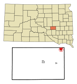 Location in Jerauld County and the state of South Dakota | |
| Coordinates: 44°10′55″N 98°22′3″W / 44.18194°N 98.36750°WCoordinates: 44°10′55″N 98°22′3″W / 44.18194°N 98.36750°W | |
| Country | United States |
| State | South Dakota |
| County | Jerauld |
| Platted | 1883[1] |
| Area[2] | |
| • Total | 1.64 sq mi (4.25 km2) |
| • Land | 1.63 sq mi (4.22 km2) |
| • Water | 0.01 sq mi (0.03 km2) |
| Elevation | 1,319 ft (402 m) |
| Population (2010)[3] | |
| • Total | 286 |
| • Estimate (2013)[4] | 285 |
| • Density | 175.5/sq mi (67.8/km2) |
| Time zone | Central (CST) (UTC-6) |
| • Summer (DST) | CDT (UTC-5) |
| ZIP code | 57312 |
| Area code(s) | 605 |
| FIPS code | 46-01020[5] |
| GNIS feature ID | 1253631[6] |
Alpena (pronounced al-PEE'-nuh[7]) is a town in Jerauld County, South Dakota, United States. The population was 286 at the 2010 census.
History
Alpena was platted in 1883, and most likely was named after Alpena, Michigan, the native home of the town's proprietor.[8] A post office has been in operation at Alpena since 1883.[9]
Geography
Alpena is located at 44°10′55″N 98°22′03″W / 44.181843°N 98.367539°W.[10]
According to the United States Census Bureau, the town has a total area of 1.64 square miles (4.25 km2), of which, 1.63 square miles (4.22 km2) of it is land and 0.01 square miles (0.03 km2) is water.[2]
Alpena has been assigned the ZIP code 57312, and the FIPS place code 01020.
Demographics
| Historical population | |||
|---|---|---|---|
| Census | Pop. | %± | |
| 1900 | 153 | — | |
| 1910 | 417 | 172.5% | |
| 1920 | 576 | 38.1% | |
| 1930 | 499 | −13.4% | |
| 1940 | 440 | −11.8% | |
| 1950 | 426 | −3.2% | |
| 1960 | 407 | −4.5% | |
| 1970 | 307 | −24.6% | |
| 1980 | 288 | −6.2% | |
| 1990 | 251 | −12.8% | |
| 2000 | 265 | 5.6% | |
| 2010 | 286 | 7.9% | |
| Est. 2015 | 275 | [11] | −3.8% |
| U.S. Decennial Census[12] 2013 Estimate[4] | |||
2010 census
As of the census[3] of 2010, there were 286 people, 110 households, and 73 families residing in the town. The population density was 175.5 inhabitants per square mile (67.8/km2). There were 124 housing units at an average density of 76.1 per square mile (29.4/km2). The racial makeup of the town was 86.7% White, 0.7% Native American, 1.0% Pacific Islander, 9.8% from other races, and 1.7% from two or more races. Hispanic or Latino of any race were 23.8% of the population.
There were 110 households of which 30.9% had children under the age of 18 living with them, 53.6% were married couples living together, 8.2% had a female householder with no husband present, 4.5% had a male householder with no wife present, and 33.6% were non-families. 27.3% of all households were made up of individuals and 8.2% had someone living alone who was 65 years of age or older. The average household size was 2.60 and the average family size was 3.18.
The median age in the town was 34.3 years. 26.2% of residents were under the age of 18; 5.6% were between the ages of 18 and 24; 27.9% were from 25 to 44; 24.8% were from 45 to 64; and 15.4% were 65 years of age or older. The gender makeup of the town was 51.0% male and 49.0% female.
2000 census
As of the census[5] of 2000, there were 265 people, 113 households, and 78 families residing in the town. The population density was 161.1 people per square mile (62.0/km2). There were 122 housing units at an average density of 74.2 per square mile (28.5/km2). The racial makeup of the town was 99.62% White and 0.38% Asian. Hispanic or Latino of any race were 0.38% of the population.
There were 113 households out of which 30.1% had children under the age of 18 living with them, 58.4% were married couples living together, 8.0% had a female householder with no husband present, and 30.1% were non-families. 28.3% of all households were made up of individuals and 8.8% had someone living alone who was 65 years of age or older. The average household size was 2.35 and the average family size was 2.82.
In the town the population was spread out with 24.9% under the age of 18, 6.0% from 18 to 24, 23.0% from 25 to 44, 28.3% from 45 to 64, and 17.7% who were 65 years of age or older. The median age was 41 years. For every 100 females there were 108.7 males. For every 100 females age 18 and over, there were 114.0 males.
The median income for a household in the town was $35,455, and the median income for a family was $38,000. Males had a median income of $25,625 versus $16,607 for females. The per capita income for the town was $13,533. About 10.4% of families and 14.4% of the population were below the poverty line, including 18.5% of those under the age of eighteen and none of those sixty five or over.
Media
The area is served by the True Dakotan weekly newspaper.[13]
Notable natives
- Al Neuharth, USA Today editor
References
- ↑ "SD Towns" (PDF). South Dakota State Historical Society. Archived (PDF) from the original on 10 February 2010. Retrieved 2010-02-10.
- 1 2 "US Gazetteer files 2010". United States Census Bureau. Archived from the original on 2012-01-24. Retrieved 2012-06-21.
- 1 2 "American FactFinder". United States Census Bureau. Retrieved 2012-06-21.
- 1 2 "Population Estimates". United States Census Bureau. Retrieved 2014-11-08.
- 1 2 "American FactFinder". United States Census Bureau. Archived from the original on 2013-09-11. Retrieved 2008-01-31.
- ↑ "US Board on Geographic Names". United States Geological Survey. 2007-10-25. Retrieved 2008-01-31.
- ↑ "Broadcast Pronunciation Guide and South Dakota Pronunciations". Associated Press. Retrieved 2009-11-10.
- ↑ Federal Writers' Project (1940). South Dakota place-names, v.1-3. University of South Dakota. p. 21.
- ↑ "Jerauld County". Jim Forte Postal History. Retrieved 22 January 2015.
- ↑ "US Gazetteer files: 2010, 2000, and 1990". United States Census Bureau. 2011-02-12. Retrieved 2011-04-23.
- ↑ "Annual Estimates of the Resident Population for Incorporated Places: April 1, 2010 to July 1, 2015". Retrieved July 2, 2016.
- ↑ United States Census Bureau. "Census of Population and Housing". Archived from the original on May 11, 2015. Retrieved November 8, 2014.
- ↑ "True Dakotan". South Dakota Press Association. Archived from the original on 2 October 2010. Retrieved October 29, 2010.
Municipalities and communities of Jerauld County, South Dakota, United States | ||
|---|---|---|
| City | 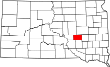 | |
| Towns | ||
| Unincorporated communities |
| |
| Townships |
| |
| Places | ||