Alpe d'Huez Airport
| Alpe d'Huez Airport L'altiport de l'Alpe d'Huez | |||||||||||
|---|---|---|---|---|---|---|---|---|---|---|---|
| IATA: AHZ – ICAO: LFHU | |||||||||||
| Summary | |||||||||||
| Airport type | Public | ||||||||||
| Serves | Alpe d'Huez, Rhône-Alpes, France | ||||||||||
| Elevation AMSL | 1,840 m / 6,037 ft | ||||||||||
| Coordinates | 45°05′16″N 006°05′06″E / 45.08778°N 6.08500°ECoordinates: 45°05′16″N 006°05′06″E / 45.08778°N 6.08500°E | ||||||||||
| Website | |||||||||||
| Maps | |||||||||||
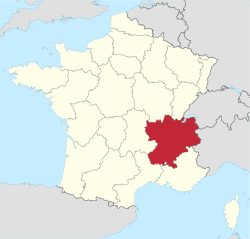 Rhône-Alpes region in France | |||||||||||
 AHZ Location of the airport in the Rhône-Alpes region | |||||||||||
| Runways | |||||||||||
| |||||||||||
Alpe D'Huez Airport (IATA: AHZ, ICAO: LFHU) (French: L'altiport de l'Alpe d'Huez) is a small Altiport serving the town of Alpe d'Huez.
References
- ↑ Airport information for AHZ at Great Circle Mapper.
- ↑ Airport information for Alpe D'Huez Airport at Search (for) Travel website.
This article is issued from Wikipedia - version of the 1/23/2016. The text is available under the Creative Commons Attribution/Share Alike but additional terms may apply for the media files.