Aloguinsan, Cebu
| Aloguinsan | |
|---|---|
| Municipality | |
|
Cantabugon, Aloguinsan | |
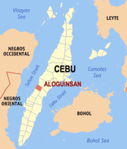 Map of Cebu with Aloguinsan highlighted | |
.svg.png) Aloguinsan Location within the Philippines | |
| Coordinates: 10°13′N 123°33′E / 10.22°N 123.55°ECoordinates: 10°13′N 123°33′E / 10.22°N 123.55°E | |
| Country | Philippines |
| Region | Central Visayas (Region VII) |
| Province | Cebu |
| District | 3rd District of Cebu |
| Founded | 1886 |
| Barangay | 15 (see § Barangays) |
| Government [1] | |
| • Type | Sangguniang Bayan |
| • Mayor | Cynthia Moreno (Ind) |
| • Vice mayor | Augustus Moreno |
| • Town Council |
Members
|
| • Representative | Gwendolyn Garcia |
| Area[2] | |
| • Total | 61.92 km2 (23.91 sq mi) |
| Population (2015 census)[3] | |
| • Total | 32,100 |
| • Density | 520/km2 (1,300/sq mi) |
| • Voter (2016)[4] | 20,124 |
| Time zone | PST (UTC+8) |
| ZIP code | 6040 |
| IDD : area code | +63 (0)32 |
| Income class | 4th class |
| PSGC | 072204000 |

Aloguinsan is a 4th municipal income class municipality in the province of Cebu, Philippines.[2] According to the 2015 census, it has a population of 32,100.[3] In the 2016 election, it had 20,124 registered voters.[4] By road is 59 km (37 mi) southwest of Cebu City. Aloguinsan public market is held at the top of the beach.
History
Aloguinsan was formerly a barrio of Pinamungajan. It was created a town by the Royal Decree of the Kingdom of Spain in 1886.[5]
Bulwarte, a historic landmark, still stands as mute testimony to the courage of the early inhabitants of Aloguinsan. Because of the frequent Moro attacks, the natives, under the supervision of the Spaniards, constructed a watchtower on top of a hill at the mouth of a river. From this vantage point, they could see incoming Moro vintas.
One night (a full moon and favorable winds), the Muslim invaders approached the village. With old people, women, and children safe behind the hills, the men began firing their cannons and did not stop until the pirates had been annihilated. It was the end of Moro assaults.
The historic hill of Villona between the barrios of Olango and Cawasan was also the site of a battle between the American forces and Filipino revolutionaries. The rebels under the leadership of Anastacio de la Cruz encountered the forces of Lt. Walker on Holy Thursday, April 1903. Lt. Walker and a number of his men were killed. The following day, Good Friday, Lt. McCoy took over the command of the American troops and outfought the Pulahanes (the rebels were so called because of their red headbands) who were defeated.
The courage and patriotism of the Aloguinsan were again tested in World War II. Cebuano guerillas from the place stubbornly and fiercely resisted Japanese invaders to help Allied Filipino troops of the 81st, 82nd and 83rd Infantry Division of the Philippine Commonwealth Army in barrio Konguigon resulting in the death of many Japanese soldiers. The enemy retaliated by killing many civilians, including babies, and there entered by joint Filipino and American troops together with the Cebuano guerillas until the end in the Second World War.
Barangays
Aloguinsan comprises 15 barangays:[2]
| PSGC | Barangay | Population | ±% p.a. | ||
|---|---|---|---|---|---|
| 2015[3] | 2010[6] | ||||
| 072204001 | Angilan | 8.2% | 2,634 | 1,926 | +6.14% |
| 072204002 | Bojo | 5.8% | 1,869 | 1,603 | +2.97% |
| 072204003 | Bonbon | 24.3% | 7,807 | 6,611 | +3.22% |
| 072204004 | Esperanza | 5.8% | 1,866 | 1,759 | +1.13% |
| 072204005 | Kandingan | 2.9% | 937 | 848 | +1.92% |
| 072204006 | Kantabogon | 5.3% | 1,697 | 1,526 | +2.04% |
| 072204007 | Kawasan | 7.0% | 2,239 | 1,975 | +2.42% |
| 072204008 | Olango | 3.6% | 1,151 | 1,026 | +2.21% |
| 072204009 | Poblacion | 10.6% | 3,392 | 2,747 | +4.10% |
| 072204010 | Punay | 4.8% | 1,544 | 1,531 | +0.16% |
| 072204011 | Rosario | 5.8% | 1,868 | 1,864 | +0.04% |
| 072204012 | Saksak | 3.6% | 1,157 | 1,139 | +0.30% |
| 072204013 | Tampa‑an | 6.3% | 2,021 | 1,513 | +5.67% |
| 072204014 | Toyokon | 2.2% | 693 | 680 | +0.36% |
| 072204015 | Zaragos | 3.8% | 1,225 | 902 | +6.00% |
| Total | 32,100 | 27,650 | +2.88% | ||
Demographics
| Population census of Aloguinsan | |||||||||||||||||||||||||
|---|---|---|---|---|---|---|---|---|---|---|---|---|---|---|---|---|---|---|---|---|---|---|---|---|---|
|
| ||||||||||||||||||||||||
| Source: Philippine Statistics Office[3][6][7] | |||||||||||||||||||||||||
In the 2016 election, it had 20,124 registered voters, meaning that 63% of the population are aged 18 and over.[4]
Festival
Every June, they celebrate the famous "Kinsan Festival", named for a fish that is usually abundant in months of May to July.[8] The town fiesta is celebrated every 23 and 24 October in honor of St. Raphael the Archangel.
Tourist Attractions
- Bojo River
- Hermit's Cove
- Hidden Beach
Notable residents
- Jojo Tangkay - A professional basketball player notably played in PBL then PBA's Welcoat Dragons.
References
- ↑ "Municipality". Quezon City, Philippines: Department of the Interior and Local Government. Retrieved 31 May 2013.
- 1 2 3 "Municipal: Aloguinsan, Cebu". PSA. Philippines: National Statistical Coordination Board. Retrieved 8 January 2016.
- 1 2 3 4 "Region VII (CENTRAL VISAYAS)". Census of Population (2015): Total Population by Province, City, Municipality and Barangay (Report). PSA. Retrieved 20 June 2016.
- 1 2 3 "2016 National and Local Elections Statistics". Commission on Elections. 2016.
- ↑ Lipsius 2011, p. 2.
- 1 2 "Region VII (CENTRAL VISAYAS)". Census of Population and Housing (2010): Total Population by Province, City, Municipality and Barangay (Report). NSO. Retrieved 29 June 2016.
- ↑ "Region VII (CENTRAL VISAYAS)". Census of Population (1995, 2000 and 2007): Total Population by Province, City and Municipality (Report). NSO. Archived from the original on 24 June 2011.
- ↑ Lipsius 2011, p. 95.
Bibliography
- Lipsius, Terrie (29 December 2011). My Awe-Inspiring Journey. Trafford Publishing. ISBN 978-1466906679.
External links
 |
Pinamungajan | | ||
| Tañon Strait | |
Carcar | ||
| ||||
| | ||||
| Barili |
Cebu City (capital) | |
| Municipalities |
|
| Component cities | |
| Highly urbanized cities | (Administratively independent from the province but grouped under Cebu by the Philippine Statistics Authority. Mandaue is grouped under the 6th legislative district of Cebu but still independent from the province.) |