Alnwick/Haldimand
| Alnwick/Haldimand | |
|---|---|
| Township (lower-tier) | |
| Township of Alnwick/Haldimand | |
|
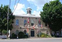
Township hall in Grafton | |
| Nickname(s): The Township between the Lakes | |
 Alnwick/Haldimand | |
| Coordinates: 44°05′N 78°02′W / 44.083°N 78.033°WCoordinates: 44°05′N 78°02′W / 44.083°N 78.033°W | |
| Country |
|
| Province |
|
| County | Northumberland |
| Incorporated | 2000 |
| Government | |
| • Type | Township |
| • Mayor | John Logel |
| • Federal riding | Northumberland-Peterborough South |
| • Prov. riding | Northumberland—Quinte West |
| Area[1] | |
| • Land | 398.57 km2 (153.89 sq mi) |
| Population (2011)[2] | |
| • Total | 6,617 |
| • Density | 16.6/km2 (43/sq mi) |
| Time zone | EST (UTC-5) |
| • Summer (DST) | EDT (UTC-4) |
| Postal Code | K0K |
| Area code(s) | 905, 705, 289 and 365 |
| Website | www.alnwickhaldimand.ca |
The Township of Alnwick/Haldimand is a township in central Ontario, Canada, in Northumberland County, situated between Lake Ontario and Rice Lake. It was formed in 2001 by the merger of Alnwick Township in the north and Haldimand Township in the south.[3] Alderville First Nation is an autonomously governed First Nation contained within the township boundaries, in two non-contiguous sections along County Roads 45 and 18.
History
Alnwick Township
Alnwick Township was originally surveyed in 1795 when twenty-four lots were laid out on the first concession. It was named for Alnwick in Northumberland, England. The first crown grants were issued in 1798 and other surveys would follow in subsequent years.[4] The township's first residents were made up of United Empire Loyalists, attracted by large unencumbered land grants, sometimes in the thousands of acres.[5] In 1835, 3,600 acres of land along the first and second concessions were set aside as an Indian settlement. Shortly after, the Indian Band from Grape Island was moved into this settlement and a school and church were built at Alderville.[4] The first council meeting was held in 1845 at Alderville School. The Alnwick/Haldimand Township building located in Grafton was built in 1858. Prior to its construction, Township Council meetings were held at local taverns or the residences of council members.[6]
Haldimand Township
Haldimand Township was formed in 1791 and was named in honour of Sir Frederick Haldimand – a British general who served as Governor-in-Chief of Canada between 1778 and 1796.[7] By 1804, there were 356 settlers in Haldimand Township making it the second most populous township in the region after Hamilton Township to the West.[7] The town hall was constructed in 1860. However, in order to be as accessible to as many rate payers as possible, council held frequent meetings in public buildings in towns across the Township. On one occasion following a fire that destroyed the Centreton Community Centre in 1943, a council meeting was held at the private residence of former reeve Stanley McBride.[7]
Municipal Restructuring
As part of provincial initiatives in the late 1990s, the Government of Ontario pursued a policy of municipal amalgamations to rationalize municipal levels of government services and ”reduc[e] government entanglement and bureaucracy with an eye to eliminating waste and duplication as well as unfair downloading by the province”.[8] On June 9, 1999, an order from the Ontario Minister of Municipal Affairs for the amalgamation of Alnwick Township and Haldimand Township into a single Township of Alnwick/Haldimand received Royal assent. The amalgamation came into effect on January 1, 2001.[3]
Geography
Geographical Features
Alnwick/Haldimand is part of the Oak Ridges Moraine: a significant land form in Ontario.
31.3 km² of the Cobourg Creek watershed runs through the Township. The majority of this area is located within the Oak Ridges Moraine.[9] The Creek supports a diverse ecosystem including forests, meadows and wetlands. Numerous species inhabit the Creek including brown trout, rainbow trout, scuplins and darters. Migratory Chinook Salmon spawn in the creek and Atlantic Salmon are being stocked as part of a provincial initiative to return these native fish to Lake Ontario.[9]
The Ganaraska Forest is a 11,000-acre forest located in the Township. It is one of the largest blocks of forested land in southern Ontario.[10] The Millvalley Hills Forest is a 297 hectare forest located within the Township of Alnwick/Haldimand. The dominant trees species are red and white pine, and red and white oak, however red oak dominates the area.[9]
The Harwood Road Wetland is a class 2 provincially significant wetland located in the Township of Hamilton and the Township of Alnwick/Haldimand. 95.9 hectares in size, the wetland is 95% swamp, and 0.5% marsh.[9]
Communities
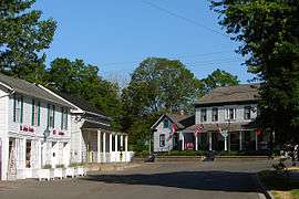
The township comprises the communities of Burnley, Carmel, Centreton, Dunnette Landing, Fenella, Grafton, The Gully, Lakeport, Little Germany, McCracken Landing, Oak Heights, Robins Landing, Roseneath, Vernonville and Wicklow.
Alderville First Nation
The Alderville First Nation is an Anishinaabe First Nation located in southern Ontario, Canada. As of September 2008, Alderville First Nation had 1007 registered band members, of which their on-Reserve population was only 313 people, meaning the majority of their registered population live outside the reserve (off-reserve) in neighbouring communities.[11]
The First Nation have reserved for themselves two areas. Their main reserve, the Alderville First Nation (formerly designated as Alderville Indian Reserve 37 by Indian and Northern Affairs Canada), is located near the south shores of Rice Lake in Ontario (44°11′N 78°04′W / 44.183°N 78.067°W). It consists of six non-contiguous areas within the Alnwick/Haldimand Township approximately 30 kilometres (19 mi) north of Cobourg, and occupies a total area of 1,199.8 hectares (2,965 acres). They also maintain a smaller parcel of land on nearby Sugar Island, the 40.5 hectares (100 acres) Sugar Island 37A Indian Reserve (44°13′N 78°8.25′W / 44.217°N 78.13750°W).[12] It has been home to the Mississauga division of the Anishinaabe (Ojibwa) Nation since the mid-1830s.[13]
Economy
The township is rural based with agriculture being the largest contributor to the general economy. Grain, cash crops, milk, livestock, vineyards and apple farming are all viable in the area.[5] The top industries for the employed labour force are manufacturing, public administration and construction. Approximately 15% of workers were self-employed as of the 2011 Census of Canada.[14]
Tourism is also a contributor to the local economy. Venues such as Golden Beach Resort and Ste. Anne's Country Inn & Spa are among the top private sector employers in Northumberland County.[15] Outdoor activities including hiking, kayaking, snowmobiling, fishing, birding and camping also contribute to the tourism industry.[16]
Demographics
Population
As of the 2011 Census of Canada, the population of Alnwick/Haldimand was 6,617 with a median age of 46.6 years.[17] Each year there is a seasonal cottage population influx of approximately 1,500 individuals which is expected to continue into the future.[9]
| Canada census – Alnwick/Haldimand community profile | |||
|---|---|---|---|
| 2011 | 2006 | ||
| Population: | 6,617 (2.8% from 2006) | 6,435 (10.1% from 2001) | |
| Land area: | 398.57 km2 (153.89 sq mi) | 398.08 km2 (153.70 sq mi) | |
| Population density: | 16.6/km2 (43/sq mi) | 16.2/km2 (42/sq mi) | |
| Median age: | 43.4 (M: 44.0, F: 42.8) | ||
| Total private dwellings: | 3,052 | 2,858 | |
| Median household income: | $63,913 | ||
| References: 2011[1] 2006[18] | |||
According to the 2011 National Household Survey, 13.1% of the population was foreign-born and 86.6% were Canadian born. The most common countries of birth of immigrants living in Alnwick/Haldimand are the United Kingdom (62% of the immigrant population) and the Netherlands (6.4%).[14]
Population trend:[19]
- Population in 2011: 6617
- Population in 2006: 6435
- Population in 2001: 5846
- Population in 1996:
- Alnwick (township): 1078
- Haldimand (township): 4450
- Population in 1991:
- Alnwick (township): 1072
- Haldimand (township): 4172
Religion
According to the 2011 National Household Survey, 72.7% of the population in Alnwick/Haldimand reported a religious affiliation while 27.4% said they had no religious affiliation. The most common religion was the United Church (22.3%), followed by Anglicanism, (22.2%) and Roman Catholicism (13.5%).[14]
Languages Spoken
Mother tongue:[18]
- English as first language: 92.4%
- French as first language: 1.2%
- English and French as first language: 0.2%
- Other as first language: 6.2%
Government
Local Government
Alnwick/Haldimand has a Township Council of 5 members including a Mayor, Deputy Mayor, and three ward councillors. In addition to the Township Council, members sit on a number of local committees.
Township Council 2014 - 2018[20]
| Position | Name | Portfolio | Committee Appointments (As of August 2015) |
|---|---|---|---|
| Mayor | John Logel | Protective Services |
|
| Deputy Mayor | Gail Latchford | Public Works and Infrastructure |
|
| Councillor Ward 1 | Raymond Benns | Rural and Environment |
|
| Councillor Ward 1 | Bernadette Murray | Culture and Heritage |
|
| Councillor Ward 2 | Sherry Gibson | Recreation, Tourism, Economic Development |
|
County Government
Alnwick/Haldimand is part of Northumberland County. County Council is composed of the mayors of each of the seven towns, townships and local municipalities within its boundaries. The head of County Council is called the Warden as is elected annually from amongst its membership.[21]
Alnwick/Haldimand Mayor John Logel serves as the representative on the County Council.
Provincial Representation
Alnwick/Haldimand is in the provincial electoral district of Northumberland—Quinte West. As of June 12, 2014, the Member of Provincial Parliament (MPP) is Lou Rinaldi.[22]
| Northumberland—Quinte West | ||||
|---|---|---|---|---|
| Assembly | Years | Member | Party | |
| Riding created from Northumberland and Prince Edward—Hastings | ||||
| 39th | 2007–2011 | Lou Rinaldi | Liberal | |
| 40th | 2011–2014 | Rob Milligan | Progressive Conservative | |
| 41st | 2014–Present | Lou Rinaldi | Liberal | |
Federal Representation
As of the 2015 Federal Election, Alnwick/Haldimand is in the federal electoral district of Northumberland—Peterborough South.[23] This riding was created by the 2012 federal electoral boundaries redistribution and came into effect upon the calling of the 42nd Canadian federal election.
Prior to 2015, Alnwick/Haldimand was in the federal electoral district of Northumberland—Quinte West.
| Parliament | Years | Member | Party | |
|---|---|---|---|---|
| Northumberland—Quinte West Riding created from Northumberland and Prince Edward—Hastings |
||||
| 38th | 2004–2006 | Paul Macklin | Liberal | |
| 39th | 2006–2008 | Rick Norlock | Conservative | |
| 40th | 2008–2011 | |||
| 41st | 2011–2015 | |||
| Riding dissolved into Northumberland—Peterborough South and Bay of Qunite | ||||
See also
References
- 1 2 "2011 Community Profiles". Canada 2011 Census. Statistics Canada. July 5, 2013. Retrieved 2012-03-13.
- ↑ "Alnwick/Haldimand census profile". 2011 Census of Population. Statistics Canada. Retrieved 2012-03-13.
- 1 2 "Municipal Restructuring Activity Summary Table". www.mah.gov.on.ca. Retrieved 2015-08-16.
- 1 2 "Alderville - Alnwick Township History". www.ontariogenealogy.com. Retrieved 2015-08-16.
- 1 2 "Mayors Message | Township of Alnwick Haldimand". www.alnwickhaldimand.ca. Retrieved 2015-08-16.
- ↑ Heritage Alnwick/Haldimand. "A self-guided walking tour of the Historic Hamlet of Grafton" (PDF). A self-guided walking tour of the Historic Hamlet of Grafton. Retrieved August 16, 2015.
- 1 2 3 Haldimand's History Committee (1997). Memories of Haldimand Township: When the Lakes Roared. http://www.ourroots.ca/e/toc.aspx?id=6034: Boston Mills Press.
- ↑ Progressive Conservative Party of Ontario. 1994. The Common Sense Revolution. Toronto: Progressive Conservative Party of Ontario.
- 1 2 3 4 5 Cobourg Creek Background Report: Abiotic, Biotic and Cultural Features. Ganaraska Region Conservation Authority. 2008.
- ↑ "About Ganaraska Forest Centre: The Forest THE FOREST". www.ganaraskaforestcentre.ca. Retrieved 2015-08-16.
- ↑ Registered Population. First Nation Profiles. Department of Indian Affairs and Northern Development.
- ↑ Reserve Detail. First Nation Profiles. Department of Indian Affairs and Northern Development.
- ↑ General History. Alderville First Nation.
- 1 2 3 "NHS Focus on Geography Series – Alnwick/Haldimand". www12.statcan.gc.ca. Retrieved 2015-08-16.
- ↑ "Leading Employers - Northumberland Economic Development". www.investnorthumberland.ca. Retrieved 2015-08-16.
- ↑ "Outdoor Adventure". www.northumberlandtourism.com. Retrieved 2015-08-16.
- ↑ "Focus on Geography Series, 2011 Census - Census subdivision of Alnwick/Haldimand, TP (Ontario)". www12.statcan.gc.ca. Retrieved 2015-08-16.
- 1 2 "2006 Community Profiles". Canada 2006 Census. Statistics Canada. March 30, 2011. Retrieved 2009-02-24.
- ↑ Statistics Canada: 1996, 2001, 2006 census
- ↑ "Council | Township of Alnwick Haldimand". alnwickhaldimand.ca. Retrieved 2015-08-16.
- ↑ "Meet Your Council - Northumberland County". www.northumberlandcounty.ca. Retrieved 2015-08-16.
- ↑ "Legislative Assembly of Ontario | Members (MPPs) | Current MPPs | Lou Rinaldi, MPP (Northumberland—Quinte West)". www.ontla.on.ca. Retrieved 2015-08-16.
- ↑ "Northumberland–Peterborough South | Maps Corner | Elections Canada Online". www.elections.ca. Retrieved 2015-08-16.
External links
 |
Otonabee-South Monaghan, Sugar Island 37A Rice Lake |
Asphodel-Norwood | | |
| Hamilton Township | |
Trent Hills Cramahe | ||
| ||||
| | ||||
| Lake Ontario |