Alleen
| Alleen Lyngdal Alléen | |
|---|---|
| Town | |
|
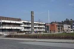
View of the government building for Lyngdal municipality | |
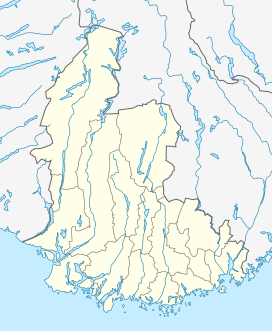 Alleen  Alleen Location of the town | |
| Coordinates: 58°08′15″N 07°04′02″E / 58.13750°N 7.06722°ECoordinates: 58°08′15″N 07°04′02″E / 58.13750°N 7.06722°E | |
| Country | Norway |
| Region | Southern Norway |
| County | Vest-Agder |
| District | Lister |
| Municipality | Lyngdal |
| Area[1] | |
| • Total | 3.93 km2 (1.52 sq mi) |
| Elevation[2] | 9 m (30 ft) |
| Population (2015)[1] | |
| • Total | 4,901 |
| • Density | 1,247/km2 (3,230/sq mi) |
| Time zone | CET (UTC+01:00) |
| • Summer (DST) | CEST (UTC+02:00) |
| Post Code | 4580 Lyngdal |
Alleen or Lyngdal is a town which is the administrative centre of the municipal of Lyngdal in Vest-Agder county, Norway. It lies along the east side of the river Lygna, just north of the head of the Rosfjorden and northeast of the head of the Lyngdalsfjorden. The small villages of Skomrak and Svenevik both lie just south of the town and the small farming area of Hæåk lies about 8 kilometres (5.0 mi) to the northwest. On 1 January 2001, the municipal government declared the urban area of Alleen to be a town called Lyngdal. Both names are used to refer to the urban area.[3]
Lyngdal Church lies in the northern part of the town. The European route E39 highway and County Road 43 both pass through the town. It previously had an annual cattle auction. Alleen is the site of the largest primary and secondary schools in Lyngdal. The 3.93-square-kilometre (970-acre) town has a population (2015) of 4,901. This gives the town a population density of 1,247 inhabitants per square kilometre (3,230/sq mi).[1]
References
- 1 2 3 Statistisk sentralbyrå (1 January 2015). "Urban settlements. Population and area, by municipality.".
- ↑ "Alleen, Lyngdal (Vest-Agder)". yr.no. Retrieved 2016-10-08.
- ↑ Store norske leksikon. "Alléen" (in Norwegian). Retrieved 2016-10-01.