Unorganized South East Algoma District
| Unorganized South East Algoma District | |
|---|---|
| Unorganized area | |
| Algoma, Unorganized, South East Part | |
 Unorganized South East Algoma | |
| Coordinates: 46°07′00″N 82°04′30″W / 46.11667°N 82.07500°WCoordinates: 46°07′00″N 82°04′30″W / 46.11667°N 82.07500°W | |
| Country | Canada |
| Province | Ontario |
| District | Algoma |
| Government | |
| • Federal riding | Algoma—Manitoulin—Kapuskasing |
| • Prov. riding | Algoma—Manitoulin |
| Area[1] | |
| • Land | 43.57 km2 (16.82 sq mi) |
| Population (2011)[1] | |
| • Total | 0 |
| • Density | 0/km2 (0/sq mi) |
| Time zone | EST (UTC-5) |
| • Summer (DST) | EDT (UTC-4) |
Unorganized South East Algoma District is an unorganized area in the Canadian province of Ontario, comprising a small unincorporated portion in the southeasternmost corner of the Algoma District. It comprises a small strip of land which lies between the territory of the Sagamok First Nation and the Algoma District's boundary with the Sudbury District, as well as several small islands within the North Channel of Lake Huron, such as Eagle, Fréchette, Fox, Hotham, Middleton, North and South Benjamin Islands.[2]
The division comprises 43.28 square kilometres (16.71 sq mi) (increased from 41.71 km² in the 2001 census), and had a reported population of zero in the Canada 2006 Census.[3]
The division includes the historic Fort La Cloche trading post and a small portion of La Cloche Provincial Park.
Demographics
- Population in 2011: 0
- Population in 2006: 0
- Population in 2001: 0
- Population in 1996: 0
- Population in 1991: 0
See also
References
- 1 2 3 "Algoma, Unorganized, South East Part census profile". 2011 Census of Population. Statistics Canada. Retrieved 2012-02-10.
- ↑ GeoSearch2006: Algoma, Unorganized, South East Part
- ↑ "Algoma, Unorganized, South East Part community profile". 2006 Census data. Statistics Canada. Retrieved 2011-02-24.
- ↑ Statistics Canada: 2006, 2001, 1996 census
 |
Sagamok | Sables-Spanish Rivers | | |
| Spanish | |
Sables-Spanish Rivers | ||
| ||||
| | ||||
| North Channel of Lake Huron Billings |
North Channel of Lake Huron Northeastern Manitoulin and the Islands |
| Cities | 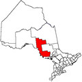 | |
|---|---|---|
| Towns | ||
| Townships | ||
| Villages | ||
| First Nations | ||
| Indian reserves | ||
| Local services boards | ||
| Unorganized areas | ||
| ||