Alden (village), New York
| Alden, New York | |
|---|---|
| Village | |
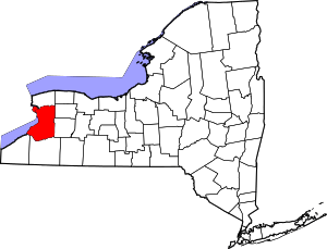
_highlighted.svg.png) Location in Erie County and the state of New York | |
| Coordinates: 42°54′3″N 78°29′36″W / 42.90083°N 78.49333°WCoordinates: 42°54′3″N 78°29′36″W / 42.90083°N 78.49333°W | |
| Country | United States |
| State | New York |
| County | Erie |
| Town | Alden |
| Area | |
| • Total | 2.7 sq mi (7.0 km2) |
| • Land | 2.7 sq mi (7.0 km2) |
| • Water | 0.0 sq mi (0.0 km2) |
| Elevation | 863 ft (263 m) |
| Population (2010) | |
| • Total | 2,605 |
| • Density | 960/sq mi (370/km2) |
| Time zone | Eastern (EST) (UTC-5) |
| • Summer (DST) | EDT (UTC-4) |
| ZIP code | 14004 |
| Area code(s) | 716 |
| FIPS code | 36-01088 |
| GNIS feature ID | 0942255 |
| Website |
www2 |
Alden is a village in Erie County, New York, United States. The population was 2,605 at the 2010 census. It is part of the Buffalo–Niagara Falls Metropolitan Statistical Area.
The village is centrally located within the town of Alden. Its principal street is Broadway (U.S. Route 20).
History
Alden was incorporated in 1869. In 1996, voters of the village defeated an attempt to dissolve the village and merge with the town.
Geography
According to the United States Census Bureau, the village has a total area of 2.7 square miles (7.0 km²), all of which is land.
US Route 20 (Broadway) intersects the northern terminus of former NY-239, now Erie County Route 578 (Exchange Street), in Alden village.
Demographics
| Historical population | |||
|---|---|---|---|
| Census | Pop. | %± | |
| 1850 | 150 | — | |
| 1860 | 285 | 90.0% | |
| 1880 | 521 | — | |
| 1890 | 533 | 2.3% | |
| 1900 | 607 | 13.9% | |
| 1910 | 828 | 36.4% | |
| 1920 | 755 | −8.8% | |
| 1930 | 846 | 12.1% | |
| 1940 | 954 | 12.8% | |
| 1950 | 1,252 | 31.2% | |
| 1960 | 2,042 | 63.1% | |
| 1970 | 2,651 | 29.8% | |
| 1980 | 2,488 | −6.1% | |
| 1990 | 2,457 | −1.2% | |
| 2000 | 2,666 | 8.5% | |
| 2010 | 2,605 | −2.3% | |
| Est. 2015 | 2,589 | [1] | −0.6% |
As of the census[3] of 2000, there were 2,666 people, 1,083 households, and 723 families residing in the village. The population density was 980.2 people per square mile (378.4/km²). There were 1,144 housing units at an average density of 420.6 per square mile (162.4/km²). The racial makeup of the village was 98.72% White, 0.34% Black or African American, 0.08% Native American, 0.56% Asian, 0.11% Pacific Islander, and 0.19% from two or more races. Hispanic or Latino of any race were 0.19% of the population.
There were 1,083 households out of which 32.9% had children under the age of 18 living with them, 53.2% were married couples living together, 9.7% had a female householder with no husband present, and 33.2% were non-families. 28.3% of all households were made up of individuals and 12.6% had someone living alone who was 65 years of age or older. The average household size was 2.45 and the average family size was 3.01.
In the village the population was spread out with 26.3% under the age of 18, 6.6% from 18 to 24, 30.8% from 25 to 44, 21.1% from 45 to 64, and 15.3% who were 65 years of age or older. The median age was 38 years. For every 100 females there were 98.4 males. For every 100 females age 18 and over, there were 93.2 males.
The median income for a household in the village was $41,630, and the median income for a family was $51,161. Males had a median income of $34,821 versus $24,245 for females. The per capita income for the village was $20,864. About 4.9% of families and 7.6% of the population were below the poverty line, including 9.8% of those under age 18 and 6.5% of those age 65 or over.
Notable residents
- Lyman K. Bass, born in Alden, United States congressman[4]
- Mike Cole, former New York state assemblyman
- Edmund F. Cooke, US congressman
- Charles H. Larkin, Wisconsin pioneer politician
- Doreen Taylor, country singer
References
- ↑ "Annual Estimates of the Resident Population for Incorporated Places: April 1, 2010 to July 1, 2015". Retrieved July 2, 2016.
- ↑ "Census of Population and Housing". Census.gov. Archived from the original on May 11, 2015. Retrieved June 4, 2015.
- ↑ "American FactFinder". United States Census Bureau. Archived from the original on 2013-09-11. Retrieved 2008-01-31.
- ↑ Who Was Who in America, Historical Volume, 1607-1896. Marquis Who's Who. 1967.