Albanel, Quebec
| Albanel | |
|---|---|
| Municipality | |
 | |
 | |
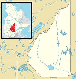 Albanel Location in Saguenay–Lac-Saint-Jean Quebec. | |
| Coordinates: 48°53′N 72°27′W / 48.883°N 72.450°WCoordinates: 48°53′N 72°27′W / 48.883°N 72.450°W[1] | |
| Country |
|
| Province |
|
| Region | Saguenay–Lac-Saint-Jean |
| RCM | Maria-Chapdelaine |
| Settled | 1880s |
| Constituted | 11 April 1990 |
| Government[2] | |
| • Mayor | Evangeline Plourde |
| • Federal riding | Lac-Saint-Jean |
| • Prov. riding | Roberval |
| Area[2][3] | |
| • Total | 203.10 km2 (78.42 sq mi) |
| • Land | 198.48 km2 (76.63 sq mi) |
| Population (2011)[3] | |
| • Total | 2,293 |
| • Density | 11.6/km2 (30/sq mi) |
| • Pop (2006–11) |
|
| • Dwellings | 950 |
| Time zone | EST (UTC−5) |
| • Summer (DST) | EDT (UTC−4) |
| Postal code(s) | G8M 3J5 |
| Area code(s) | 418 and 581 |
| Climate | Dfb |
| Website |
www |
Albanel is a municipality in the Canadian province of Quebec, located within the regional county municipality of Maria-Chapdelaine. The municipality had a population of 2,293 as of the Canada 2011 Census.[4]
History
The geographic township of Albanel was proclaimed in 1883, named after Jesuit missionary and explorer Charles Albanel (ca. 1616-1696). It had excellent land for farming, among the finest in the Lac Saint-Jean region at the time. Circa 1891, a mission was established in the township, served by pastors from Saint-Méthode and Normandin. In 1892, the Albanel post office opened. In 1899, the township was incorporated as the Township Municipality of Albanel.[1]
The presence of adequate hydraulic power, in particular the Chute aux Français on the Mistassini River, and several dairies had contributed to modest, but significant, economic growth of the village of Albanel. In 1930, it separated from the township and formed the Village Municipality of Albanel.[1]
In April 1990, the township and village municipalities of Albanel were merged again to form the Municipality of Albanel.[1]
Demographics
Population trend:[5]
- Population in 2011: 2293 (2006 to 2011 population change: -1.4%)
- Population in 2006: 2326
- Population in 2001: 2455
- Population in 1996: 2540
- Population in 1991: 2496
Private dwellings occupied by usual residents: 900 (total dwellings: 950)
Mother tongue:[4]
- English as first language: 0.4%
- French as first language: 98.9%
- English and French as first language: 0%
- Other as first language: 0.7%

Climate
| Climate data for Albanel | |||||||||||||
|---|---|---|---|---|---|---|---|---|---|---|---|---|---|
| Month | Jan | Feb | Mar | Apr | May | Jun | Jul | Aug | Sep | Oct | Nov | Dec | Year |
| Record high °C (°F) | 9.4 (48.9) |
7.8 (46) |
16.5 (61.7) |
28 (82) |
32.8 (91) |
35.6 (96.1) |
35.6 (96.1) |
36.1 (97) |
32.8 (91) |
28.3 (82.9) |
19.4 (66.9) |
10.4 (50.7) |
36.1 (97) |
| Average high °C (°F) | −11.8 (10.8) |
−9 (16) |
−2 (28) |
6.9 (44.4) |
16.2 (61.2) |
21.6 (70.9) |
24.1 (75.4) |
22.4 (72.3) |
16.3 (61.3) |
8.8 (47.8) |
0.6 (33.1) |
−8.7 (16.3) |
7.1 (44.8) |
| Average low °C (°F) | −22.8 (−9) |
−20.5 (−4.9) |
−13.6 (7.5) |
−3.5 (25.7) |
3.7 (38.7) |
8.9 (48) |
11.7 (53.1) |
10.5 (50.9) |
5.5 (41.9) |
0.2 (32.4) |
−6.8 (19.8) |
−18.6 (−1.5) |
−3.8 (25.2) |
| Record low °C (°F) | −45 (−49) |
−43.3 (−45.9) |
−37.2 (−35) |
−25.6 (−14.1) |
−11.7 (10.9) |
−5.5 (22.1) |
1.1 (34) |
−1.1 (30) |
−6.7 (19.9) |
−13.3 (8.1) |
−30 (−22) |
−43.3 (−45.9) |
−45 (−49) |
| Average precipitation mm (inches) | 61.7 (2.429) |
47 (1.85) |
51.5 (2.028) |
59.8 (2.354) |
87.5 (3.445) |
80.9 (3.185) |
108.6 (4.276) |
96.9 (3.815) |
89.9 (3.539) |
67.5 (2.657) |
63.3 (2.492) |
72.4 (2.85) |
886.7 (34.909) |
| Source: Environment Canada[6] | |||||||||||||
References
- 1 2 3 4 "Albanel (Municipalité)" (in French). Commission de toponymie du Québec. Retrieved 2010-11-24.
- 1 2 Ministère des Affaires municipales, des Régions et de l'Occupation du territoire - Répertoire des municipalités: Albanel
- 1 2 "Albanel census profile". 2011 Census data. Statistics Canada. Retrieved 2010-11-24.
- 1 2 "Albanel community profile". 2006 Census data. Statistics Canada. Retrieved 2010-11-24.
- ↑ Statistics Canada: 1996, 2001, 2006, 2011 census
- ↑ Environment Canada - Canadian Climate Normals 1971–2000, accessed 27 July 2009
External links
![]() Media related to Albanel, Quebec at Wikimedia Commons
Media related to Albanel, Quebec at Wikimedia Commons
 |
Girardville | Notre-Dame-de-Lorette | Saint-Eugène-d'Argentenay | |
| Saint-Edmond-les-Plaines | |
Dolbeau-Mistassini | ||
| ||||
| | ||||
| Normandin | Saint-Félicien |
| Cities & Towns | |
|---|---|
| Municipalities | |
| Parishes | |
| Villages | |
| Unorganized territories | |
| |