Alazeya River
| Alazeya | |
|---|---|
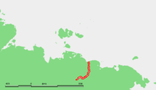 Location of the Alazeya River in Far-East Siberia. | |
| Native name | Алазея |
| Country | Sakha, Russian Federation |
| Basin | |
| Main source |
Confluence of the Nelkan and Kadylchan Rivers in the Alazeya Plateau. 116 m (381 ft) |
| River mouth |
East Siberian Sea 0 m (0 ft) |
| Basin size | 64,700 km2 (25,000 sq mi) |
| Physical characteristics | |
| Length | 1,590 km (990 mi) (total) |
| Discharge |
|
The Alazeya River (Russian: Алазея) is a river in the northeastern part of Yakutia, Russia which flows into the Arctic between the basins of the larger Indigirka River to the west and the Kolyma River to the east.
Geography
The river is 1,590 kilometres (990 mi) long. The area of its basin is 64,700 square kilometres (25,000 sq mi). It crosses through the tundra and has many lakes and marshes.
The Alazeya is formed by the confluence of the Nelkan and Kadylchan Rivers and drains into the Kolyma Bay of the East Siberian Sea, close to Logashkino.
It freezes in late September through early October and stays icebound until late May through early June. The biggest tributary of the Alazeya is the Rossokha River.
There are more than 24,000 lakes in the basin of the Alazeya River.
History
Dmitrii Zyryan was the first Russian to reach the Alazeya in 1641,[1] but did not found a permanent settlement.
References
- ↑ Lantzeff, George V., and Richard A. Pierce (1973). Eastward to Empire: Exploration and Conquest on the Russian Open Frontier, to 1750. Montreal: McGill-Queen's University Press.
Coordinates: 70°51′42″N 153°40′46″E / 70.8618°N 153.6795°E