Alabama State Route 247
| ||||
|---|---|---|---|---|
| Route information | ||||
| Maintained by ALDOT | ||||
| Length: | 24.849 mi[1] (39.991 km) | |||
| Major junctions | ||||
| South end: |
| |||
| North end: |
| |||
| Location | ||||
| Counties: | Franklin, Colbert | |||
| Highway system | ||||
| ||||

State Route 247 (SR-247) is a 25-mile-long (40 km) route that serves as a connection between State Route 24 east of Halltown with U.S. Highway 72 east of Pride.
Route description
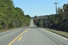
State Route 247 in Franklin County
SR-247 begins at an intersection with State Route 24 east of Halltown. From this point, the route travels in a northeasterly direction to its northern end at U.S. Highway 72 to the east of Pride.
Major intersections
| County | Location | mi[1] | km | Destinations | Notes |
|---|---|---|---|---|---|
| Franklin | | 0.000 | 0.000 | ||
| Colbert | | 24.849 | 39.991 | ||
| 1.000 mi = 1.609 km; 1.000 km = 0.621 mi | |||||
References
- 1 2 "Milepost maps". Alabama Department of Transportation. February 2009. Retrieved May 11, 2013.
This article is issued from Wikipedia - version of the 2/10/2016. The text is available under the Creative Commons Attribution/Share Alike but additional terms may apply for the media files.