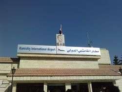
Al-Qamishli Airport
| Al-Qamishli Airport مطار القامشلي الدولي | |||||||||||
|---|---|---|---|---|---|---|---|---|---|---|---|
 | |||||||||||
| IATA: KAC – ICAO: OSKL | |||||||||||
| Summary | |||||||||||
| Airport type | Public | ||||||||||
| Operator | Government | ||||||||||
| Serves | Al-Qamishli, Syria | ||||||||||
| Elevation AMSL | 1,480 ft / 451 m | ||||||||||
| Coordinates | 37°01′14″N 041°11′29″E / 37.02056°N 41.19139°E | ||||||||||
| Map | |||||||||||
 KAC Location of airport in Syria | |||||||||||
| Runways | |||||||||||
| |||||||||||
Al-Qamishli Airport[3] (Arabic: مطار القامشلي) (IATA: KAC, ICAO: OSKL) is an airport serving Al-Qamishli, a city in northeastern Syria.
Facilities
The airport resides at an elevation of 1,480 feet (451 m) above mean sea level. It has one runway designated 03/21 with an asphalt surface measuring 3,615 by 46 metres (11,860 ft × 151 ft).[1]
Airlines and destinations
| Airlines | Destinations |
|---|---|
| Cham Wings Airlines | Damascus |
| FlyDamas | Damascus, Latakia |
| Syrian Air | Damascus, Beirut, Latakia[4] |
During Syrian Civil War
On 21 January 2016, Russia′s activity presumably aimed at setting up a new military base in the government-controlled and mainly abandoned airport was first reported.[5][6][7]
References
- 1 2 Airport information for OSKL from DAFIF (effective October 2006)
- ↑ Airport information for KAC at Great Circle Mapper. Source: DAFIF (effective October 2006).
- ↑ SYRIA:direct. 21 October 2015 http://syriadirect.org/news/hasakah%E2%80%99s-qamishli-international-airport-now-closed-to-civilians/. Missing or empty
|title=(help) - ↑ Fisk, Robert. "What does Isis look like from the air? I buckled up my seat belt and found out." The Independent. November 9, 2014.
- ↑ "Russians survey new airbase on Syria-Turkey border, US officials concerned". Fox News Channel. 21 January 2016. Retrieved 23 January 2016.
- ↑ "Россия и США синхронно создают новые авиабазы на севере Сирии". NEWSru. 23 January 2016. Retrieved 23 January 2016.
- ↑ "U.S. officials: Russia looking at Syria airfield near Turkey". CNN. 22 January 2016. Retrieved 23 January 2016.
External links
This article is issued from Wikipedia - version of the 11/25/2016. The text is available under the Creative Commons Attribution/Share Alike but additional terms may apply for the media files.