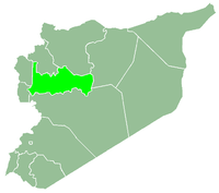
Akakir
| Akakir عكاكير Akakeer | |
|---|---|
| Village | |
 Akakir Location in Syria | |
| Coordinates: 34°52′22″N 36°23′44″E / 34.87278°N 36.39556°E | |
| Country |
|
| Governorate | Hama |
| District | Masyaf |
| Subdistrict | Awj |
| Elevation | 759 m (2,489 ft) |
| Population (2004) | |
| • Total | 2,495 |
| Time zone | EET (UTC+2) |
| • Summer (DST) | EEST (UTC+3) |
Akakir (Arabic: عكاكير, also spelled Akakeer) is a village in northwestern Syria, administratively part of the Hama Governorate, located southwest of Hama. Nearby localities include Kafr Ram to the west, Fahel to the south, al-Shinyah to the southeast, al-Taybah al-Gharbiyah to the east, Maryamin to the northeast and Kafr Kamrah and Awj to the north. According to the Syria Central Bureau of Statistics (CBS), Akakir had a population of 2,495 in the 2004 census.[1] Its inhabitants are predominantly Alawites.[2]
In 1829, during the late Ottoman era, Akakir was part of Jabal Gharbi, a fiscal region inhabited by members of the Alawite community,[3] and paid 1,812 qirsh to satisfy the takalif, a tax meant to cover the expenses of the annual hajj ("pilgrimage") to Mecca. This was a decrease from 1818 when the village paid 2,312 qirsh.[4] It was classified as an Alawite village in 1838 by English scholar Eli Smith.[2] In 1929 Akakir was one of five villages (the other three were al-Bayyadiyah, al-Rusafa, Abu Qubays and Baarin) to be ceded to the Alawite State from the qadaa ("subdistrict") of Masyaf of the Sanjak of Hama.[5]
References
- ↑ General Census of Population and Housing 2004. Syria Central Bureau of Statistics (CBS). Hama Governorate. (Arabic)
- 1 2 Smith, 1841, p. 180.
- ↑ Douwes, 2000, p. 142.
- ↑ Douwes, 2000, p. 229.
- ↑ Bosworth, 1989, p. 791.
Bibliography
- Boulanger, Robert (1966). The Middle East, Lebanon, Syria, Jordan, Iraq, Iran. Hachette.
- Clifford Edmund, Bosworth (1989). The Encyclopaedia of Islam: Fascicules 111-112 : Masrah Mawlid, Parts 111-112. BRILL. ISBN 9004092390.
- Douwes, Dick (2000). The Ottomans in Syria: a history of justice and oppression. I.B. Tauris. ISBN 1860640311.
- Smith, Eli; Robinson, Edward (1841). Biblical Researches in Palestine, Mount Sinai and Arabia Petraea: A Journal of Travels in the Year 1838. 3. Crocker and Brewster.

